File:Límite entre Chile y Perú en el río Loa, Plano General del Reyno del Perú en la América Meridional de Andrés Baleato (1796).jpg
Jump to navigation
Jump to search

Size of this preview: 775 × 600 pixels. Other resolutions: 310 × 240 pixels | 620 × 480 pixels | 992 × 768 pixels | 1,280 × 991 pixels | 2,377 × 1,840 pixels.
Original file (2,377 × 1,840 pixels, file size: 1.63 MB, MIME type: image/jpeg)
Captions
Captions
Add a one-line explanation of what this file represents
Summary
[edit].jpg&action=edit§ion=1)
| Description |
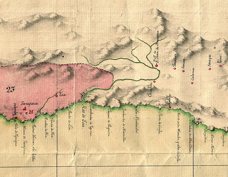
Español: Plano general del Reyno del Perú en la America Meridional de Andrés Baleato (1796) |
| Date | |
| Source | https://bibliotecavirtual.defensa.gob.es/BVMDefensa/es/consulta/registro.do?id=36713 |
| Author | Andrés Baleato |
| Other versions |
.jpg)
Licensing
[edit].jpg&action=edit§ion=2)
|
This work is in the public domain in its country of origin and other countries and areas where the copyright term is the author's life plus 70 years or fewer. | |
| This file has been identified as being free of known restrictions under copyright law, including all related and neighboring rights. | |
File history
Click on a date/time to view the file as it appeared at that time.
| Date/Time | Thumbnail | Dimensions | User | Comment | |
|---|---|---|---|---|---|
| current | 16:22, 21 August 2022 | | 2,377 × 1,840 (1.63 MB) | Janitoalevic (talk | contribs) | File:Plano general del Reyno del Perú en la America Meridional de Andrés Baleato (1796).jpg cropped 91 % horizontally, 83 % vertically using CropTool with precise mode. |
You cannot overwrite this file.
File usage on Commons
The following 2 pages use this file:
.svg)
.jpg&oldid=846213066)