File:Kyiv oblast location map.svg
Jump to navigation
Jump to search

Size of this PNG preview of this SVG file: 517 × 599 pixels. Other resolutions: 207 × 240 pixels | 414 × 480 pixels | 662 × 768 pixels | 883 × 1,024 pixels | 1,766 × 2,048 pixels | 533 × 618 pixels.
Original file (SVG file, nominally 533 × 618 pixels, file size: 138 KB)
Captions
Captions
Add a one-line explanation of what this file represents
Summary
[edit]
| Description |
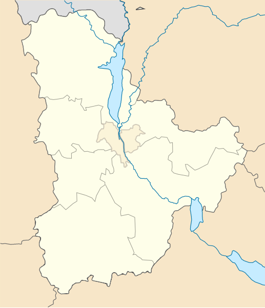
English: Districts of the Kiev region, from July 17, 2020 Русский: Районы Киевской области с 17 июля 2020 года Українська: Райони Київської області з 17 червня 2020 року |
| Date | |
| Source | Own work |
| Author | RosssW |
| SVG development | This locator map was created with Inkscape. |
Licensing
[edit]
I, the copyright holder of this work, hereby publish it under the following license:
This file is licensed under the Creative Commons Attribution-Share Alike 4.0 International license.
- You are free:
- to share – to copy, distribute and transmit the work
- to remix – to adapt the work
- Under the following conditions:
- attribution – You must give appropriate credit, provide a link to the license, and indicate if changes were made. You may do so in any reasonable manner, but not in any way that suggests the licensor endorses you or your use.
- share alike – If you remix, transform, or build upon the material, you must distribute your contributions under the same or compatible license as the original.
File history
Click on a date/time to view the file as it appeared at that time.
| Date/Time | Thumbnail | Dimensions | User | Comment | |
|---|---|---|---|---|---|
| current | 13:58, 18 September 2023 | | 533 × 618 (138 KB) | RosssW (talk | contribs) | корректировка границ Обуховского района по запросу |
| 10:32, 13 August 2020 |  | 533 × 618 (149 KB) | RosssW (talk | contribs) | корр. | |
| 10:28, 13 August 2020 |  | 533 × 618 (149 KB) | RosssW (talk | contribs) | корр. | |
| 10:18, 13 August 2020 |  | 533 × 618 (149 KB) | RosssW (talk | contribs) | корр. | |
| 09:34, 13 August 2020 |  | 533 × 618 (149 KB) | RosssW (talk | contribs) | корр. | |
| 14:59, 12 August 2020 |  | 533 × 618 (149 KB) | RosssW (talk | contribs) | Uploaded own work with UploadWizard |
You cannot overwrite this file.
File usage on Commons
The following page uses this file:
- File:Kiev oblast location map.svg (file redirect)
File usage on other wikis
The following other wikis use this file:
- Usage on ar.wikipedia.org
- Usage on be.wikipedia.org
- Прып’яць
- Чарнобыль
- Барыспіль
- Белая Царква
- Вышнэвэ
- Боярка
- Сквыра
- Ягатын
- Багуслаў
- Узын
- Кагарлык
- Пераяслаў
- Шаблон:На карце/Украіна Кіеўская вобласць
- Ржышчыў
- Васылькіў
- Крушынка (Украіна)
- Тэцііў
- Чабаны (Фасціўскі раён)
- Білагародка (Кіева-Святошынскі раён)
- Пэтрапаўліўска Баршчагіўка
- Бобрыця (Кіева-Святошынскі раён)
- Бузава (Кіева-Святошынскі раён)
- Буча (Кіева-Святошынскі раён)
- Хмільна (Кіева-Святошынскі раён)
- Любыміўка (Кіева-Святошынскі раён)
- Гурыўшчына
- Віта-Паштова
- Юрыўка (Кіева-Святошынскі раён)
- Гатнэ
- Гарбовычы
- Ліснэ (Кіева-Святошынскі раён)
- Мрыя (Кіева-Святошынскі раён)
- Шпыцькы
- Святапэтрыўскэ
- Чайкы (Кіева-Святошынскі раён)
- Крукіўшчына
- Княжычы (Фасціўскі раён)
- Жорніўка (Фасціўскі раён)
- Тарасіўка (Боярская гарадская грамада)
- Навэ (Фасціўскі раён)
- Горэнка
- Машчун
- Шэўчэнкавэ (Кіева-Святошынскі раён)
- Хоціў
- Круглык (Кіева-Святошынскі раён)
- Крэмэнышчэ
- Гарэнычы
- Стоянка (Кіева-Святошынскі раён)
- Лука (Кіева-Святошынскі раён)
View more global usage of this file.