File:Kurfürstentum Hessen Blatt 69 Lohra.jpg
Jump to navigation
Jump to search
Size of this preview: 577 × 599 pixels. Other resolutions: 231 × 240 pixels | 462 × 480 pixels | 740 × 768 pixels | 986 × 1,024 pixels | 1,972 × 2,048 pixels | 6,141 × 6,377 pixels.
Original file (6,141 × 6,377 pixels, file size: 5.48 MB, MIME type: image/jpeg)
Captions
Captions
Add a one-line explanation of what this file represents
Summary
[edit]
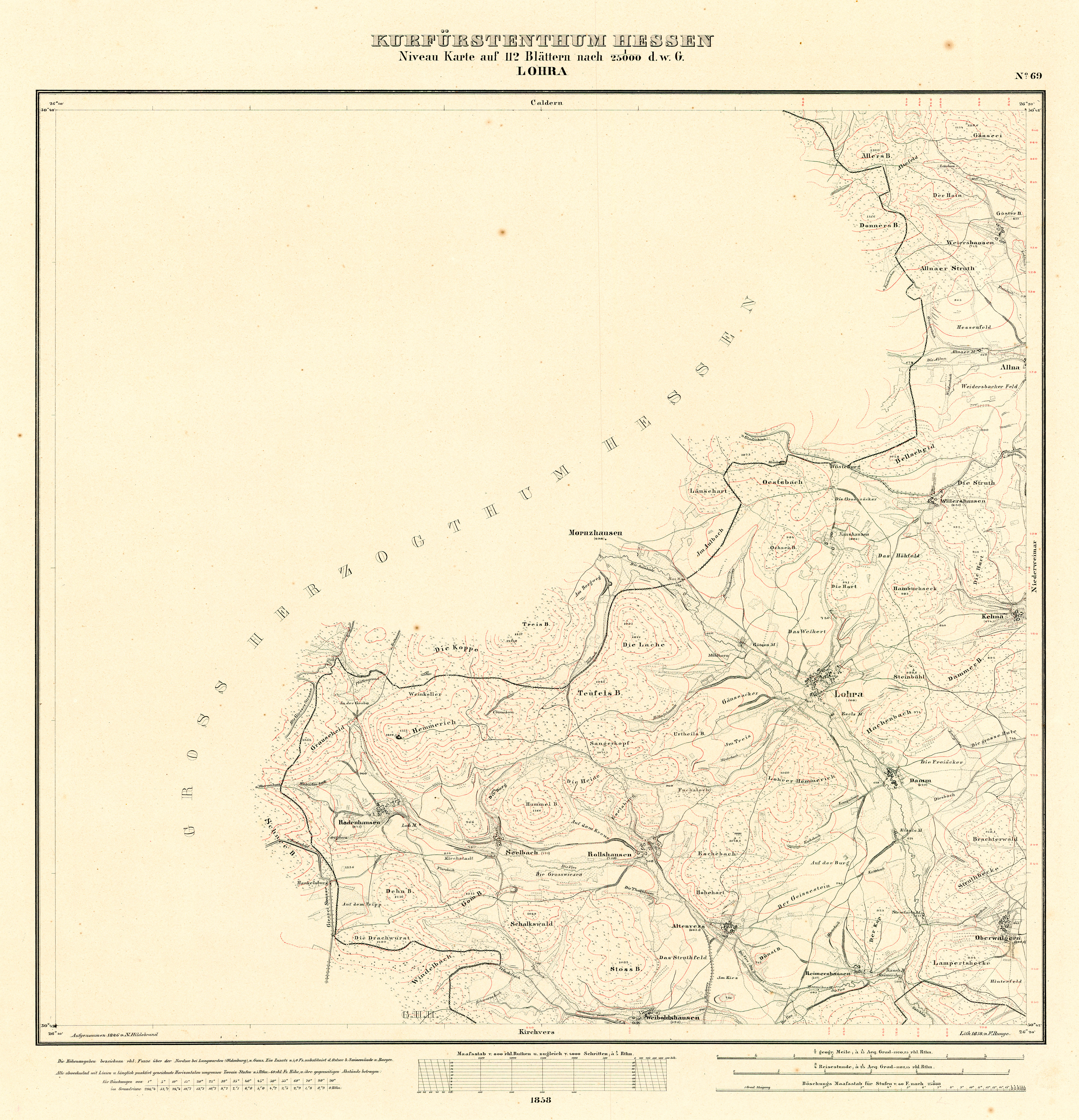
| Title |
Kurfürstentum Hessen Niveau Karte auf 112 Blättern, Blatt 69: Lohra |
|||||||||
| Description |
Deutsch: Topografische Karte des Kurfürstentums Hessen. |
|||||||||
| Date | ||||||||||
| Source | Lagis:Historische Kartenwerke | |||||||||
| Creator |
Landesgeschichtliches Informationssystem Hessen (Lagis) |
|||||||||
| Permission (Reusing this file) |
|
|||||||||
| Geotemporal data | ||||||||||
| Date depicted | ||||||||||
| Map location |
Deutsch: Hessen |
|||||||||
| Map type | topographic map | |||||||||
| Scale | 1:25,000 | |||||||||
| Heading |
 |
|||||||||
| Bounding box |
|
|||||||||
| Georeferencing | ||||||||||
| Bibliographic data | ||||||||||
| Language | German | |||||||||
File history
Click on a date/time to view the file as it appeared at that time.
| Date/Time | Thumbnail | Dimensions | User | Comment | |
|---|---|---|---|---|---|
| current | 10:06, 17 September 2020 | | 6,141 × 6,377 (5.48 MB) | HeinrichStuerzl (talk | contribs) | =={{int:filedesc}}== {{Map |title =Kurfürstentum Hessen Niveau Karte auf 112 Blättern, Blatt 69: Lohra |description ={{de|1=Topografische Karte des Kurfürstentums Hessen.}} |legend = |author =Landesgeschichtliches Informationssystem Hessen (Lagis) |date =1858 |source =[https://www.lagis-hessen.de/de/subjects/idrec/sn/hkw/id/147 Lagis:Historische Kartenwerke] |permission ={{PD-old-100-192... |
You cannot overwrite this file.
File usage on Commons
The following 2 pages use this file: