File:Kungsstugan (The King's Cottage), Örebro, Närke, Sweden (44706962442).jpg

Original file (3,000 × 2,161 pixels, file size: 2.45 MB, MIME type: image/jpeg)
Captions
Captions
Summary
[edit],_%C3%96rebro,_N%C3%A4rke,_Sweden_(44706962442).jpg&action=edit§ion=1)
| Description |
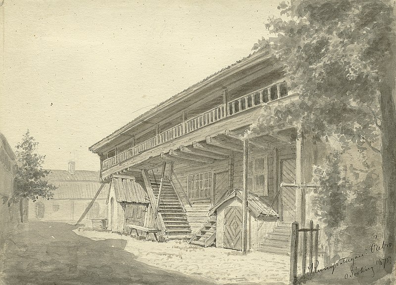
English: The King's Cottage in Örebro, probably built in the 16th century. According to tradition, the future King Karl IX stayed in a guestroom in the building when visiting Örebro in 1580, since Örebro castle was under rebuilding. Primarily, the cottage was used for storing food. (It was moved from its original position in the beginning of the 20th century.) Wash drawing by Olof Sörling, from 1875. |
| Date | |
| Source | https://www.flickr.com/photos/swedish_heritage_board/44706962442/ |
| Author | Swedish National Heritage Board |
| Permission (Reusing this file) |
At the time of upload, the image license was automatically confirmed using the Flickr API. For more information see Flickr API detail. |
| Flickr sets |
|
| Flickr tags |
|
| Camera location | | View this and other nearby images on: OpenStreetMap |
|---|
,_%C3%96rebro,_N%C3%A4rke,_Sweden_(44706962442).jpg¶ms=059.272865_N_0015.231814_E_globe:Earth_type:camera__&language=en)
Licensing
[edit],_%C3%96rebro,_N%C3%A4rke,_Sweden_(44706962442).jpg&action=edit§ion=2)
This image was taken from Flickr's The Commons. The uploading organization may have various reasons for determining that no known copyright restrictions exist, such as:
More information can be found at https://flickr.com/commons/usage/. Please add additional copyright tags to this image if more specific information about copyright status can be determined. See Commons:Licensing for more information. |
| This image was originally posted to Flickr by Swedish National Heritage Board at https://flickr.com/photos/34419668@N08/44706962442 (archive). It was reviewed on 4 February 2019 by FlickreviewR 2 and was confirmed to be licensed under the terms of the No known copyright restrictions. |
File history
Click on a date/time to view the file as it appeared at that time.
| Date/Time | Thumbnail | Dimensions | User | Comment | |
|---|---|---|---|---|---|
| current | 13:38, 4 February 2019 | | 3,000 × 2,161 (2.45 MB) | Fæ (talk | contribs) | Swedish National Heritage Board - Riksantikvarieämbetet, Set 72157632881785944, ID 44706962442, Original title Kungsstugan (The King's Cottage), ?rebro, N?rke, Sweden #573 |
You cannot overwrite this file.
File usage on Commons
There are no pages that use this file.
,_Örebro,_Närke,_Sweden_(44706962442).jpg&oldid=653872565)