File:Kungsboken-karta-hango.jpg
Jump to navigation
Jump to search

Size of this preview: 800 × 531 pixels. Other resolutions: 320 × 212 pixels | 640 × 425 pixels | 1,024 × 680 pixels | 1,280 × 850 pixels | 2,560 × 1,699 pixels | 13,847 × 9,190 pixels.
Original file (13,847 × 9,190 pixels, file size: 8.37 MB, MIME type: image/jpeg)
Captions
Captions
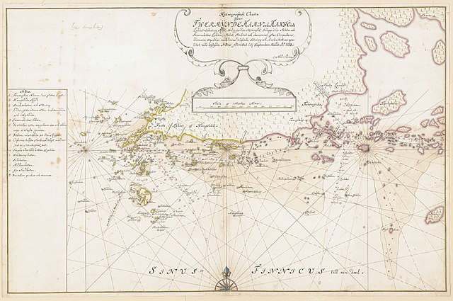
Hand drawn map of Tvärminne and Hangö
Summary
[edit]| Description |
Svenska: handritad 1700-talskarta över Tvärminne och Hangö udde
English: hand drawn 17th century map of Tvärminne and Hangö |
|||
| Date | ||||
| Source |
https://sok.riksarkivet.se/arkiv/R0KYpXyliY7CjuODpBiDy1
|
|||
| Creator |
Nils Ström |
|||
| Georeferencing | If inappropriate please set warp_status = skip to hide. |

Licensing
[edit]
|
This work is in the public domain in its country of origin and other countries and areas where the copyright term is the author's life plus 70 years or fewer. | |
| This file has been identified as being free of known restrictions under copyright law, including all related and neighboring rights. | |
This work is in the public domain in the United States because it meets three requirements:
For background information, see the explanations on Non-U.S. copyrights.
Note: This tag should not be used for sound recordings. |
File history
Click on a date/time to view the file as it appeared at that time.
| Date/Time | Thumbnail | Dimensions | User | Comment | |
|---|---|---|---|---|---|
| current | 10:11, 28 November 2022 | | 13,847 × 9,190 (8.37 MB) | Nils Weinander (Riksarkivet Sverige) (talk | contribs) | Remaining Kungsboken itemsꓹ commons images by OpenRefine (details) |
You cannot overwrite this file.
File usage on Commons
The following page uses this file:
File usage on other wikis
The following other wikis use this file:
- Usage on sv.wikipedia.org
- Usage on www.wikidata.org