File:KulmSummit with mobile radar station.jpg
Jump to navigation
Jump to search
Size of this preview: 800 × 491 pixels. Other resolutions: 320 × 197 pixels | 640 × 393 pixels | 1,024 × 629 pixels | 1,280 × 786 pixels | 2,458 × 1,510 pixels.
Original file (2,458 × 1,510 pixels, file size: 2.48 MB, MIME type: image/jpeg)
Captions
Captions
Add a one-line explanation of what this file represents
Summary
[edit]
| Description |
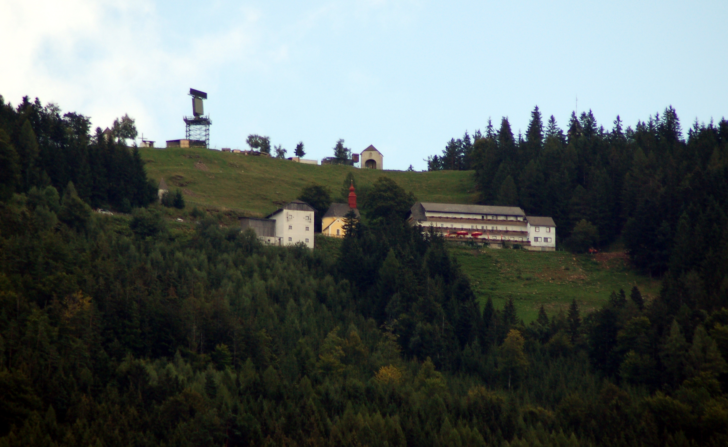
English: The summit area of Kulm (975m), Styria, Austria. The image shows a mobile radar station of the Austrian military, the cross on the summit enclosed into that military area. The military area is part of the Goldhaube Air observation system. A bit below is the chapel and the Kulmwirt. |
| Date | |
| Source | Own work |
| Author | Herzi Pinki |
| Camera location | | View this and other nearby images on: OpenStreetMap |
|---|
Licensing
[edit]
I, the copyright holder of this work, hereby publish it under the following licenses:
This file is licensed under the Creative Commons Attribution-Share Alike 3.0 Unported license.
- You are free:
- to share – to copy, distribute and transmit the work
- to remix – to adapt the work
- Under the following conditions:
- attribution – You must give appropriate credit, provide a link to the license, and indicate if changes were made. You may do so in any reasonable manner, but not in any way that suggests the licensor endorses you or your use.
- share alike – If you remix, transform, or build upon the material, you must distribute your contributions under the same or compatible license as the original.

|
Permission is granted to copy, distribute and/or modify this document under the terms of the GNU Free Documentation License, Version 1.2 or any later version published by the Free Software Foundation; with no Invariant Sections, no Front-Cover Texts, and no Back-Cover Texts. A copy of the license is included in the section entitled GNU Free Documentation License. |
You may select the license of your choice.
| Annotations | This image is annotated: View the annotations at Commons |
File history
Click on a date/time to view the file as it appeared at that time.
| Date/Time | Thumbnail | Dimensions | User | Comment | |
|---|---|---|---|---|---|
| current | 01:05, 30 August 2009 | | 2,458 × 1,510 (2.48 MB) | Herzi Pinki (talk | contribs) | {{Information |Description={{en|1=The summit area of Kulm (975m), Styria, Austria. The image shows a mobile radar station of the Austrian military, the cross on the summit enclosed into that military area. The military area is part of the Goldhaube Air ob |
You cannot overwrite this file.
File usage on Commons
There are no pages that use this file.
File usage on other wikis
The following other wikis use this file:
- Usage on de.wikipedia.org