File:Kukkula Stone Age Settlement Location in Sastamala, Finland.jpg
Jump to navigation
Jump to search
Size of this preview: 800 × 533 pixels. Other resolutions: 320 × 213 pixels | 640 × 427 pixels | 1,024 × 683 pixels | 1,280 × 853 pixels | 2,560 × 1,707 pixels | 5,472 × 3,648 pixels.
Original file (5,472 × 3,648 pixels, file size: 7 MB, MIME type: image/jpeg)
Captions
Captions
Add a one-line explanation of what this file represents
Summary
[edit]
| Description |
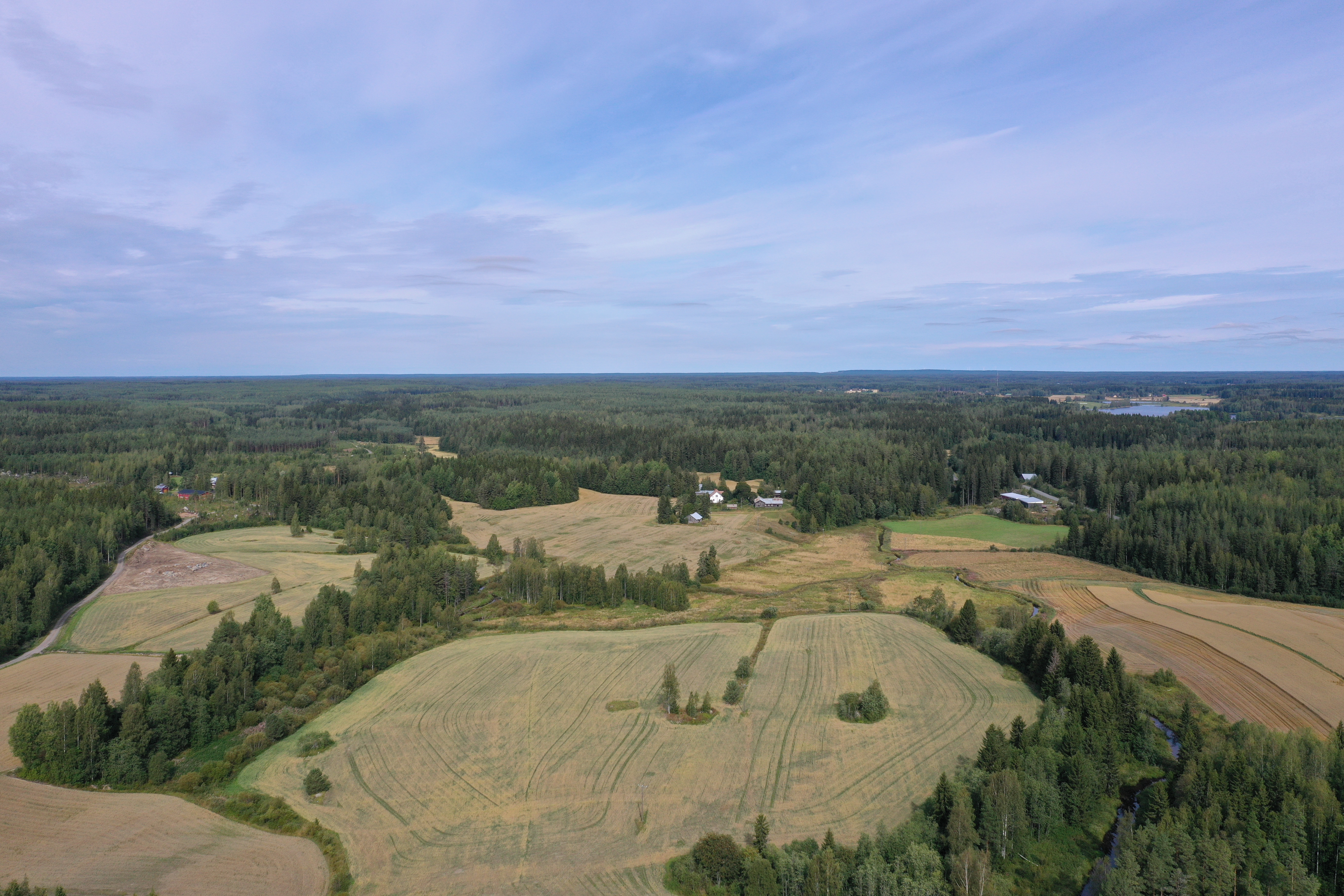
Suomi: Kukkulan kivikautinen asuinpaikka Sävijoen laaksossa Sastamalan Suodenniemellä. Sävijoen laakso tunnistettiin eräänlaiseksi kivikautiseksi "taajamaksi" vuosina 2007-2008 suoritetussa arkeologisessa inventoinnissa. Sen mukaan "ilmeisesti tämä laakso, kapea muinaismeren lahti on lukuisine salmineen ja lahtineen ollut erityisen sopiva pyyntielinkeinojen harjoittamiselle ja asuinpaikkojen rakentamiselle."
Kukkulan asuinpaikka tunnistettiin ensi kerran jo vuonna 1910, kun myöhempi valtionarkeologi Julius Ailio kävi tarkastamassa sen alueelta tehtyjen runsaiden esinelöytöjen vuoksi.
English: Kukkula Stone Age Settlement Location in Sastamala, Finland. This settlement location is in Sastamala, Finland at Sävijoki River Valley. It was identified as a prehistoric "population centre" during an archaelogical inventory in 2007-2008. The inventory states that "apparently this valley, a narrow bay of the prehistoric Baltic sea, with its numerous narrow straits and sounds has been very suitable for hunting, fishing and building settlements."
This settlement was identified for the first time already in 1910, as later state archaelogist Dr. Julius Ailio came to check on in after several prehistoric artefacts were found in the area.
|
| Date | |
| Source | Own work |
| Author | Mik@el |
| Camera location | | View this and other nearby images on: OpenStreetMap |
|---|
Licensing
[edit]
I, the copyright holder of this work, hereby publish it under the following license:
This file is licensed under the Creative Commons Attribution-Share Alike 4.0 International license.
- You are free:
- to share – to copy, distribute and transmit the work
- to remix – to adapt the work
- Under the following conditions:
- attribution – You must give appropriate credit, provide a link to the license, and indicate if changes were made. You may do so in any reasonable manner, but not in any way that suggests the licensor endorses you or your use.
- share alike – If you remix, transform, or build upon the material, you must distribute your contributions under the same or compatible license as the original.

|
This image was uploaded as part of Wiki Loves Monuments 2019.
|
 |
File history
Click on a date/time to view the file as it appeared at that time.
| Date/Time | Thumbnail | Dimensions | User | Comment | |
|---|---|---|---|---|---|
| current | 07:39, 11 September 2019 | | 5,472 × 3,648 (7 MB) | Mik@el (talk | contribs) | User created page with UploadWizard |
You cannot overwrite this file.
File usage on Commons
There are no pages that use this file.
File usage on other wikis
The following other wikis use this file:
- Usage on fi.wikipedia.org