File:Kuji Tsudayama 06a2345as.jpg
Jump to navigation
Jump to search
No higher resolution available.
Kuji_Tsudayama_06a2345as.jpg (480 × 300 pixels, file size: 79 KB, MIME type: image/jpeg)
Captions
Captions
Add a one-line explanation of what this file represents
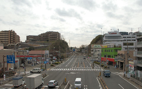
撮影日:2006年 2月27日
撮影地:二ヶ領用水上「切通し」交差点付近(神奈川県川崎市高津区久地)
撮影者:cory
付記:
- 津田山(七面山)の経緯についてはja:久地#歴史およびja:津田山駅#歴史を参照。
- Tsudayama (Shichimen-yama hill), passed through by Japanese national highway Route 246 "Tokyo-Yokohama bypass".
Date: 2006-02-27 (Feb 27, 2006)
Place: Kuji Takatsu Kawasaki Kanagawa, Japan.
Author: ISAKA Yoji (cory)
This file is licensed under the Creative Commons Attribution-Share Alike 2.1 Japan license.
- You are free:
- to share – to copy, distribute and transmit the work
- to remix – to adapt the work
- Under the following conditions:
- attribution – You must give appropriate credit, provide a link to the license, and indicate if changes were made. You may do so in any reasonable manner, but not in any way that suggests the licensor endorses you or your use.
- share alike – If you remix, transform, or build upon the material, you must distribute your contributions under the same or compatible license as the original.


|
Permission is granted to copy, distribute and/or modify this document under the terms of the GNU Free Documentation License, Version 1.2 or any later version published by the Free Software Foundation; with no Invariant Sections, no Front-Cover Texts, and no Back-Cover Texts. A copy of the license is included in the section entitled GNU Free Documentation License. |
| This file is licensed under the Creative Commons Attribution-Share Alike 3.0 Unported license. | ||
| ||
| This licensing tag was added to this file as part of the GFDL licensing update. |
| Camera location | | View this and other nearby images on: OpenStreetMap |
|---|
File history
Click on a date/time to view the file as it appeared at that time.
| Date/Time | Thumbnail | Dimensions | User | Comment | |
|---|---|---|---|---|---|
| current | 13:31, 18 June 2006 | | 480 × 300 (79 KB) | Cory (talk | contribs) | ;津田山(七面山)を切り通しで越える東京・横浜バイパス 撮影日:2006年 2月27日 <br />撮影地:[[:ja:神奈川県道・東京都道9号川崎府中線 |
You cannot overwrite this file.
File usage on Commons
The following page uses this file:
File usage on other wikis
The following other wikis use this file: