File:Kudaka Island,Nanjo.jpg
Jump to navigation
Jump to search

Size of this preview: 800 × 392 pixels. Other resolutions: 320 × 157 pixels | 640 × 314 pixels | 1,024 × 502 pixels | 1,280 × 628 pixels | 2,560 × 1,256 pixels | 5,300 × 2,600 pixels.
Original file (5,300 × 2,600 pixels, file size: 4.07 MB, MIME type: image/jpeg)
Captions
Captions
Add a one-line explanation of what this file represents
Summary
[edit]
| Description |
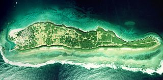
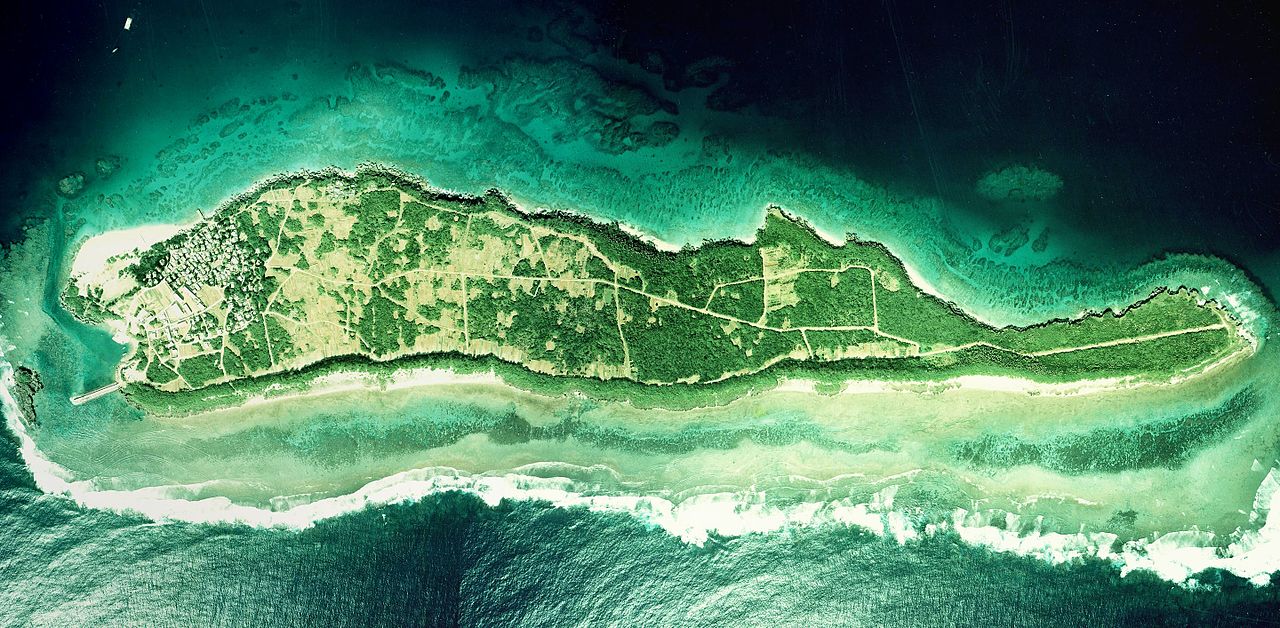
English: Kudaka Island, Nanjo, Okinawa, Japan.
日本語: 久高島(沖縄県南城市)
国土交通省の国土画像情報(カラー空中写真)を元に作成。
|
| Date | |
| Source | COK-77-1-C87-6, COK-77-1-C87-7, COK-77-1-C87-8 |
| Author |
English: Geospatial Information Authority of Japan
日本語: 国土地理院 |
| Camera location | | View this and other nearby images on: OpenStreetMap |
|---|
| This is a retouched picture, which means that it has been digitally altered from its original version. Modifications: Combined 3 aerial photos and cropped. Modifications made by Kugel~commonswiki.
|
Licensing
[edit]

|
The copyright holder of this file, the Ministry of Land, Infrastructure, Transport and Tourism of Japan, allows anyone to use it for any purpose, provided that the copyright holder is properly attributed. Redistribution, derivative work, commercial use, and all other use is permitted. |
Attribution:
Copyright © National Land Image Information (Color Aerial Photographs), Ministry of Land, Infrastructure, Transport and Tourism
|
 |
This image is copyrighted by the Ministry of Land, Infrastructure, Transport and Tourism of Japan. For terms of use, see the stipulation to use of National Land Information (in Japanese) and message from MLIT (in Japanese and English). When you display this image on an article, include the following phrase in the description: "Made based on National Land Image Information (Color Aerial Photographs), Ministry of Land, Infrastructure, Transport and Tourism".
|
File history
Click on a date/time to view the file as it appeared at that time.
| Date/Time | Thumbnail | Dimensions | User | Comment | |
|---|---|---|---|---|---|
| current | 06:27, 20 March 2017 | | 5,300 × 2,600 (4.07 MB) | Kugel~commonswiki (talk | contribs) | Combined photos using by stitching software |
| 08:44, 17 October 2013 | 5,529 × 1,185 (2.36 MB) | Kugel~commonswiki (talk | contribs) | renewal | ||
| 10:50, 31 March 2010 |  | 5,425 × 2,921 (1.88 MB) | Kugel~commonswiki (talk | contribs) | {{Information |Description={{en|1=Kudaka Island, Nanjo, Okinawa, Japan.}} {{ja|1=久高島(沖縄県南城市)}} |Source=Japanese Ministry of Land, Infrastructure, Transport and Tourism[http://w3land.mlit.go.jp/cgi-bin/WebGIS2/WC_AirPhoto.cgi?IT=p&DT= |
You cannot overwrite this file.
File usage on Commons
The following page uses this file:
File usage on other wikis
The following other wikis use this file:
- Usage on cs.wikipedia.org
- Usage on ja.wikipedia.org
- Usage on zh.wikipedia.org