File:Krzynowłoga Mała (gmina) location map.png
Jump to navigation
Jump to search

Size of this preview: 714 × 599 pixels. Other resolutions: 286 × 240 pixels | 572 × 480 pixels | 915 × 768 pixels | 1,115 × 936 pixels.
Original file (1,115 × 936 pixels, file size: 247 KB, MIME type: image/png)
Captions
Captions
Add a one-line explanation of what this file represents
| Description |
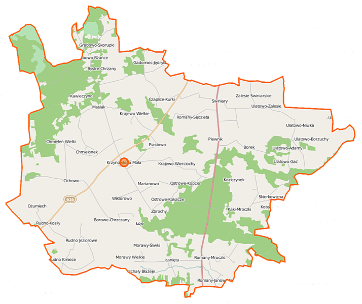
Polski: Mapa gminy Krzynowłoga Mała, Polska
English: Map of Gmina Krzynowłoga Mała, Poland |
|||||||||
| Date | ||||||||||
| Source | You may find a page on the OpenStreetMap wiki page for Krzynowłoga Mała (gmina) | |||||||||
| Creator |
OpenStreetMap contributors OpenStreetMap contributors |
|||||||||
| Permission (Reusing this file) |
OpenStreetMap data is available under the Open Database License (details). Map tiles are licensed under the Creative Commons Attribution-ShareAlike 2.0 license (CC-BY-SA 2.0).
This file is licensed under the Creative Commons Attribution-Share Alike 2.0 Generic license.
|
|||||||||
| Geotemporal data | ||||||||||
| Bounding box |
|
|||||||||
| Georeferencing | If inappropriate please set warp_status = skip to hide. | |||||||||
File history
Click on a date/time to view the file as it appeared at that time.
| Date/Time | Thumbnail | Dimensions | User | Comment | |
|---|---|---|---|---|---|
| current | 07:12, 23 September 2014 | | 1,115 × 936 (247 KB) | VanWiel (talk | contribs) | {{OpenStreetMap | name = Krzynowłoga Mała (gmina) | location = Krzynowłoga Mała (gmina) | description = {{pl|Mapa gminy Krzynowłoga Mała, Polska}} {{en|Map of Gmina Krzynowłoga Mała, Poland}} | top... |
You cannot overwrite this file.
File usage on Commons
There are no pages that use this file.
File usage on other wikis
The following other wikis use this file:
- Usage on fr.wikipedia.org
- Usage on pl.wikipedia.org
- Krzynowłoga Mała (gmina)
- Borowe-Chrzczany
- Bystre-Chrzany
- Chmieleń Wielki
- Chmielonek
- Czaplice-Bąki
- Czaplice-Kurki
- Gadomiec-Jędryki
- Goski-Wąsosze
- Grabowo-Skorupki
- Krajewo-Kłódki
- Krajewo Wielkie (województwo mazowieckie)
- Krajewo-Wierciochy
- Krzynowłoga Mała
- Kaki-Mroczki
- Kawieczyno
- Masiak
- Morawy Wielkie
- Ostrowe-Stańczyki
- Ożumiech
- Romany-Fuszki
- Romany-Janowięta
- Romany-Sebory
- Romany-Sędzięta
- Rudno Jeziorowe
- Rudno Kmiece
- Skierkowizna
- Ulatowo-Adamy
- Ulatowo-Borzuchy
- Ulatowo-Czerniaki
- Ulatowo-Gać
- Ulatowo-Zalesie
- Ulatowo-Żyły
- Zbrochy
- Cichowo (województwo mazowieckie)
- Rudno-Kosiły
- Łanięta (województwo mazowieckie)
- Plewnik (województwo mazowieckie)
- Łoje (powiat przasnyski)
- Marianowo (powiat przasnyski)
- Piastowo (powiat przasnyski)
- Świniary (powiat przasnyski)
- Wiktorowo (powiat przasnyski)
- Borowe-Gryki
- Gadomiec-Wyraki
- Grabowo-Rżańce
- Parafia św. Dominika w Krzynowłodze Małej
- Kościół św. Dominika w Krzynowłodze Małej
- Gadomiec-Jebieńki
View more global usage of this file.
_location_map.png)
_location_map.png&oldid=927582471)