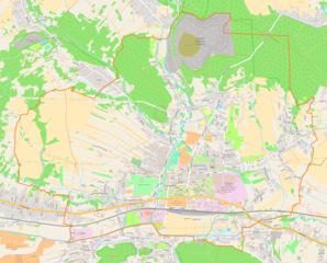
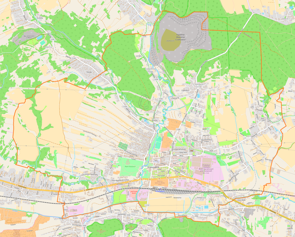
File:Krzeszowice location map.png

Original file (2,192 × 1,765 pixels, file size: 3.42 MB, MIME type: image/png)
Captions
Captions
Summary
[edit]
| Description |
English: Location map |
| Date | |
| Source | Own work |
| Author | Smat |
| Description |
Polski: Mapa Krzeszowic, Polska
English: Map of Krzeszowice, Poland |
|||||||||
| Date | ||||||||||
| Source | You may find a page on the OpenStreetMap wiki page for Krzeszowice | |||||||||
| Creator |
OpenStreetMap contributors OpenStreetMap contributors |
|||||||||
| Permission (Reusing this file) |
OpenStreetMap data is available under the Open Database License (details). Map tiles are licensed under the Creative Commons Attribution-ShareAlike 2.0 license (CC-BY-SA 2.0).
This file is licensed under the Creative Commons Attribution-Share Alike 2.0 Generic license.
|
|||||||||
| Geotemporal data | ||||||||||
| Bounding box |
|
|||||||||
| Georeferencing | If inappropriate please set warp_status = skip to hide. | |||||||||
Licensing
[edit]
| This work contains information from OpenStreetMap, which is made available under the Open Database License (ODbL).
The ODbL does not require any particular license for maps produced from ODbL data. Prior to 1 August 2020, map tiles produced by the OpenStreetMap Foundation were licensed under the CC-BY-SA-2.0 license. Maps produced by other people may be subject to other licences. |
File history
Click on a date/time to view the file as it appeared at that time.
| Date/Time | Thumbnail | Dimensions | User | Comment | |
|---|---|---|---|---|---|
| current | 15:30, 5 March 2018 | | 2,192 × 1,765 (3.42 MB) | Smat (talk | contribs) | User created page with UploadWizard |
You cannot overwrite this file.
File usage on Commons
There are no pages that use this file.
File usage on other wikis
The following other wikis use this file:
- Usage on pl.wikipedia.org
- Żbik (Krzeszowice)
- Synagoga w Krzeszowicach (ul. Wąska 1)
- Synagoga w Krzeszowicach (ul. Wąska 4)
- Czatkowice (Krzeszowice)
- Kościół św. Marcina w Krzeszowicach
- Krzeszowice (stacja kolejowa)
- Bartlowa Góra
- Solca (góra)
- Pałac Potockich w Krzeszowicach
- Źródło Główne w Krzeszowicach
- Olchówki
- Parafia św. Marcina w Krzeszowicach
- Osiedle Centrum (Krzeszowice)
- Osiedle Nowy Świat (Krzeszowice)
- Osiedle Jurajskie
- Osiedle Parkowe (Krzeszowice)
- Willa Japonka
- Zespół dawnego folwarku w Krzeszowicach
- Traktiernia w Krzeszowicach
- Vauxhall w Krzeszowicach
- Zdrój Kapliczka pod Matką Boską
- Spichlerz folwarczny w Krzeszowicach
- Budynek dawnej stajni pałacowych (angielskich) w Krzeszowicach
- Leśniczówka i ogród w Krzeszowicach
- Łazienki Zofia
- Park Miejski w Krzeszowicach
- Stary Pałac Potockich w Krzeszowicach
- Buzdyganówka
- Cmentarz parafialny w Krzeszowicach
- Kaplica cmentarna w Krzeszowicach
- Kaplica św. Stanisława Biskupa w Krzeszowicach
- Muzeum Ziemi Krzeszowickiej w Krzeszowicach
- Parafia św. Jana Pawła II w Krzeszowicach
- Dom schronienia w Krzeszowicach
- Moduł:Mapa/dane/Krzeszowice
- Kopalnia Wapienia Czatkowice
- Zbór Kościoła Zielonoświątkowego „Słowo Życia” w Krzeszowicach
- Usage on pl.wikibooks.org
- Usage on pt.wikipedia.org