File:Krotoszyn (gmina) location map.png
Jump to navigation
Jump to search

Size of this preview: 800 × 582 pixels. Other resolutions: 320 × 233 pixels | 640 × 465 pixels | 1,024 × 744 pixels | 1,194 × 868 pixels.
Original file (1,194 × 868 pixels, file size: 162 KB, MIME type: image/png)
Captions
Captions
Add a one-line explanation of what this file represents
| Description |
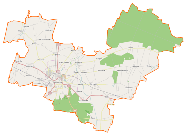
Polski: Mapa gminy Krotoszyn, Polska
English: Map of Gmina Krotoszyn, Poland |
|||||||||
| Date | ||||||||||
| Source | You may find a page on the OpenStreetMap wiki page for Krotoszyn (gmina) | |||||||||
| Creator |
OpenStreetMap contributors OpenStreetMap contributors |
|||||||||
| Permission (Reusing this file) |
OpenStreetMap data is available under the Open Database License (details). Map tiles are licensed under the Creative Commons Attribution-ShareAlike 2.0 license (CC-BY-SA 2.0).
This file is licensed under the Creative Commons Attribution-Share Alike 2.0 Generic license.
|
|||||||||
| Geotemporal data | ||||||||||
| Bounding box |
|
|||||||||
| Georeferencing | If inappropriate please set warp_status = skip to hide. | |||||||||
File history
Click on a date/time to view the file as it appeared at that time.
| Date/Time | Thumbnail | Dimensions | User | Comment | |
|---|---|---|---|---|---|
| current | 13:15, 13 December 2014 | | 1,194 × 868 (162 KB) | VanWiel (talk | contribs) | {{OpenStreetMap | name = Krotoszyn (gmina) | location = Krotoszyn (gmina) | description = {{pl|Mapa gminy Krotoszyn, Polska}} {{en|Map of Gmina Krotoszyn, Poland}} | top = 51.8076 | bottom = 51.6231... |
You cannot overwrite this file.
File usage on Commons
There are no pages that use this file.
File usage on other wikis
The following other wikis use this file:
- Usage on de.wikipedia.org
- Usage on fr.wikipedia.org
- Usage on it.wikipedia.org
- Usage on pl.wikipedia.org
- Krotoszyn
- Rezerwat przyrody Dąbrowa Smoszew
- Gorzupia (województwo wielkopolskie)
- Jasne Pole
- Kobierno (powiat krotoszyński)
- Krotoszyn (gmina)
- Benice (województwo wielkopolskie)
- Baszyny
- Biadki
- Chwaliszew
- Durzyn
- Duszna Górka
- Dzierżanów (województwo wielkopolskie)
- Lutogniew (wieś)
- Orpiszew
- Osusz
- Różopole (wieś)
- Roszki
- Smoszew
- Tomnice
- Wróżewy
- Bożacin (województwo wielkopolskie)
- Romanów (województwo wielkopolskie)
- Świnków (województwo wielkopolskie)
- Unisław (województwo wielkopolskie)
- Ustków (województwo wielkopolskie)
- Brzoza (powiat krotoszyński)
- Janów (Orpiszew)
- Nowy Folwark (powiat krotoszyński)
- Wielowieś (powiat krotoszyński)
- Rezerwat przyrody Miejski Bór
- Raciborów (województwo wielkopolskie)
- Krotoszyn (stacja kolejowa)
- Krotoszyn Wąskotorowy
- Ugrzele
- Pustkowie Jędrzejewskie
- Roszki-Bór
- Brzezinka (województwo wielkopolskie)
- Dąbrowa (gmina Krotoszyn)
- Jastrzębiec (województwo wielkopolskie)
- Jelonek (powiat krotoszyński)
- Miłowiec
- Odrodzenie (województwo wielkopolskie)
- Rozdrażewek (gmina Krotoszyn)
- Sokołówka (powiat krotoszyński)
- Stare Budy (Roszki)
- Stary Las (województwo wielkopolskie)
View more global usage of this file.
_location_map.png)
_location_map.png&oldid=519972217)