File:Kronach - Am Pförtchen 5-3.jpg
Jump to navigation
Jump to search
Size of this preview: 400 × 600 pixels. Other resolutions: 160 × 240 pixels | 320 × 480 pixels | 512 × 768 pixels | 682 × 1,024 pixels | 2,000 × 3,000 pixels.
Original file (2,000 × 3,000 pixels, file size: 2.8 MB, MIME type: image/jpeg)
Captions
Captions
Add a one-line explanation of what this file represents
Summary
[edit]
| Description |
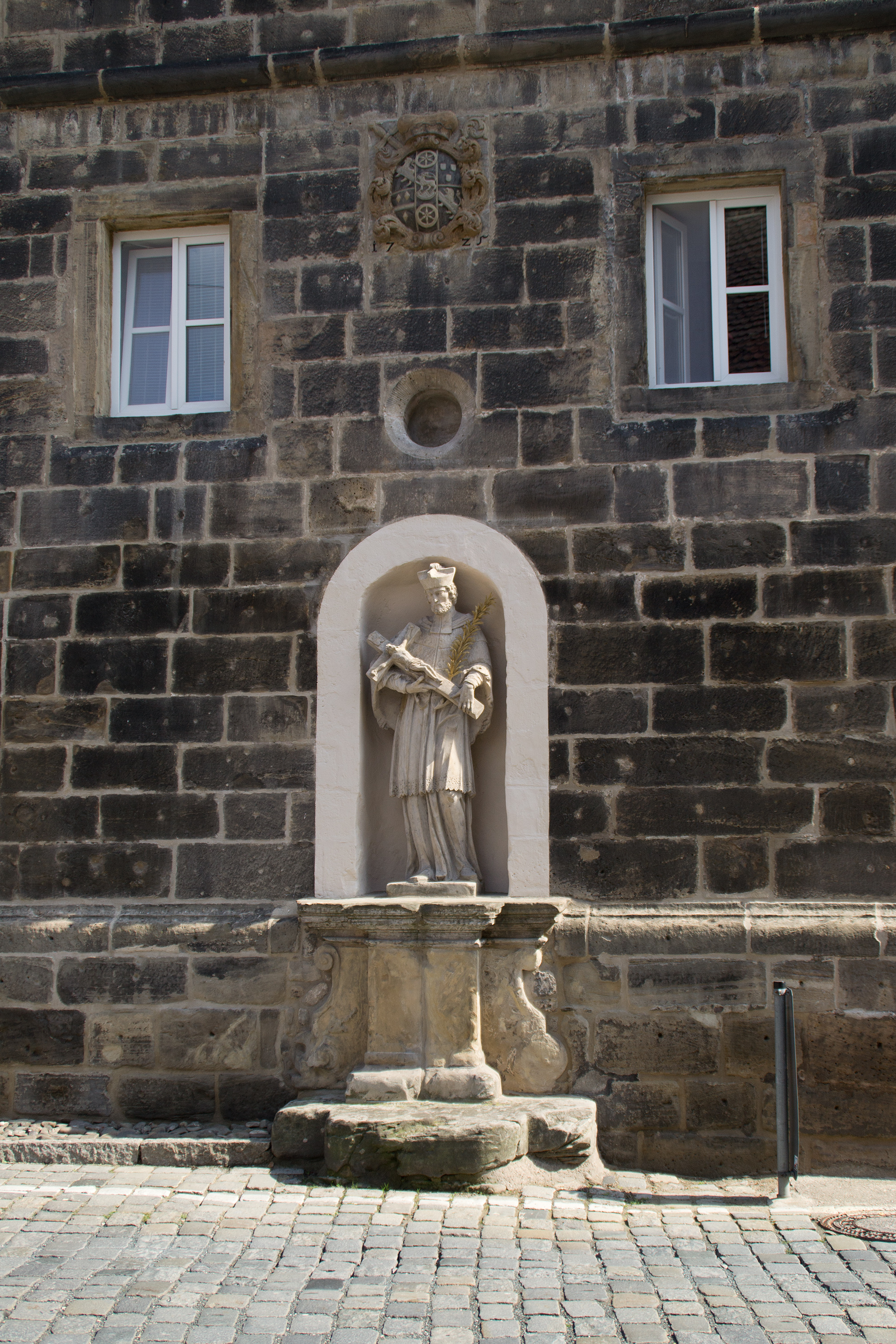
Deutsch: Statue des Heiligen Johannes Nepomuk am Gebäude "Am Pförtchen 5" in Kronach, darüber eine im Zuge von Renovierungsarbeiten im Jahr 2011 wieder freigelegte ehemalige Schießscharte und darüber das Wappen des Bamberger Fürstbischofs Lothar Franz von Schönborn.
This is a photograph of an architectural monument. It is on the list of cultural monuments of Kronach, no. D-4-76-145-23. |
| Date | |
| Source | Own work |
| Author | Tors |
| Camera location | | View this and other nearby images on: OpenStreetMap |
|---|
Licensing
[edit]
I, the copyright holder of this work, hereby publish it under the following license:
This file is licensed under the Creative Commons Attribution-Share Alike 3.0 Unported license.
- You are free:
- to share – to copy, distribute and transmit the work
- to remix – to adapt the work
- Under the following conditions:
- attribution – You must give appropriate credit, provide a link to the license, and indicate if changes were made. You may do so in any reasonable manner, but not in any way that suggests the licensor endorses you or your use.
- share alike – If you remix, transform, or build upon the material, you must distribute your contributions under the same or compatible license as the original.

|
Hinweis: Dieses Bild ist nicht gemeinfrei! Es darf jedoch kostenlos genutzt werden, solange die Bedingungen seiner Lizenz eingehalten werden. | Note: This image is not in the public domain! You can use it free of charge as long as you comply with the terms of its license. |
| Diese Bedingungen beinhalten angemessene Urheber- und Rechteangaben. Bitte verwenden Sie für die Namensnennung den folgenden Text und platzieren Sie diesen vorzugsweise in unmittelbarer Nähe des Bildes: | These terms include that you give appropriate credit. Please use the following text for attribution and place it in the immediate vicinity of the image: | |
Tors / Wikimedia Commons / CC-BY-SA-3.0
| ||
| Die Platzierung an einer anderen Stelle Ihrer Publikation ist ebenfalls möglich, solange dabei der Zusammenhang zwischen Bild und Urheberangabe gewahrt bleibt. | You may also place this text in a different location of your publication as long as the connection between image and credit remains intact. | |
File history
Click on a date/time to view the file as it appeared at that time.
| Date/Time | Thumbnail | Dimensions | User | Comment | |
|---|---|---|---|---|---|
| current | 22:46, 5 March 2012 | | 2,000 × 3,000 (2.8 MB) | Tors (talk | contribs) | {{Information |Description ={{de|1=Statue des Heiligen Johannes Nepomuk am Gehäuse "Am Pförtchen 5" in Kronach, darüber eine im Zuge von Renovierungsarbeiten im Jahr 2011 wieder freigelegte ehemalige Schie... |
You cannot overwrite this file.
File usage on Commons
There are no pages that use this file.