File:Kroatien BV042745745.jpg
Jump to navigation
Jump to search

Size of this preview: 800 × 536 pixels. Other resolutions: 320 × 214 pixels | 640 × 428 pixels | 1,024 × 686 pixels | 1,280 × 857 pixels | 2,560 × 1,714 pixels | 7,691 × 5,149 pixels.
Original file (7,691 × 5,149 pixels, file size: 2.52 MB, MIME type: image/jpeg)
Captions
Captions
Add a one-line explanation of what this file represents
Summary
[edit]| Title |
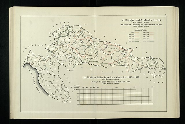
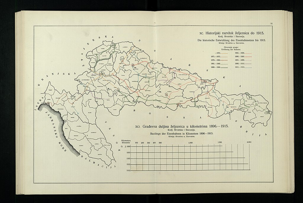
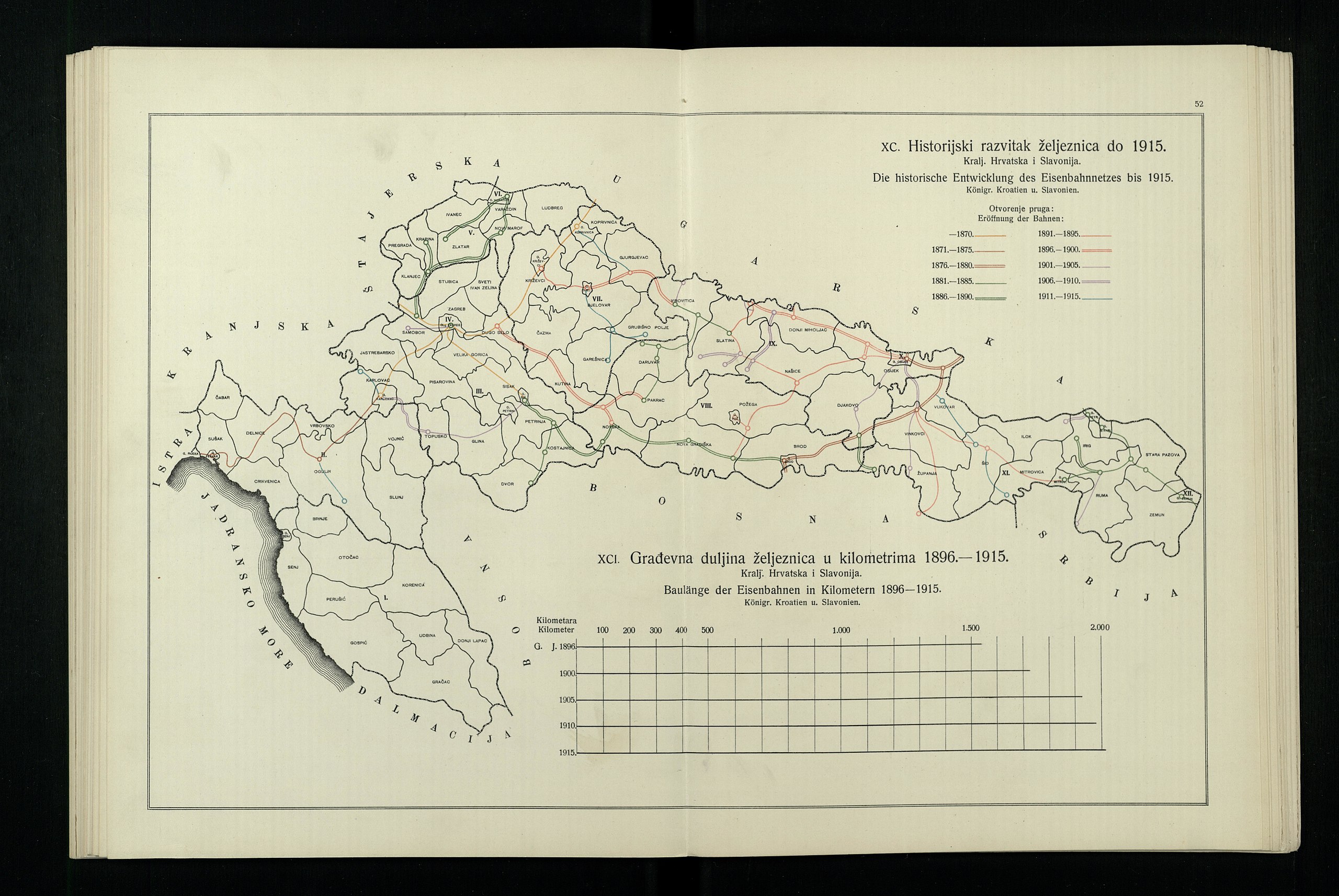
Historijski razvitak željeznica do 1915. Kralj. Hrvatska i Slavonija |
|||||||||||||||||||||||
| Description |
Deutsch: Kroatien, Slawonien, Eisenbahnnetznetz |
|||||||||||||||||||||||
| Date | ||||||||||||||||||||||||
| Source | Leibniz-Institut für Ost- und Südosteuropaforschung (IOS) GeoPortOst | |||||||||||||||||||||||
| Permission (Reusing this file) |
|
|||||||||||||||||||||||
| Geotemporal data | ||||||||||||||||||||||||
| Date depicted | from 1850 until 1915 | |||||||||||||||||||||||
| Map location | Kroatien | |||||||||||||||||||||||
| Map type | Kartogramm | |||||||||||||||||||||||
| Bounding box |
|
|||||||||||||||||||||||
| Georeferencing | ||||||||||||||||||||||||
| Bibliographic data | ||||||||||||||||||||||||
| Map sheet | S. 52 | |||||||||||||||||||||||
| Language | Croatian | |||||||||||||||||||||||
| Archival data | ||||||||||||||||||||||||
| Collection |
|
|||||||||||||||||||||||
| Accession number |
BV042745745 |
|||||||||||||||||||||||

Licensing
[edit]
|
This work is in the public domain in its country of origin and other countries and areas where the copyright term is the author's life plus 70 years or fewer. | |
| This file has been identified as being free of known restrictions under copyright law, including all related and neighboring rights. | |
File history
Click on a date/time to view the file as it appeared at that time.
| Date/Time | Thumbnail | Dimensions | User | Comment | |
|---|---|---|---|---|---|
| current | 21:35, 19 February 2019 | | 7,691 × 5,149 (2.52 MB) | H.bauer26 (talk | contribs) | pattypan 18.02 |
You cannot overwrite this file.
File usage on Commons
There are no pages that use this file.