File:Krems an der Donau - Donau-Universität, Hauptgebäude.JPG
Jump to navigation
Jump to search

Size of this preview: 800 × 533 pixels. Other resolutions: 320 × 213 pixels | 640 × 427 pixels | 1,024 × 683 pixels | 1,280 × 854 pixels | 2,560 × 1,707 pixels | 4,547 × 3,032 pixels.
Original file (4,547 × 3,032 pixels, file size: 10.72 MB, MIME type: image/jpeg)
Captions
Captions
Add a one-line explanation of what this file represents
Summary
[edit]
| Description |
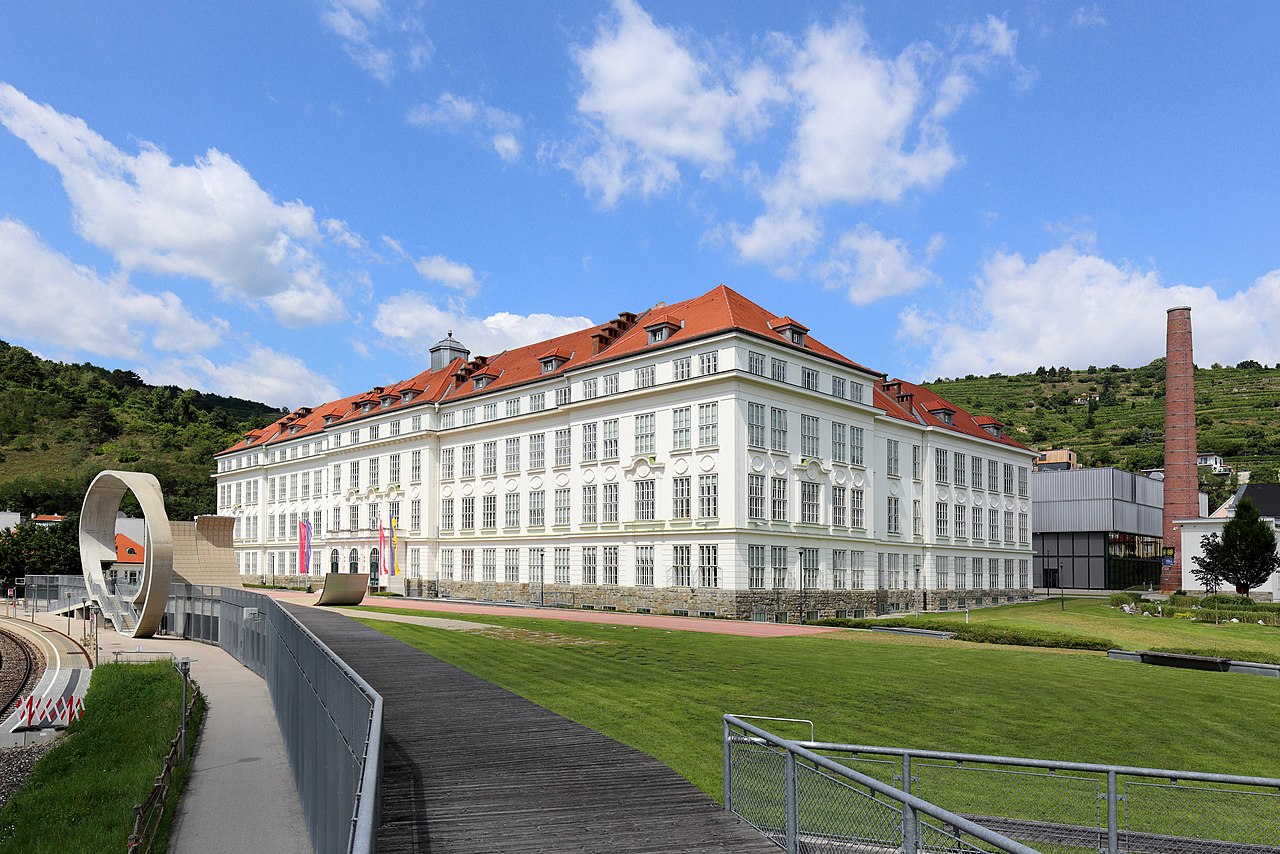
Deutsch: Hauptgebäude der Donau-Universität Krems in Stein an der Donau, ein Ortsteil der niederösterreichischen Stadt Krems. Rechts im Hintergrund der Schlot des Heizhauses der ehemaligen Fabrik und der Campus, der nach Plänen des Architekten Dietmar Feichtinger errichtet und am 7. Oktober 2005 eröffnet wurde.
Das Fabriksgebäude, ein dreistöckiger Stahlbetonskelettbau in der Formensprache eines „dritten Barock“, wurde von 1919 bis 1922 nach Plänen des Architekten Paul Hoppe als Tabakfabrik für die Österreichische Tabakregie errichtet. Die Eröffnung der neuen Fabrik nahm am 16. Juni 1922 der damalige Generaldirektor der Tabakwerke, Dr. Karl Dorrek, vor und in den Jahr 1987/91 wurde die Produktionsstätte geschlossen. Leerstehende Räumlichkeiten mit einer Nutzfläche von rd. 1500 m² wurden bereits ab Oktober 1988 von der Wissenschaftlichen Landesakademie für Niederösterreich genutzt. Im Anschluss adaptierte Architekt Manfred Wehdorn das historische Gebäude, so dass rd. 12.000 bis 15.000 m² Nutzfläche mit der Eröffnung der Donau-Universität Krems am 13. September 1995 zur Verfügung standen. |
| Date | |
| Source | Own work |
| Author | C.Stadler/Bwag |
| Permission (Reusing this file) |
Deutsch: Hallo, du darfst meine Fotos kostenlos nutzen, aber nenne mich bitte als Fotograf, beispielsweise „Foto: C.Stadler/Bwag“ oder © C.Stadler/Bwag; CC-BY-SA-4.0. Auf mehr Angaben bestehe ich nicht - im Gegensatz zu manch anderen, die die Vorgaben der unten angeführten Lizenzierung auf Punkt und Beistrich einfordern. English: Feel free to use my photos, but please mention me as the author like © C.Stadler/Bwag or © C.Stadler/Bwag; CC-BY-SA-4.0 (that's good enough) and if you want send me a message: bwag@gmx.net. |
| Camera location | | View this and other nearby images on: OpenStreetMap |
|---|
| Object location | | View this and other nearby images on: OpenStreetMap |
|---|
Licensing
[edit]
I, the copyright holder of this work, hereby publish it under the following license:
This file is licensed under the Creative Commons Attribution-Share Alike 4.0 International license.
- You are free:
- to share – to copy, distribute and transmit the work
- to remix – to adapt the work
- Under the following conditions:
- attribution – You must give appropriate credit, provide a link to the license, and indicate if changes were made. You may do so in any reasonable manner, but not in any way that suggests the licensor endorses you or your use.
- share alike – If you remix, transform, or build upon the material, you must distribute your contributions under the same or compatible license as the original.
File history
Click on a date/time to view the file as it appeared at that time.
| Date/Time | Thumbnail | Dimensions | User | Comment | |
|---|---|---|---|---|---|
| current | 14:28, 9 August 2016 | | 4,547 × 3,032 (10.72 MB) | Bwag (talk | contribs) | {{Information |Description= {{de|1= Hauptgebäude der Donau-Universität Krems in Stein an der Donau, ein Ortsteil der niederösterreichischen Stadt Krems.<br/>Der... |
You cannot overwrite this file.
File usage on Commons
The following 3 pages use this file:
File usage on other wikis
The following other wikis use this file:
- Usage on be.wikipedia.org
- Usage on de.wikipedia.org
- Usage on en.wikipedia.org
- Usage on et.wikipedia.org
- Usage on fi.wikipedia.org
- Usage on sh.wikipedia.org
- Usage on www.wikidata.org
- Usage on zh.wikipedia.org