File:KraeklingboBrand1992-map.svg
Jump to navigation
Jump to search

Size of this PNG preview of this SVG file: 781 × 479 pixels. Other resolutions: 320 × 196 pixels | 640 × 393 pixels | 1,024 × 628 pixels | 1,280 × 785 pixels | 2,560 × 1,570 pixels.
Original file (SVG file, nominally 781 × 479 pixels, file size: 107 KB)
Captions
Captions
Add a one-line explanation of what this file represents
Summary
[edit]
| Description |
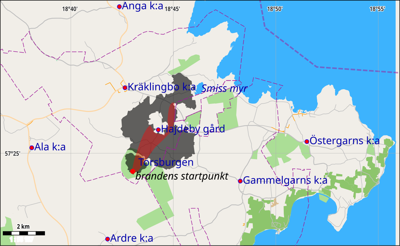
Svenska: Karta över branden vid Torsburgen i Kräklingbo sn på östra Gotland 1992. Data från OSM & utbredning enligt kartskiss funnen på www.brevikshistoria.n.nu/komplettering-till-kapitel-15 (utan källa) och lantmäteriets och Google maps ortofoton |
|||
| Date | ||||
| Source | openstreetmap.org | |||
| Creator |
OpenStreetMap contributors |
|||
| Permission (Reusing this file) |
OpenStreetMap data is available under the Open Database License (details). Map tiles are licensed under the Creative Commons Attribution-ShareAlike 2.0 license (CC-BY-SA 2.0).
This file is licensed under the Creative Commons Attribution-Share Alike 2.0 Generic license.
|
|||
| Georeferencing | If inappropriate please set warp_status = skip to hide. |
File history
Click on a date/time to view the file as it appeared at that time.
| Date/Time | Thumbnail | Dimensions | User | Comment | |
|---|---|---|---|---|---|
| current | 19:24, 1 September 2014 | | 781 × 479 (107 KB) | Taxelson (talk | contribs) | större text |
| 19:10, 1 September 2014 |  | 781 × 479 (109 KB) | Taxelson (talk | contribs) | User created page with UploadWizard |
You cannot overwrite this file.
File usage on Commons
There are no pages that use this file.
File usage on other wikis
The following other wikis use this file:
- Usage on en.wikipedia.org
- Usage on sv.wikipedia.org