File:Kr Niederung.png
Jump to navigation
Jump to search

Size of this preview: 721 × 600 pixels. Other resolutions: 289 × 240 pixels | 577 × 480 pixels | 923 × 768 pixels | 1,047 × 871 pixels.
Original file (1,047 × 871 pixels, file size: 1.98 MB, MIME type: image/png)
Captions
Captions
Add a one-line explanation of what this file represents
Summary
[edit]| Description |
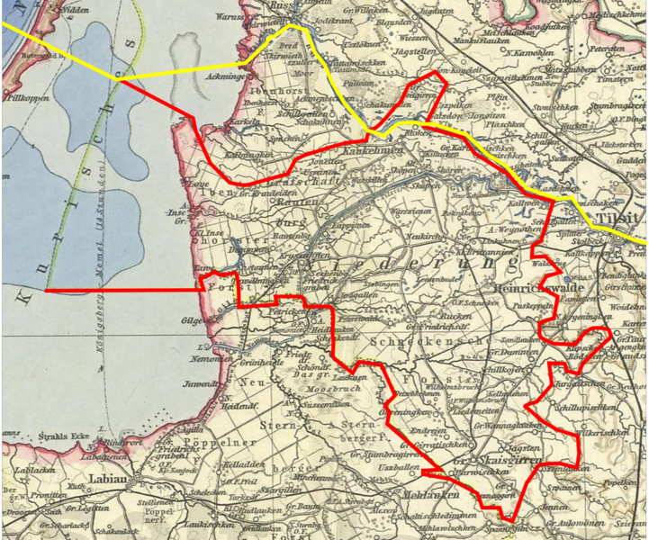
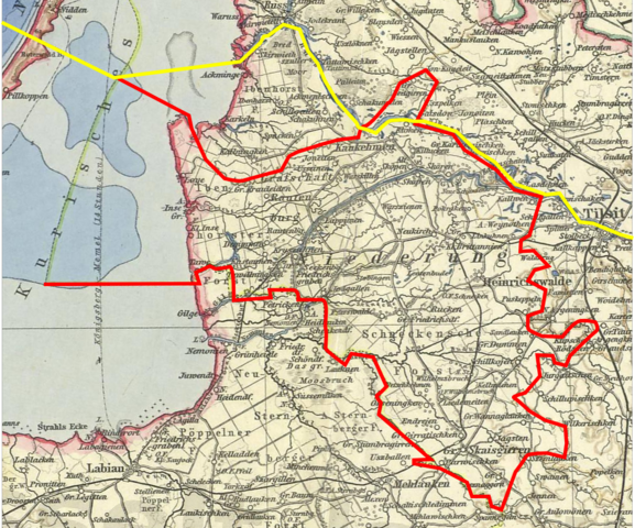
Deutsch: Bearbeiteter Ausschnitt einer Karte von Ostpreußen. Rot: Grenzen des Landkreises Niederung (Kreisstadt Heinrichswalde). Gelb: heutige Grenze zwischen Litauen (Norden) und Russland (Süden).
English: Edited detail from a map of East Prussia (Germany). Red limits of Niederung County. Yellow: modern international boundary between Lithuania (north) and Russia (south). |
| Date | |
| Source |
Vogels Karte des Deutschen Reichs (Map of the German Empire). Scale 1:500,000. Perteis, Gotha, 1907. Sheet 5: Königsberg. Author: Carl Vogel (1828-97). Drawn by V.Geyer, H.Kehnert, O.Koffmann, P.Langhans, M.Risch and C.Scherrer. |
| Author | Uploader: Michael König (User:Magadan) → Message. |
Licensing
[edit]|
This work is in the public domain in its country of origin and other countries and areas where the copyright term is the author's life plus 70 years or fewer. | |
| This file has been identified as being free of known restrictions under copyright law, including all related and neighboring rights. | |
File history
Click on a date/time to view the file as it appeared at that time.
| Date/Time | Thumbnail | Dimensions | User | Comment | |
|---|---|---|---|---|---|
| current | 23:48, 28 December 2008 | | 1,047 × 871 (1.98 MB) | Magadan (talk | contribs) | {{Information |Description={{de|1=.}} |Source=. |Author=. |Date= |Permission= |other_versions= }} <!--{{ImageUpload|full}}--> |
You cannot overwrite this file.
File usage on Commons
The following page uses this file:
File usage on other wikis
The following other wikis use this file:
- Usage on de.wikipedia.org
- Usage on lt.wikipedia.org
- Usage on lt.wikibooks.org
- Usage on ru.wikipedia.org