File:Koyama Uchinoura map.png
Koyama_Uchinoura_map.png (357 × 388 pixels, file size: 13 KB, MIME type: image/png)
Captions
Captions
Summary
[edit]
| Description | |||
| Source | File:Japan map.png | ||
| Author |
|
||
| Permission (Reusing this file) |
|
Licensing
[edit]

|
Permission is granted to copy, distribute and/or modify this document under the terms of the GNU Free Documentation License, Version 1.2 or any later version published by the Free Software Foundation; with no Invariant Sections, no Front-Cover Texts, and no Back-Cover Texts. A copy of the license is included in the section entitled GNU Free Documentation License. |
- You are free:
- to share – to copy, distribute and transmit the work
- to remix – to adapt the work
- Under the following conditions:
- attribution – You must give appropriate credit, provide a link to the license, and indicate if changes were made. You may do so in any reasonable manner, but not in any way that suggests the licensor endorses you or your use.
- share alike – If you remix, transform, or build upon the material, you must distribute your contributions under the same or compatible license as the original.
File history
Click on a date/time to view the file as it appeared at that time.
| Date/Time | Thumbnail | Dimensions | User | Comment | |
|---|---|---|---|---|---|
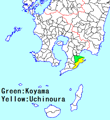
| current | 13:56, 26 July 2009 | | 357 × 388 (13 KB) | Sanjo (talk | contribs) | 鹿児島県肝付町発足前の旧高山町・内之浦町の位置を示す地図画像。ファイル:Japan map.pngを基に投稿者が作成。緑が高山町、黄が内之浦町を指す。 {{Japan map}} |
You cannot overwrite this file.
File usage on Commons
There are no pages that use this file.
File usage on other wikis
The following other wikis use this file:
- Usage on ja.wikipedia.org
- Usage on ko.wikipedia.org