File:Kostrzyn (gmina) location map.png
Jump to navigation
Jump to search

Size of this preview: 683 × 599 pixels. Other resolutions: 274 × 240 pixels | 547 × 480 pixels | 793 × 696 pixels.
Original file (793 × 696 pixels, file size: 116 KB, MIME type: image/png)
Captions
Captions
Add a one-line explanation of what this file represents
| Description |
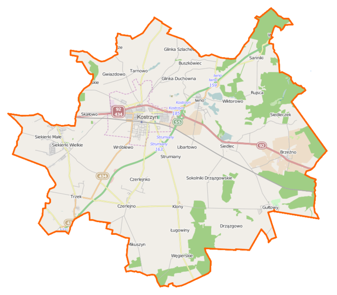
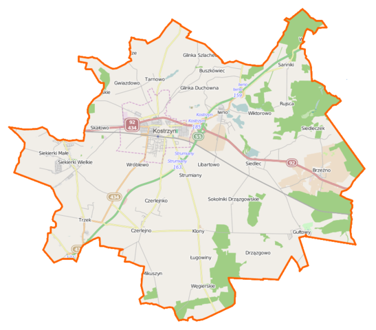
Polski: Mapa gminy Kostrzyn, Polska
English: Map of Gmina Kostrzyn, Poland |
|||||||||
| Date | ||||||||||
| Source | You may find a page on the OpenStreetMap wiki page for Kostrzyn (gmina) | |||||||||
| Creator |
OpenStreetMap contributors OpenStreetMap contributors |
|||||||||
| Permission (Reusing this file) |
OpenStreetMap data is available under the Open Database License (details). Map tiles are licensed under the Creative Commons Attribution-ShareAlike 2.0 license (CC-BY-SA 2.0).
This file is licensed under the Creative Commons Attribution-Share Alike 2.0 Generic license.
|
|||||||||
| Geotemporal data | ||||||||||
| Bounding box |
|
|||||||||
| Georeferencing | If inappropriate please set warp_status = skip to hide. | |||||||||
File history
Click on a date/time to view the file as it appeared at that time.
| Date/Time | Thumbnail | Dimensions | User | Comment | |
|---|---|---|---|---|---|
| current | 09:53, 22 December 2014 | | 793 × 696 (116 KB) | VanWiel (talk | contribs) | {{OpenStreetMap | name = Kostrzyn (gmina) | location = Kostrzyn (gmina) | description = {{pl|Mapa gminy Kostrzyn, Polska}} {{en|Map of Gmina Kostrzyn, Poland}} | top = 52.4535 | bottom = 52.3074 | l... |
You cannot overwrite this file.
File usage on Commons
There are no pages that use this file.
File usage on other wikis
The following other wikis use this file:
- Usage on fr.wikipedia.org
- Usage on pl.wikipedia.org
- Kostrzyn
- Kostrzyn (gmina)
- Gułtowy
- Czerlejnko
- Czerlejno
- Drzązgowo (powiat poznański)
- Glinka Duchowna
- Libartowo
- Siedleczek
- Siekierki Wielkie
- Skałowo
- Sokolniki Drzązgowskie
- Sokolniki Klonowskie
- Trzek
- Gwiazdowo (województwo wielkopolskie)
- Iwno (województwo wielkopolskie)
- Jagodno (województwo wielkopolskie)
- Klony (powiat poznański)
- Sanniki (województwo wielkopolskie)
- Węgierskie (województwo wielkopolskie)
- Brzeźno (powiat poznański)
- Siedlec (powiat poznański)
- Strumiany (powiat poznański)
- Tarnowo (powiat poznański)
- Wróblewo (powiat poznański)
- Wiktorowo (gmina Kostrzyn)
- Kostrzyn Wielkopolski
- Siekierki Małe
- Glinka Szlachecka
- Rujsca
- Antonin (powiat poznański)
- Buszkówiec
- Chorzałki
- Leśna Grobla
- Ługowiny
- Gułtowy (przystanek kolejowy)
- Pałac w Gułtowach
- Kościół Świętych Apostołów Piotra i Pawła w Kostrzynie
- Parafia Świętych Apostołów Piotra i Pawła w Kostrzynie
- Parafia bł. Jolanty w Kostrzynie
- Cmentarz żydowski w Kostrzynie
- Mikuszyn
- Kościół św. Jadwigi w Siekierkach Wielkich
- Pomnik Powstańców Wielkopolskich w Czerlejnie
- Pałac w Czerlejnie
- Moduł:Mapa/dane/Kostrzyn
- Moduł:Mapa/dane/Kostrzyn (gmina)
- Park Harcerza w Kostrzynie
- Parafia św. Kazimierza w Gułtowach
View more global usage of this file.
_location_map.png)
_location_map.png&oldid=519970979)