File:Korstrask lagaskifte.jpg
Jump to navigation
Jump to search

Size of this preview: 726 × 600 pixels. Other resolutions: 291 × 240 pixels | 581 × 480 pixels | 930 × 768 pixels | 1,085 × 896 pixels.
Original file (1,085 × 896 pixels, file size: 573 KB, MIME type: image/jpeg)
Captions
Captions
Add a one-line explanation of what this file represents
Summary
[edit]
| Description |
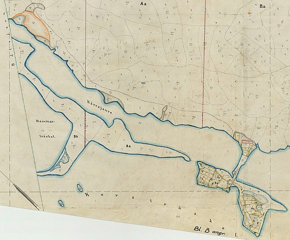
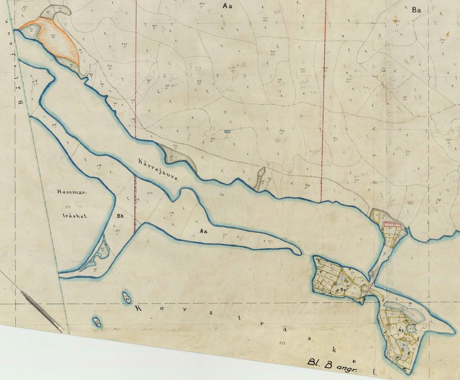
Svenska: Utsnitt ur lagaskifteskarta över Korsträsks by, Arjeplogs socken, Norrbottens län, upprättad år 1912. Laga skiftet fastställdes 16 september 1916.
English: Part of map of Korsträsk village, Arjeplog parish, Norrbotten county, northern Sweden, drawn in 1912. |
| Date | |
| Source | Lantmäteriets historiska kartor |
| Author | Ernst Sandström, distrikslantmätare (1994-1936) |
| Permission (Reusing this file) |
Vid användning utanför Wikipediaprojektet måste "Foto: Gudrun Norstedt" anges intill bilden. When used outside the Wikipedia project the photo must be labelled "Photo: Gudrun Norstedt" or the equivalent in the relevant language. |
| Camera location | | View this and other nearby images on: OpenStreetMap |
|---|
Licensing
[edit]
|
This work is in the public domain in its country of origin and other countries and areas where the copyright term is the author's life plus 70 years or fewer. This work is in the public domain in the United States because it was published (or registered with the U.S. Copyright Office) before January 1, 1929. | |
| This file has been identified as being free of known restrictions under copyright law, including all related and neighboring rights. | |
File history
Click on a date/time to view the file as it appeared at that time.
| Date/Time | Thumbnail | Dimensions | User | Comment | |
|---|---|---|---|---|---|
| current | 12:17, 19 August 2017 | | 1,085 × 896 (573 KB) | Skogsfrun (talk | contribs) | User created page with UploadWizard |
You cannot overwrite this file.
File usage on Commons
There are no pages that use this file.
File usage on other wikis
The following other wikis use this file:
- Usage on sv.wikipedia.org