File:Korsbetningen - KMB - 16001000033524.jpg
Jump to navigation
Jump to search
Size of this preview: 447 × 600 pixels. Other resolutions: 179 × 240 pixels | 574 × 770 pixels.
Original file (574 × 770 pixels, file size: 135 KB, MIME type: image/jpeg)
Captions
Captions
Add a one-line explanation of what this file represents
| Korsbetningen
( |
|||||||||||||||||||||||||||
|---|---|---|---|---|---|---|---|---|---|---|---|---|---|---|---|---|---|---|---|---|---|---|---|---|---|---|---|
| Photographer |
|
||||||||||||||||||||||||||
| Title |
Korsbetningen |
||||||||||||||||||||||||||
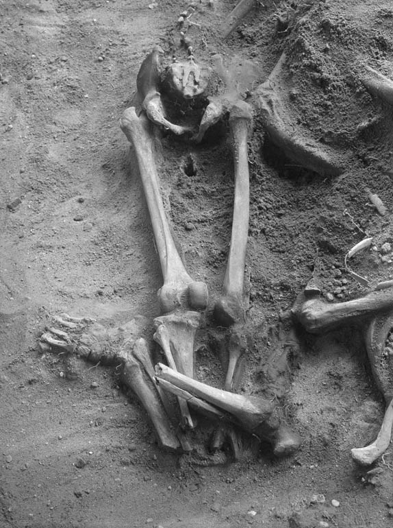
| Original caption |
Notera Av dokumentationsskäl har originalbeskrivningen från Riksantikvarieämbetet behållits. Tillrättalägganden och alternativa beskrivningar bör införas separat från nedanstående information. Massgrav 3:II:Fe 2.Tibia och fibula avhuggna.Felaktigheter kan även anmälas till denna sida. Motiv: Korsbetningen |
||||||||||||||||||||||||||
| Description |
Massgrav 3:II:Fe 2.Tibia och fibula avhuggna.
|
||||||||||||||||||||||||||
| Depicted place | Sweden, Gotland Municipality, Visby civil parish | ||||||||||||||||||||||||||
| Date | 18 July 1928 | ||||||||||||||||||||||||||
| Collection |
|
||||||||||||||||||||||||||
| Accession number | |||||||||||||||||||||||||||
| Source |
Nils Åzelius / Kulturmiljöbild, Riksantikvarieämbetet
|
||||||||||||||||||||||||||
| Permission (Reusing this file) |
|
||||||||||||||||||||||||||


| Object location | | View this and other nearby images on: OpenStreetMap |
|---|
File history
Click on a date/time to view the file as it appeared at that time.
| Date/Time | Thumbnail | Dimensions | User | Comment | |
|---|---|---|---|---|---|
| current | 00:45, 10 June 2017 | | 574 × 770 (135 KB) | AndreCostaWMSE-bot (talk | contribs) | {{Kulturmiljöbild-image | short title = Korsbetningen | original description = Massgrav 3:II:Fe 2.Tibia och fibula avhuggna.<br> Motiv: Korsbetningen<br> Kategori: Gravfält | wiki description = Massgrav 3:II:Fe 2.Tibia och fibula avhuggna. {{Fornminn... |
You cannot overwrite this file.
File usage on Commons
The following page uses this file: