File:Korean Peninsula (MODIS 2019-11-29).jpg
Jump to navigation
Jump to search

Size of this preview: 781 × 600 pixels. Other resolutions: 313 × 240 pixels | 625 × 480 pixels | 1,000 × 768 pixels | 1,280 × 983 pixels | 2,560 × 1,966 pixels | 4,604 × 3,536 pixels.
Original file (4,604 × 3,536 pixels, file size: 2.02 MB, MIME type: image/jpeg)
Captions
Captions
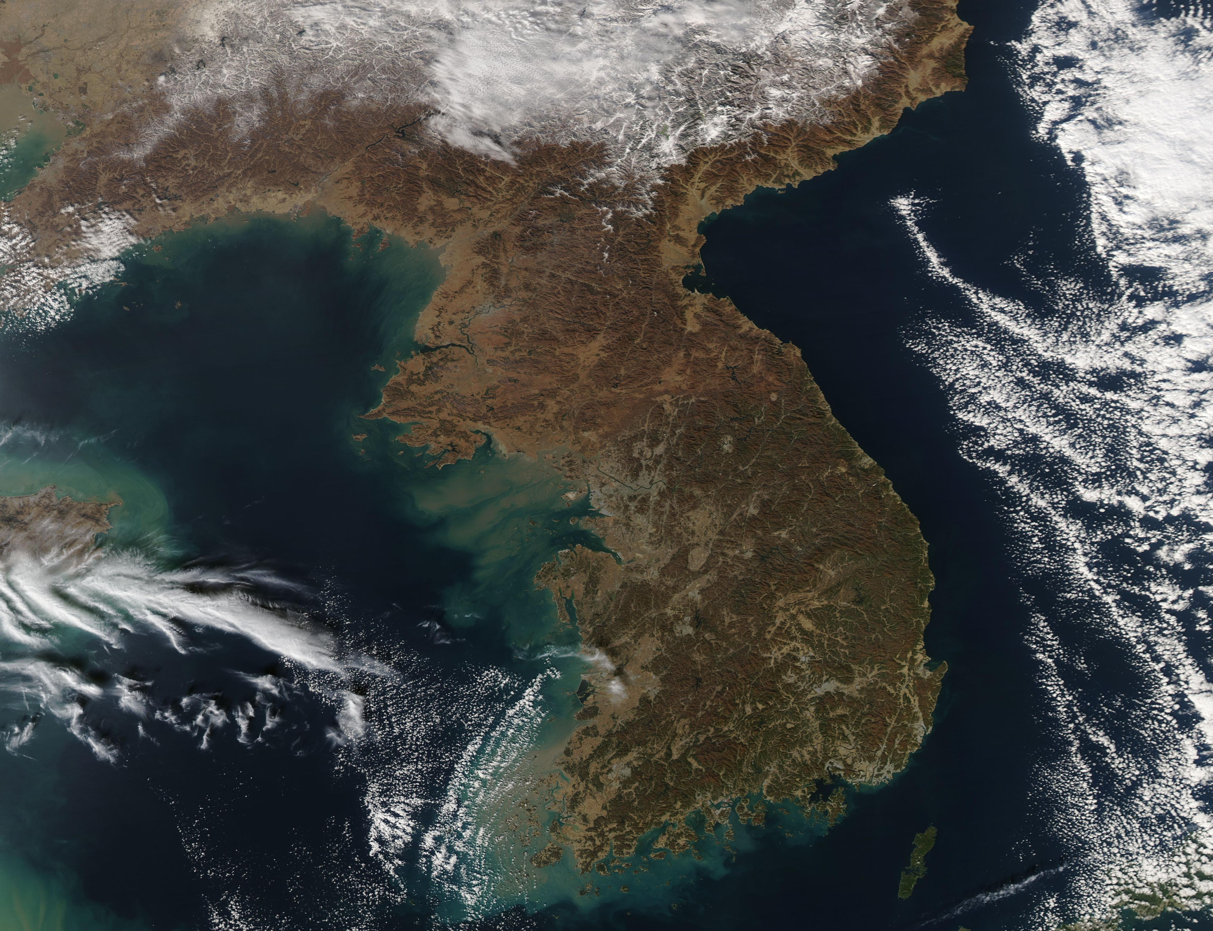
The Moderate Resolution Imaging Spectroradiometer (MODIS) on board NASA’s Aqua satellite acquired a true-color image of the sunny scene on that same day.
Summary
[edit].jpg&action=edit§ion=1)
| Description |
English: While fresh snow blanketed southeastern China and clouds hung over both the Yellow Sea (east) and Sea of Japan (East Sea), the skies over the Korean Peninsula were cloud-free on November 20, 2019. The Moderate Resolution Imaging Spectroradiometer (MODIS) on board NASA’s Aqua satellite acquired a true-color image of the sunny scene on that same day.
The Korean Peninsula stretches about 680 miles (1,100 km) southward from its border with China. It is divided between two countries, the Democratic People's Republic of Korea (North Korea) and the Republic of Korea (South Korea). The boundary between North Korea and South Korea runs roughly along the 38th parallel. This boundary was established in 1953 in an armistice agreement and is called the Korean Demilitarized Zone (DMZ). It is 237 km (147.3 mi) long. North Korea is larger than the state of Virginia and slightly smaller than Mississippi, encompassing 46,490 sq. mi (120,408 sq. km) of land. South Korea, sitting at the tip of the Korean Peninsula, has a land area of 37,421 sq. mi (96,920 sq. km), making it slightly smaller than the state of Pennsylvania but larger than the state of Indiana. South Korea enjoys roughly 1,500 mi (2,413 km) of coastline compared to North Korea’s slightly longer coastline which runs about 1,550 mi (2,495 km). |
||
| Date | Taken on 20 November 2019 | ||
| Source |
Korean Peninsula (direct link)
|
||
| Author | MODIS Land Rapid Response Team, NASA GSFC |
| This media is a product of the Aqua mission Credit and attribution belongs to the mission team, if not already specified in the "author" row |
Licensing
[edit].jpg&action=edit§ion=2)
| This file is in the public domain in the United States because it was solely created by NASA. NASA copyright policy states that "NASA material is not protected by copyright unless noted". (See Template:PD-USGov, NASA copyright policy page or JPL Image Use Policy.) | ||
 |
Warnings:
|
File history
Click on a date/time to view the file as it appeared at that time.
| Date/Time | Thumbnail | Dimensions | User | Comment | |
|---|---|---|---|---|---|
| current | 02:48, 17 February 2024 | | 4,604 × 3,536 (2.02 MB) | OptimusPrimeBot (talk | contribs) | #Spacemedia - Upload of http://modis.gsfc.nasa.gov/gallery/images/image11292019_250m.jpg via Commons:Spacemedia |
You cannot overwrite this file.
File usage on Commons
There are no pages that use this file.
.jpg&oldid=909380558)