File:Kopia mapy traktatu pokojowego z 14 czerwca 1919 (68904971).jpg
Jump to navigation
Jump to search

Size of this preview: 425 × 599 pixels. Other resolutions: 170 × 240 pixels | 341 × 480 pixels | 545 × 768 pixels | 727 × 1,024 pixels | 1,453 × 2,048 pixels | 12,752 × 17,967 pixels.
Original file (12,752 × 17,967 pixels, file size: 30.08 MB, MIME type: image/jpeg)
Captions
Captions
Add a one-line explanation of what this file represents
Summary
[edit]| Warning | The original file is very high-resolution. It might not load properly or could cause your browser to freeze when opened at full size. |
|---|
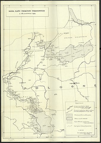
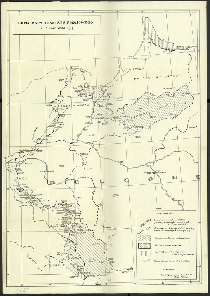
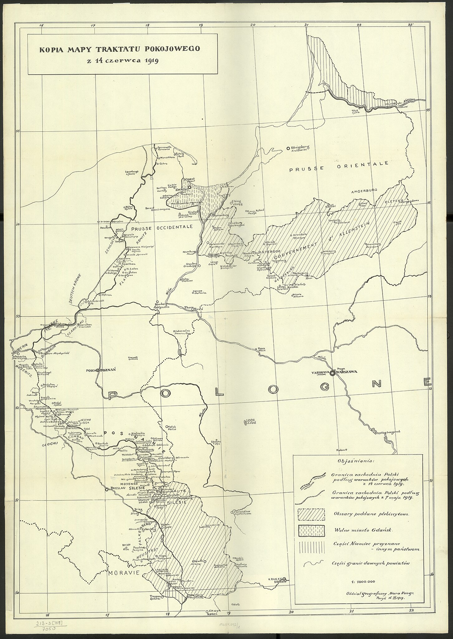
| Kopia mapy traktatu pokojowego z 14 czerwca 1919 | ||||||||||||||||||||||||
|---|---|---|---|---|---|---|---|---|---|---|---|---|---|---|---|---|---|---|---|---|---|---|---|---|
| Title |
Kopia mapy traktatu pokojowego z 14 czerwca 1919 |
|||||||||||||||||||||||
| Publisher |
wydawca nieznany Imprint: Paryż : [wydawca nieznany], 1919 |
|||||||||||||||||||||||
| Description |
Polski: 1 mapa : jednobarwna ; 71x50 cm, arkusz 75x53 cm
Polski: Tytuł z mapy w lewym górnym rogu w ramce.
Polski: Mapa wykonana przez Oddział Geograficzny Biura Prac Kongresowych na konferencji pokojowej w Paryżu (1918-1920).
Polski: Verso: blanco. |
|||||||||||||||||||||||
| Publication date | 1919 | |||||||||||||||||||||||
| Collection |
|
|||||||||||||||||||||||
| Source | https://polona.pl/item/68904971/0 | |||||||||||||||||||||||

.jpg&action=edit§ion=1)
.jpg&flash=no)
Licensing
[edit].jpg&action=edit§ion=2)
|
This work is in the public domain in its country of origin and other countries and areas where the copyright term is the author's life plus 70 years or fewer. | |
| This file has been identified as being free of known restrictions under copyright law, including all related and neighboring rights. | |

|
This file was uploaded to Wikimedia Commons as part of a GLAM-Wiki partnership between the National Library of Poland and Wikimedia Polska.
|
File history
Click on a date/time to view the file as it appeared at that time.
| Date/Time | Thumbnail | Dimensions | User | Comment | |
|---|---|---|---|---|---|
| current | 18:16, 14 February 2019 | | 12,752 × 17,967 (30.08 MB) | Polona Upload (talk | contribs) |
You cannot overwrite this file.
File usage on Commons
The following 2 pages use this file:
.jpg)
.jpg&oldid=664137750)