File:Kokudo20-139Go2006-8.jpg
Jump to navigation
Jump to search

Size of this preview: 756 × 600 pixels. Other resolutions: 303 × 240 pixels | 605 × 480 pixels | 968 × 768 pixels | 1,280 × 1,016 pixels | 1,512 × 1,200 pixels.
Original file (1,512 × 1,200 pixels, file size: 438 KB, MIME type: image/jpeg)
Captions
Captions
Add a one-line explanation of what this file represents
Summary
[edit]
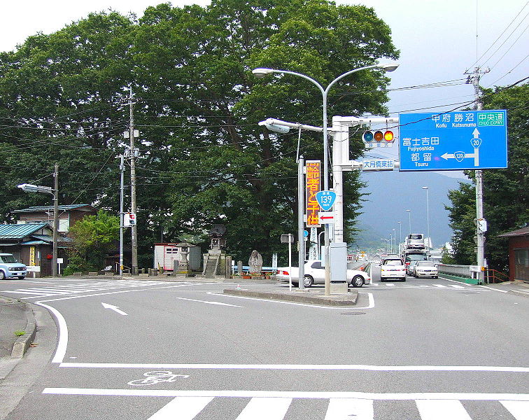
| Description | Crossroad of Route 20 and 139 of Japan. Ōtsuki, Yamanashi prefecture, Japan. |
| Date | 25 August 2006 (according to Exif data) |
| Source | No machine-readable source provided. Own work assumed (based on copyright claims). |
| Author | No machine-readable author provided. Kinori assumed (based on copyright claims). |
- 位置 - 日本国、山梨県、大月市。大月橋東詰交差点で、西向き。
- 撮影日 - 2006年8月25日。
- 撮影者 - Kinori。
- 左が国道139号、富士道。手前と前方が国道20号、甲州街道である。前方に大月橋がみえる。
en: Route 20 and Route 139 of Japan
[edit]
- Place - Ōtsuki, Yamanashi prefecture, Japan.Westward from the Crosspoint of the East Side of Ōtsuki Bridge.
- Date - August 25, 2006.
- Photographer - Kinori.
- Left is the start point of old Fiji Road, that is a part of the Route (National Highwary) 139 today. Here and right there is the Kōshū Road, now Route 20. We can see the Ōtsuki Bridge.
Licensing
[edit]
| I, the copyright holder of this work, release this work into the public domain. This applies worldwide. In some countries this may not be legally possible; if so: I grant anyone the right to use this work for any purpose, without any conditions, unless such conditions are required by law. |
File history
Click on a date/time to view the file as it appeared at that time.
| Date/Time | Thumbnail | Dimensions | User | Comment | |
|---|---|---|---|---|---|
| current | 10:40, 21 January 2007 | | 1,512 × 1,200 (438 KB) | Kinori (talk | contribs) | Crossroad of Route 20 and 139 of Japan. Ōtsuki, Yamanashi prefecture, Japan. == ja: ja:国道20号とja:国道139号の交点 == *位置 - 日本国、山梨県、ja:大月市。大月橋東詰交差点で、西� |
You cannot overwrite this file.
File usage on Commons
There are no pages that use this file.
File usage on other wikis
The following other wikis use this file:
- Usage on af.wikipedia.org