File:Knights Ferry Covered Bridge (5979049563).jpg
Jump to navigation
Jump to search

Size of this preview: 800 × 531 pixels. Other resolutions: 320 × 213 pixels | 640 × 425 pixels | 1,024 × 680 pixels | 1,280 × 850 pixels | 2,560 × 1,700 pixels | 4,288 × 2,848 pixels.
Original file (4,288 × 2,848 pixels, file size: 5.79 MB, MIME type: image/jpeg)
Captions
Captions
Add a one-line explanation of what this file represents
Summary
[edit].jpg&action=edit§ion=1)
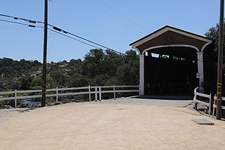
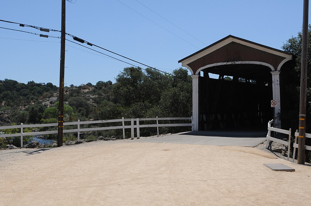
| Description | The Knights Ferry Covered Bridge near Oakdale, Calif., shown July 22, 2011, was surveyed in June by the National Park Service for inclusion as a historic landmark in the Library of Congress. The U.S. Army Corps of Engineers Sacramento District is charged with preserving the bridge, which is located on land managed under the district's Stanislaus River Parks. (U.S. Army Photo/DeDe Cordell) |
| Date | |
| Source | Knights Ferry Covered Bridge |
| Author | U.S. Army Corps of Engineers Sacramento District |
| Camera location | | View this and other nearby images on: OpenStreetMap |
|---|
.jpg¶ms=037.819141_N_-120.667734_E_globe:Earth_type:camera_source:Flickr_&language=en)
Licensing
[edit].jpg&action=edit§ion=2)
This image or file is a work of a U.S. Army Corps of Engineers soldier or employee, taken or made as part of that person's official duties. As a work of the U.S. federal government, the image is in the public domain.
|
| This image was originally posted to Flickr by USACE-Sacramento District at https://flickr.com/photos/52057813@N07/5979049563. It was reviewed on 12 October 2016 by FlickreviewR and was confirmed to be licensed under the terms of the United States Government Work. |
File history
Click on a date/time to view the file as it appeared at that time.
| Date/Time | Thumbnail | Dimensions | User | Comment | |
|---|---|---|---|---|---|
| current | 06:27, 12 October 2016 | | 4,288 × 2,848 (5.79 MB) | Vanished Account Byeznhpyxeuztibuo (talk | contribs) | Transferred from Flickr via Flickr2Commons |
You cannot overwrite this file.
File usage on Commons
There are no pages that use this file.
.jpg&oldid=861032491)