File:Kleinmaischeid Zirkelschlag.jpg
Jump to navigation
Jump to search

Size of this preview: 800 × 513 pixels. Other resolutions: 320 × 205 pixels | 640 × 410 pixels | 1,024 × 656 pixels | 1,280 × 821 pixels | 2,452 × 1,572 pixels.
Original file (2,452 × 1,572 pixels, file size: 686 KB, MIME type: image/jpeg)
Captions
Captions
Add a one-line explanation of what this file represents
| Description |
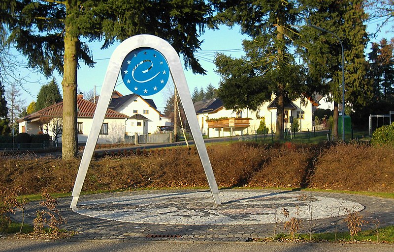
Deutsch: Denkmal Zirkelschlag in Kleinmaischeid, stellte den geografischen Mittelpunkt der Europäischen Union vom 1. Mai 2004 bis zum 31. Dezember 2006 dar.
English: Memorial Zirkelschlag in Kleinmaischeid, represents the geographical center of the European Union from Mai 1, 2004 until December 31, 2006. |
||
| Date | |||
| Source | Own work | ||
| Author | Leit | ||
| Permission (Reusing this file) |
|
| Camera location | | View this and other nearby images on: OpenStreetMap |
|---|
File history
Click on a date/time to view the file as it appeared at that time.
| Date/Time | Thumbnail | Dimensions | User | Comment | |
|---|---|---|---|---|---|
| current | 11:47, 25 December 2006 | | 2,452 × 1,572 (686 KB) | Leit (talk | contribs) | {{Information |Description= * {{de|Denkmal ''Zirkelschlag'' in de:Kleinmaischeid, stellt den geografischen Mittelpunkt der Europäischen Union vom 1. Mai 2004 bis zum 31. Dezember 2006 dar.}} * {{en|Memorial ''Zirkelschlag'' in de:Kleinmaischaid |
You cannot overwrite this file.
File usage on Commons
There are no pages that use this file.
File usage on other wikis
The following other wikis use this file:
- Usage on ca.wikipedia.org
- Usage on de.wikipedia.org
- Usage on en.wikipedia.org
- Usage on eo.wikipedia.org
- Usage on es.wikipedia.org
- Usage on fr.wikipedia.org
- Usage on hu.wikipedia.org
- Usage on kk.wikipedia.org
- Usage on nl.wikipedia.org
- Usage on ru.wikipedia.org
- Usage on uk.wikipedia.org