File:Klamath "Falls" - a misnomer (25142887521).jpg
Jump to navigation
Jump to search

Size of this preview: 800 × 536 pixels. Other resolutions: 320 × 214 pixels | 640 × 429 pixels | 1,024 × 686 pixels | 1,280 × 858 pixels | 2,560 × 1,715 pixels | 5,310 × 3,558 pixels.
Original file (5,310 × 3,558 pixels, file size: 9.73 MB, MIME type: image/jpeg)
Captions
Captions
Add a one-line explanation of what this file represents
Summary
[edit].jpg&action=edit§ion=1)
| Description |
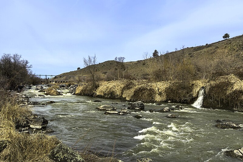
Where are the falls? Klamath Falls was originally callled Linkville (for the Link River). In 1893, the name was changed to Klamath Falls, referring to this less than exciting set of Grade 2 rapids. To make matters worse, in 1921 they built a dam across the river. Now the rapids are only visible for a few months a year, when water flow is high. Talk about hubris. Road Trip Day 3 |
| Date | |
| Source | Klamath "Falls" - a misnomer |
| Author | Sheila Sund from Salem, United States |
| Camera location | | View this and other nearby images on: OpenStreetMap |
|---|
.jpg¶ms=042.231822_N_-121.801128_E_globe:Earth_type:camera_source:Flickr_&language=en)
Licensing
[edit].jpg&action=edit§ion=2)
This file is licensed under the Creative Commons Attribution 2.0 Generic license.
- You are free:
- to share – to copy, distribute and transmit the work
- to remix – to adapt the work
- Under the following conditions:
- attribution – You must give appropriate credit, provide a link to the license, and indicate if changes were made. You may do so in any reasonable manner, but not in any way that suggests the licensor endorses you or your use.
| This image was originally posted to Flickr by docoverachiever at https://flickr.com/photos/90692748@N04/25142887521 (archive). It was reviewed on 21 November 2018 by FlickreviewR 2 and was confirmed to be licensed under the terms of the cc-by-2.0. |
File history
Click on a date/time to view the file as it appeared at that time.
| Date/Time | Thumbnail | Dimensions | User | Comment | |
|---|---|---|---|---|---|
| current | 21:02, 21 November 2018 | | 5,310 × 3,558 (9.73 MB) | Jon Kolbert (talk | contribs) | Transferred from Flickr via #flickr2commons |
You cannot overwrite this file.
File usage on Commons
There are no pages that use this file.
.jpg&oldid=480069083)