File:Kirovs'kyi district, Donetsk, Donetsk Oblast, Ukraine - panoramio.jpg
Jump to navigation
Jump to search
Size of this preview: 800 × 281 pixels. Other resolutions: 320 × 112 pixels | 640 × 225 pixels | 1,024 × 359 pixels | 1,280 × 449 pixels | 5,093 × 1,788 pixels.
Original file (5,093 × 1,788 pixels, file size: 1.39 MB, MIME type: image/jpeg)
Captions
Captions
Add a one-line explanation of what this file represents
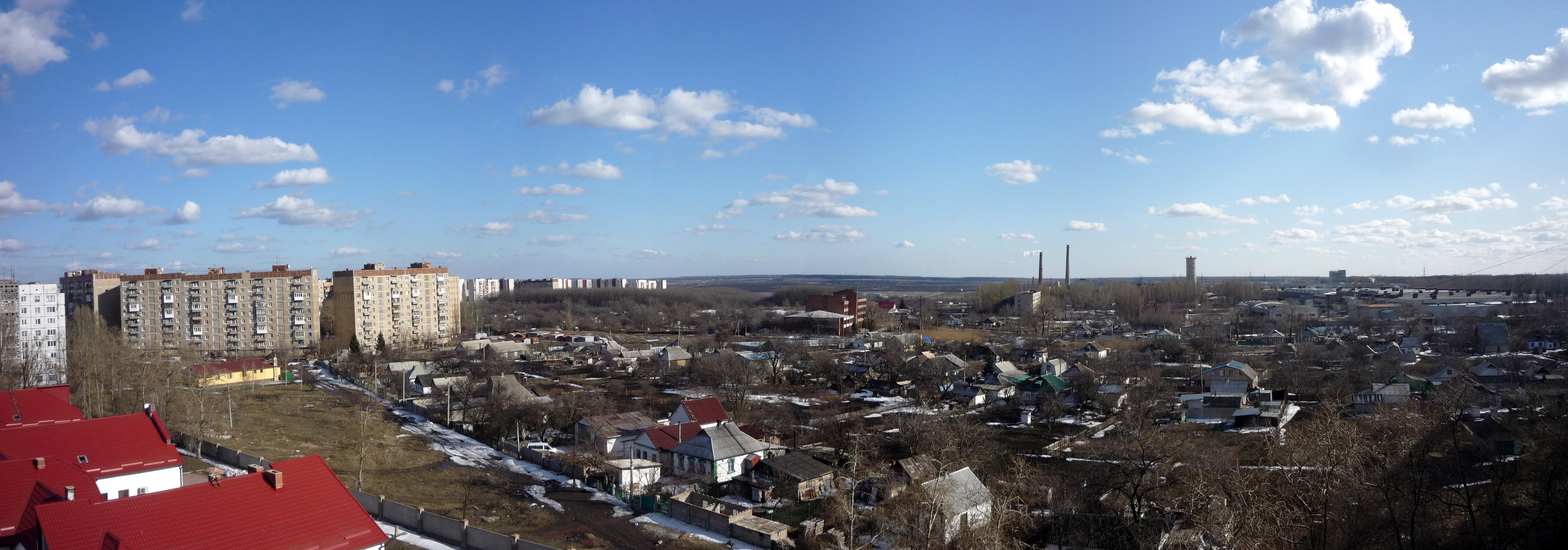
| Description | Kirovs'kyi district, Donetsk, Donetsk Oblast, Ukraine | ||
| Date | 18 March 2010 (original upload date) | ||
| Source | https://web.archive.org/web/20161015113414/http://www.panoramio.com/photo/33365740 | ||
| Author | dc_ScAn | ||
| Permission (Reusing this file) |
This file is licensed under the Creative Commons Attribution 3.0 Unported license. Attribution: dc_ScAn
|
| Camera location | | View this and other nearby images on: OpenStreetMap |
|---|

File history
Click on a date/time to view the file as it appeared at that time.
| Date/Time | Thumbnail | Dimensions | User | Comment | |
|---|---|---|---|---|---|
| current | 23:59, 4 November 2016 | 5,093 × 1,788 (1.39 MB) | Panoramio upload bot (talk | contribs) | {{Information |description=Kirovs'kyi district, Donetsk, Donetsk Oblast, Ukraine |date={{Original upload date|2010-03-18}} |source=http://www.panoramio.com/photo/33365740 |author=[http://www.panoramio.com/user/1405063?with_photo_id=33365740 dc_ScAn] |p... |
You cannot overwrite this file.
File usage on Commons
There are no pages that use this file.
File usage on other wikis
The following other wikis use this file:
- Usage on fi.wikipedia.org