File:Kiribati map LOC.jpg
Jump to navigation
Jump to search
Size of this preview: 740 × 599 pixels. Other resolutions: 296 × 240 pixels | 593 × 480 pixels | 948 × 768 pixels | 1,264 × 1,024 pixels | 2,399 × 1,943 pixels.
Original file (2,399 × 1,943 pixels, file size: 740 KB, MIME type: image/jpeg)
Captions
Captions
Add a one-line explanation of what this file represents

|
This locator map image could be re-created using vector graphics as an SVG file. This has several advantages; see Commons:Media for cleanup for more information. If an SVG form of this image is available, please upload it and afterwards replace this template with
{{vector version available|new image name}}.
It is recommended to name the SVG file “Kiribati map LOC.svg”—then the template Vector version available (or Vva) does not need the new image name parameter. |


| Description |
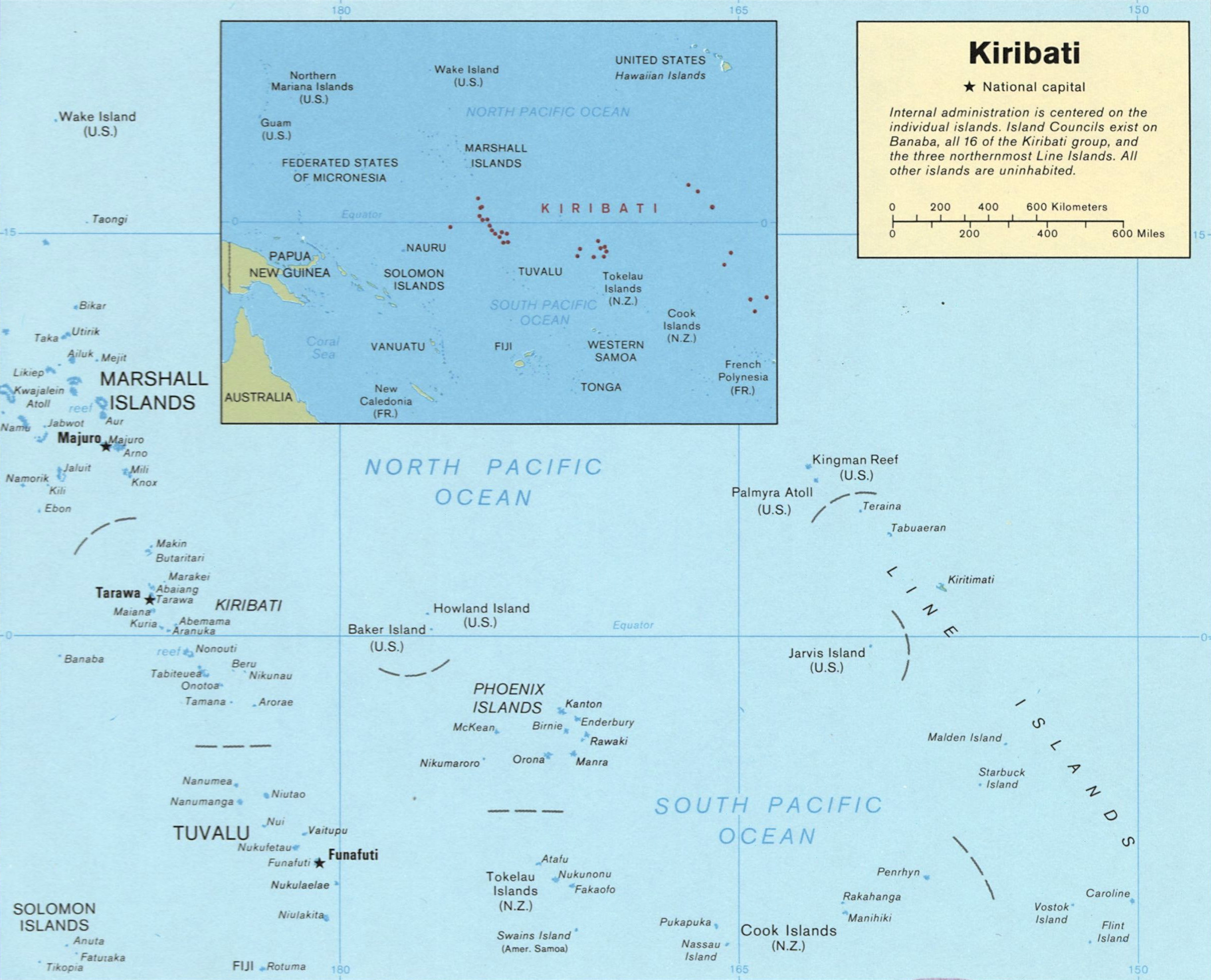
English: Map of Kiribati
Español: Mapa de Kiribati |
|||
| Source | http://memory.loc.gov/cgi-bin/map_item.pl?data=/home/www/data/gmd/gmd9/g9480/g9480/ct001399.jp2&style=gmd&itemLink=r?ammem/gmd:@field(NUMBER+@band(g9480+ct001399))&title=Kiribati. | |||
| Author | US Dept of Congress, 1989 | |||
| Permission (Reusing this file) |
|

File history
Click on a date/time to view the file as it appeared at that time.
| Date/Time | Thumbnail | Dimensions | User | Comment | |
|---|---|---|---|---|---|
| current | 13:12, 15 August 2010 | | 2,399 × 1,943 (740 KB) | Ras67 (talk | contribs) | cropped |
| 03:52, 19 January 2008 |  | 2,417 × 1,969 (447 KB) | Indolences (talk | contribs) | {{Information |Description= ''English'': Map of Kiribati ''Español'': Mapa de Kiribati |Source= ru:Изображение:Карта Кирибати.svg |Date= |Author= US Dept of Congress, 1989 |Permission= {{PD-USGo |
You cannot overwrite this file.
File usage on Commons
The following page uses this file:
File usage on other wikis
The following other wikis use this file:
- Usage on ace.wikipedia.org
- Usage on af.wikipedia.org
- Usage on als.wikipedia.org
- Usage on ami.wikipedia.org
- Usage on ar.wikipedia.org
- Usage on bg.wikipedia.org
- Usage on br.wikipedia.org
- Usage on el.wikipedia.org
- Usage on en.wikipedia.org
- Usage on en.wikiversity.org
- Usage on fa.wikipedia.org
- Usage on fr.wiktionary.org
- Usage on ga.wikipedia.org
- Usage on id.wikipedia.org
- Usage on ka.wikipedia.org
- Usage on lfn.wikipedia.org
- Usage on lt.wikipedia.org
- Usage on mrj.wikipedia.org
- Usage on pl.wikipedia.org
- Usage on pt.wikipedia.org
- Usage on ro.wikipedia.org
- Usage on ru.wikipedia.org
- Usage on sk.wikipedia.org
- Usage on tr.wiktionary.org
- Usage on uk.wikipedia.org
- Usage on vi.wikipedia.org
- Usage on xmf.wikipedia.org
- Usage on zh.wikipedia.org