File:Kermorvan-lighthouse-20060525-020.jpg
Jump to navigation
Jump to search
Size of this preview: 800 × 529 pixels. Other resolutions: 320 × 212 pixels | 640 × 424 pixels | 1,024 × 678 pixels | 1,280 × 847 pixels | 3,031 × 2,006 pixels.
Original file (3,031 × 2,006 pixels, file size: 1.12 MB, MIME type: image/jpeg)
Captions
Captions
Add a one-line explanation of what this file represents
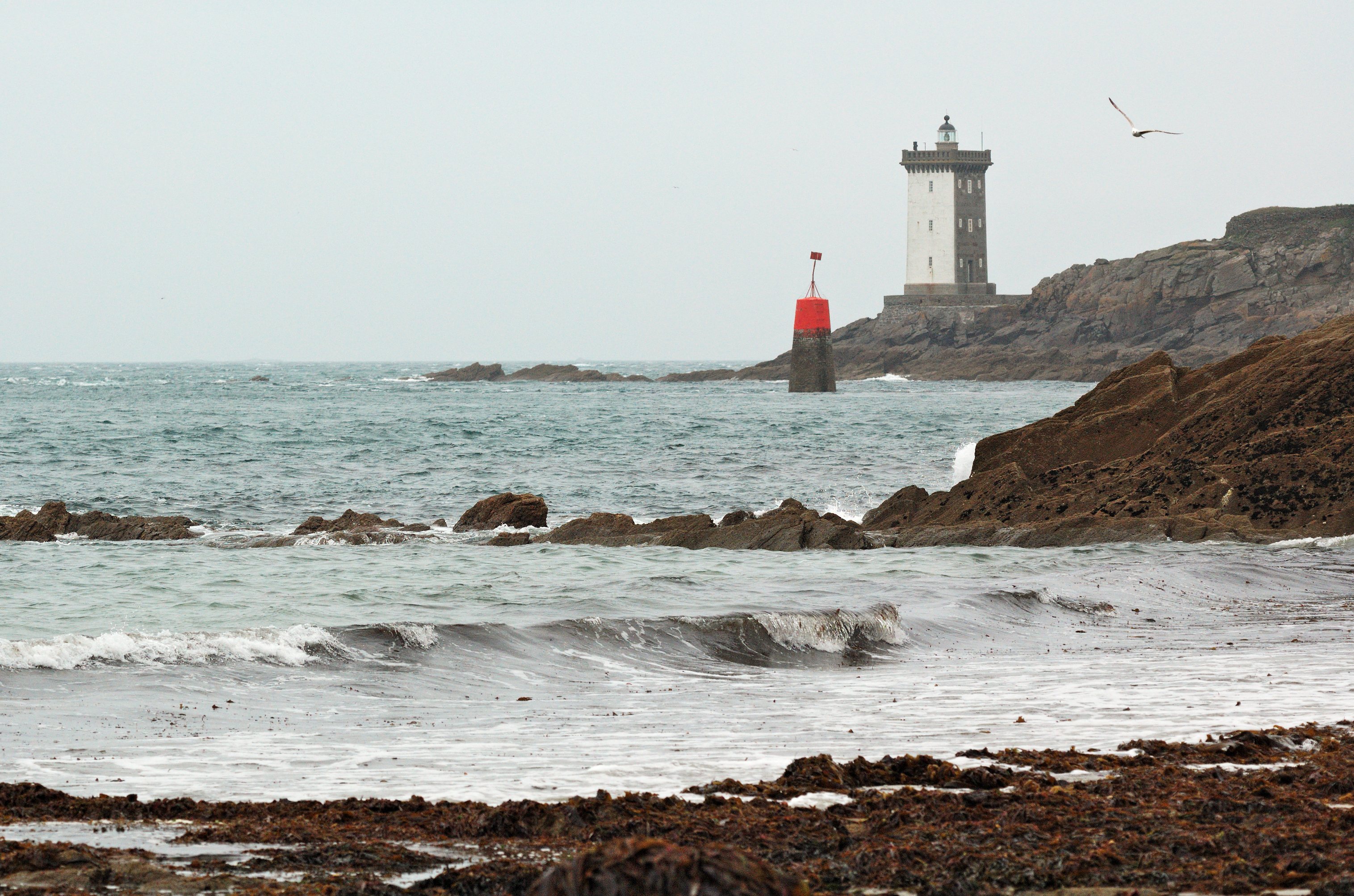
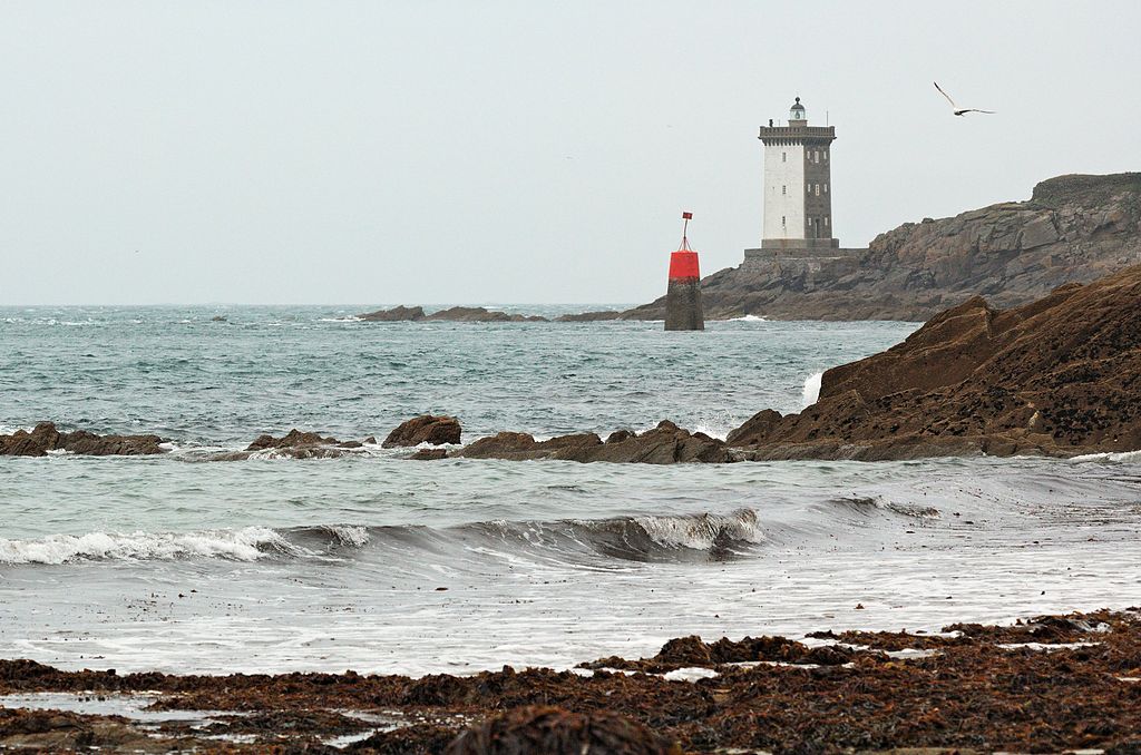
| Description | Le Conquet beach and Kermorvan lighthouse (Phare de Kermorvan). Finistère, Bretagne, France. |
| Date | 25 May 2006, 12:46 +02:00 |
| Source | Own work |
| Author | Ghouston 16:16, 15 January 2007 (UTC) |
| This file is made available under the Creative Commons CC0 1.0 Universal Public Domain Dedication. | |
| The person who associated a work with this deed has dedicated the work to the public domain by waiving all of their rights to the work worldwide under copyright law, including all related and neighboring rights, to the extent allowed by law. You can copy, modify, distribute and perform the work, even for commercial purposes, all without asking permission.
|
| Camera location | | View this and other nearby images on: OpenStreetMap |
|---|
File history
Click on a date/time to view the file as it appeared at that time.
| Date/Time | Thumbnail | Dimensions | User | Comment | |
|---|---|---|---|---|---|
| current | 09:28, 10 September 2013 | | 3,031 × 2,006 (1.12 MB) | Ghouston (talk | contribs) | Reprocessed from raw, rotated slightly. |
| 16:16, 15 January 2007 |  | 3,039 × 2,014 (1,016 KB) | Ghouston (talk | contribs) | {{Information| |Description = Le Conquet beach and Kermorvan lighthouse (Phare de Kermorvan). Finistère, Bretagne, France. |Source = self-made - http://arglist.com/cgi-bin/image?gallery=le_conquet&name=20060525-020 |Date = image taken 25 May 2006. |Autho |
You cannot overwrite this file.
File usage on Commons
The following 2 pages use this file:
File usage on other wikis
The following other wikis use this file:
- Usage on nl.wikipedia.org