File:Kazankreml map1739.jpg
Jump to navigation
Jump to search
Size of this preview: 687 × 600 pixels. Other resolutions: 275 × 240 pixels | 550 × 480 pixels | 880 × 768 pixels | 1,173 × 1,024 pixels | 2,347 × 2,048 pixels | 3,191 × 2,785 pixels.
Original file (3,191 × 2,785 pixels, file size: 5.17 MB, MIME type: image/jpeg)
Captions
Captions
Add a one-line explanation of what this file represents
Summary
[edit]
| Description |
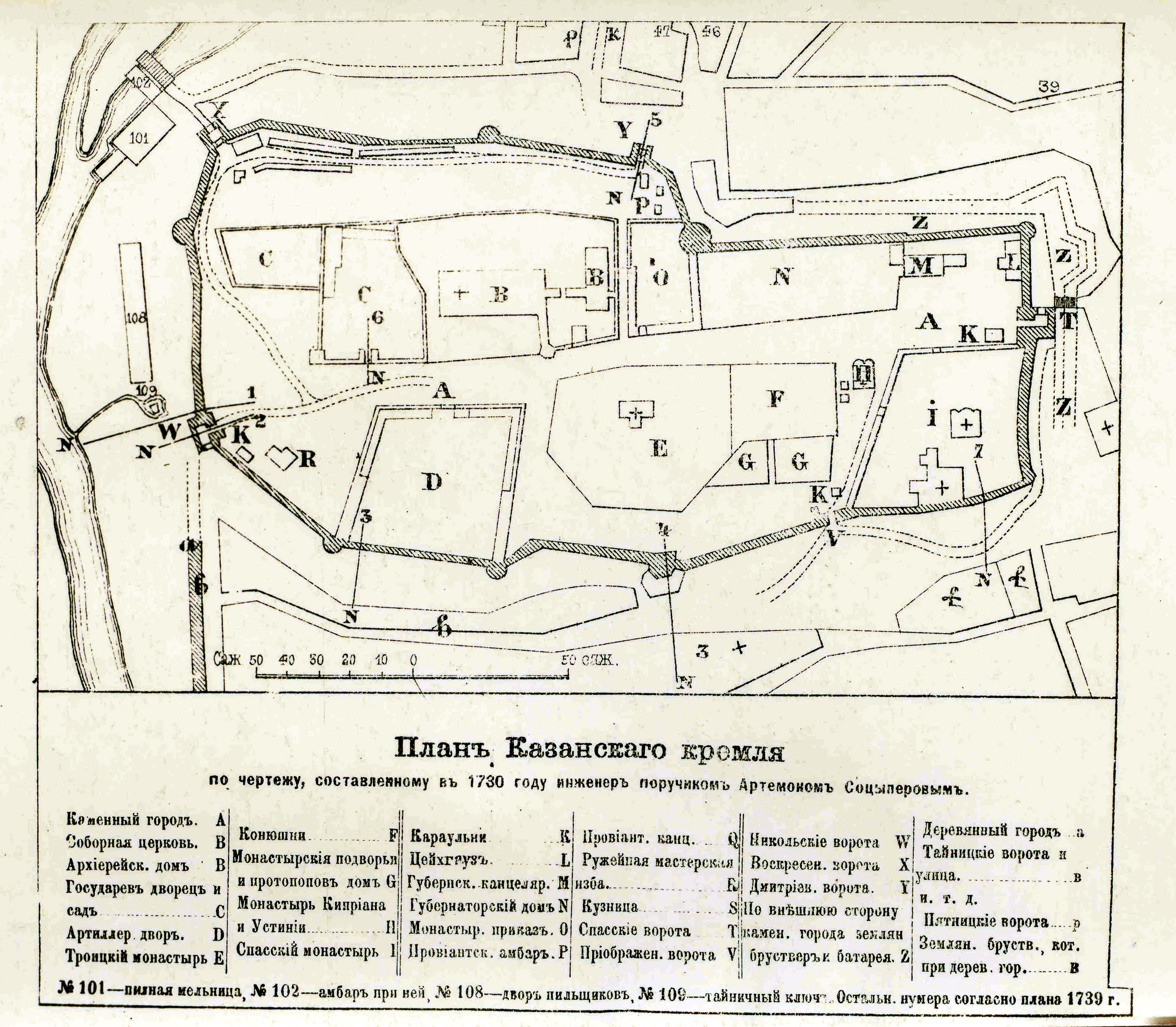
English: Plan of Kazan Kremlin, taken by military engineer lieutenant Anton Sociperov in 1730.
Letter I – Spaso-Preobrazhensky (Saviour- Transfiguration) monastery Letter E – Troitsky (Trinity) monastery Letter H – Church pf snts Kiprian and Iustinia Letter B – Blagoveshensky (Annunciation) Cathedral |
| Date | 18th century |
| Source | old book |
| Author | author died more than 70 years ago |
Licensing
[edit]
|
This work is in the public domain in its country of origin and other countries and areas where the copyright term is the author's life plus 70 years or fewer. | |
| This file has been identified as being free of known restrictions under copyright law, including all related and neighboring rights. | |
File history
Click on a date/time to view the file as it appeared at that time.
| Date/Time | Thumbnail | Dimensions | User | Comment | |
|---|---|---|---|---|---|
| current | 07:39, 1 February 2010 | | 3,191 × 2,785 (5.17 MB) | Berlogin (talk | contribs) | {{Information |Description={{en|1=Plan of Kazan Kremlin, taken by military engineer lieutenant Anton Sociperov in 1730. Letter I – Spaso-Preobrazhensky (Saviour- Transfiguration) monastery Letter E – Troitsky (Trinity) monastery Letter H – Church |
You cannot overwrite this file.
File usage on Commons
There are no pages that use this file.
File usage on other wikis
The following other wikis use this file:
- Usage on az.wikipedia.org
- Usage on ba.wikipedia.org
- Usage on he.wikipedia.org
- Usage on ru.wikipedia.org
- Usage on tt.wikipedia.org
- Usage on uk.wikipedia.org