File:Katolikus templom címeres kapudísze, 2020 Jászapáti.jpg
Jump to navigation
Jump to search

Size of this preview: 677 × 599 pixels. Other resolutions: 271 × 240 pixels | 542 × 480 pixels | 868 × 768 pixels | 1,157 × 1,024 pixels | 1,600 × 1,416 pixels.
Original file (1,600 × 1,416 pixels, file size: 501 KB, MIME type: image/jpeg)
Captions
Captions
Add a one-line explanation of what this file represents
Summary
[edit]
| Description |
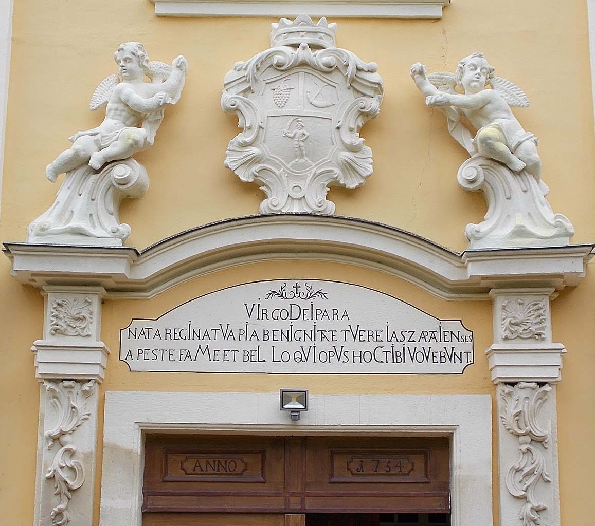
English: : Church of the Nativity of the Virgin Mary, old wooden gate with Anno 1754 inscription. Above the gate a carved stone panel with inscription, Chronogram: „VIrgo DeIpara nata regInatVa Pia BenIgnItate tVere IaszapatIenses a peste faMe et BeLLoqVIopVs hoC tIbI VoVebVnt” and carved children figure and a the CoA of Jászapáti from 1750: Jazygan horn, Jazygan Husssar with sword and grape - István király Park, Hősök Square, Jászapáti, Jász-Nagykun-Szolnok County, Hungary.
Magyar: : Kisboldogasszony-templom díszes északi bejárat. Még a régi templomból való főajtó, középen a homlokzatnál. Felette felirat fordítása: „Istennek Szűz Anyja, született királyné, a te ájtatos kegyességed által védd meg a döghaláltól, éhségtől és háborútól a jászapátiakat, kik ez egyházat Neked ajánlják.” Az építés idejére kronosztikon utal (a latin betűs szöveg egyes kiemelt betűit összeolvasva adódik az évszám) https://www.kozterkep.hu/3884/katolikus-templom-kapudisze-es-cimere- Jász-Nagykun-Szolnok megye, Jászapáti, Hősök tere, István király park
|
||
| Date | |||
| Source | Own work | ||
| Author | Globetrotter19 |
| Object location | | View this and other nearby images on: OpenStreetMap |
|---|
| Camera location | | View this and other nearby images on: OpenStreetMap |
|---|
Licensing
[edit]
I, the copyright holder of this work, hereby publish it under the following license:
This file is licensed under the Creative Commons Attribution-Share Alike 3.0 Unported license.
- You are free:
- to share – to copy, distribute and transmit the work
- to remix – to adapt the work
- Under the following conditions:
- attribution – You must give appropriate credit, provide a link to the license, and indicate if changes were made. You may do so in any reasonable manner, but not in any way that suggests the licensor endorses you or your use.
- share alike – If you remix, transform, or build upon the material, you must distribute your contributions under the same or compatible license as the original.
File history
Click on a date/time to view the file as it appeared at that time.
| Date/Time | Thumbnail | Dimensions | User | Comment | |
|---|---|---|---|---|---|
| current | 21:02, 8 August 2020 | | 1,600 × 1,416 (501 KB) | Globetrotter19 (talk | contribs) | Uploaded own work with UploadWizard |
You cannot overwrite this file.
File usage on Commons
The following page uses this file:
Metadata
This file contains additional information such as Exif metadata which may have been added by the digital camera, scanner, or software program used to create or digitize it. If the file has been modified from its original state, some details such as the timestamp may not fully reflect those of the original file. The timestamp is only as accurate as the clock in the camera, and it may be completely wrong.
| Exposure time | 1/160 sec (0.00625) | ||||||||||
|---|---|---|---|---|---|---|---|---|---|---|---|
| F-number | f/4.9 | ||||||||||
| Lens focal length | 10.3 mm | ||||||||||
| Short title |
| ||||||||||
| Orientation | Normal | ||||||||||
| Horizontal resolution | 300 dpi | ||||||||||
| Vertical resolution | 300 dpi | ||||||||||
| File change date and time | 18:39, 8 August 2020 | ||||||||||
| Y and C positioning | Co-sited | ||||||||||
| Meaning of each component |
| ||||||||||
| Image compression mode | 2 | ||||||||||
| APEX exposure bias | 0.3 | ||||||||||
| Maximum land aperture | 3.4 APEX (f/3.25) | ||||||||||
| Supported Flashpix version | 1 | ||||||||||
| Color space | sRGB | ||||||||||
| File source | Digital still camera | ||||||||||
| Scene type | A directly photographed image | ||||||||||
| Custom image processing | Normal process | ||||||||||
| Exposure mode | Auto exposure | ||||||||||
| Digital zoom ratio | 0 | ||||||||||
| Scene capture type | Standard | ||||||||||
| Scene control | None | ||||||||||
| Subject distance range | Unknown |