File:Katastrální mapa Prahy.PNG
Jump to navigation
Jump to search

Size of this preview: 800 × 585 pixels. Other resolutions: 320 × 234 pixels | 640 × 468 pixels | 1,024 × 749 pixels | 1,373 × 1,004 pixels.
Original file (1,373 × 1,004 pixels, file size: 87 KB, MIME type: image/png)
Captions
Captions
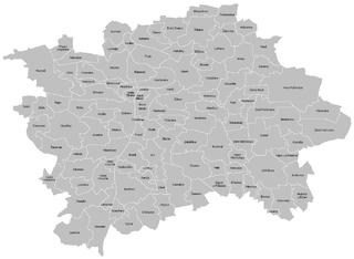
Cadastral map of Prague, Czechia

|
This locator map image could be re-created using vector graphics as an SVG file. This has several advantages; see Commons:Media for cleanup for more information. If an SVG form of this image is available, please upload it and afterwards replace this template with
{{vector version available|new image name}}.
It is recommended to name the SVG file “Katastrální mapa Prahy.svg”—then the template Vector version available (or Vva) does not need the new image name parameter. |
Summary
[edit]
| Description |
English: Cadastral map of Praha
Čeština: Katastrální mapa Prahy |
| Date | |
| Source | Own work |
| Author | Mapového náložník |
| Other versions | Derivative works of this file: Greater Prague.png |
Licensing
[edit]
| I, the copyright holder of this work, release this work into the public domain. This applies worldwide. In some countries this may not be legally possible; if so: I grant anyone the right to use this work for any purpose, without any conditions, unless such conditions are required by law. |
File history
Click on a date/time to view the file as it appeared at that time.
| Date/Time | Thumbnail | Dimensions | User | Comment | |
|---|---|---|---|---|---|
| current | 17:04, 24 March 2011 | | 1,373 × 1,004 (87 KB) | Mapového náložník (talk | contribs) | {{Information |Description ={{en|1=Cadastral map of Praha}} {{cs|1=Katastrální mapa Prahy}} |Source ={{own}} |Author =Mapového náložník |Date =23.3.2011 |Permission = |other_versions = |
You cannot overwrite this file.
File usage on Commons
The following 2 pages use this file:
File usage on other wikis
The following other wikis use this file:
- Usage on ar.wikipedia.org
- Usage on be-tarask.wikipedia.org
- Usage on ceb.wikipedia.org
- Usage on cs.wikipedia.org
- Usage on en.wikipedia.org
- Můstek
- Muzeum (Prague Metro)
- Náměstí Míru (Prague Metro)
- Zličín (Prague Metro)
- Nové Butovice (Prague Metro)
- Náměstí Republiky (Prague Metro)
- Florenc (Prague Metro)
- Českomoravská
- Ládví (Prague Metro)
- Kobylisy (Prague Metro)
- Nádraží Holešovice (Prague Metro)
- Vltavská (Prague Metro)
- Hlavní nádraží (Prague Metro)
- I. P. Pavlova (Prague Metro)
- Vyšehrad (Prague Metro)
- Pražského povstání (Prague Metro)
- Pankrác (Prague Metro)
- Budějovická (Prague Metro)
- Kačerov (Prague Metro)
- Roztyly (Prague Metro)
- Chodov (Prague Metro)
- Opatov (Prague Metro)
- Háje (Prague Metro)
- Football in the Czech Republic
- 1985 Ice Hockey World Championships
- Střížkov (Prague Metro)
- Prosek (Prague Metro)
- Letňany (Prague Metro)
- Morzin Palace
- Module:Location map/data/Czech Republic Greater Prague/doc
- Straka Academy
- Prague–Kbely Airport
- Module:Location map/data/Czech Republic Greater Prague
- Usage on fa.wikipedia.org
- Usage on ja.wikipedia.org
- Usage on kn.wikipedia.org
- Usage on mk.wikipedia.org
- Usage on si.wikipedia.org
- Usage on tr.wikipedia.org
View more global usage of this file.