File:Kasese District in Uganda.svg
Jump to navigation
Jump to search

Size of this PNG preview of this SVG file: 589 × 599 pixels. Other resolutions: 236 × 240 pixels | 472 × 480 pixels | 755 × 768 pixels | 1,007 × 1,024 pixels | 2,013 × 2,048 pixels | 1,441 × 1,466 pixels.
Original file (SVG file, nominally 1,441 × 1,466 pixels, file size: 369 KB)
Captions
Captions
Add a one-line explanation of what this file represents
Summary
[edit]
| Description |
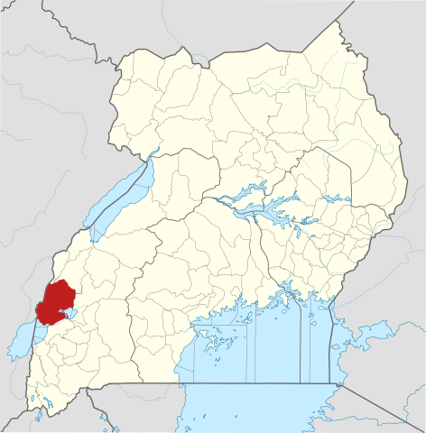
English: The location of Kasese District in Uganda, showing district boundaries as they stood in June 2017. For other districts, see Category:SVG locator maps of Districts in Uganda (location map scheme). This map may be incomplete, and may contain errors. Don't rely solely on it for navigation. In particular, note that this map overlays a spherical pseudo-mercator projection on an equirectangular projection; it is far from technically perfect.
This W3C-unspecified vector image was created with Inkscape . |
|||||||||
| Date | ||||||||||
| Source |
Derivative of:
|
|||||||||
| Creator |
OpenStreetMap contributors, Jarry1250, NordNordWest |
|||||||||
| Permission (Reusing this file) |
This file is licensed under the Creative Commons Attribution-Share Alike 3.0 Unported license. Attribution: © OpenStreetMap contributors, Jarry1250, NordNordWest/Wikipedia
|
|||||||||
| Geotemporal data | ||||||||||
| Map location | Kasese District, Uganda | |||||||||
| Spatial reference system | equirectangular | |||||||||
| Bounding box |
|
|||||||||
| Georeferencing | If inappropriate please set warp_status = skip to hide. | |||||||||
File history
Click on a date/time to view the file as it appeared at that time.
| Date/Time | Thumbnail | Dimensions | User | Comment | |
|---|---|---|---|---|---|
| current | 21:01, 25 June 2017 | | 1,441 × 1,466 (369 KB) | Jarry1250 (talk | contribs) | pattypan 17.05 |
You cannot overwrite this file.
File usage on Commons
The following page uses this file:
File usage on other wikis
The following other wikis use this file:
- Usage on en.wikipedia.org
- Kasese District
- Kasese
- Kazinga Channel
- Roman Catholic Diocese of Kasese
- Kagando Hospital
- Kasese Airport
- Mpondwe
- Hima, Uganda
- Wikipedia:WikiProject Uganda/District templates
- Template:Kasese District
- Mweya
- Mweya Airport
- Kasenyi Airport
- Kasenyi, Kasese
- Joy Doreen Biira
- Hima Cement Limited
- Bugoye Hydroelectric Power Station
- Mubuku I Hydroelectric Power Station
- Mubuku III Hydroelectric Power Station
- Mubuku
- Nyamwamba I Hydroelectric Power Station
- Rwimi Hydroelectric Power Station
- Bugoye
- Lubilia Hydroelectric Power Station
- Kilembe Mines
- Kyondo Kasese
- Bwera General Hospital
- Kilembe, Uganda
- Kilembe Mines Hospital
- Fort Portal–Kasese–Mpondwe Road
- Kikorongo
- Kikorongo–Ishaka Road
- The Rwenzori Times
- Nyamagasani I Hydroelectric Power Station
- Nyamagasani II Hydroelectric Power Station
- Nkenda–Fort Portal–Hoima High Voltage Power Line
- Nkenda–Mpondwe–Beni High Voltage Power Line
- Nkenda
- User:GerardM/Districts of Uganda
- Nyamwamba II Hydroelectric Power Station
- Usage on es.wikipedia.org
- Usage on fa.wikipedia.org
- Usage on fr.wikipedia.org
- Usage on ha.wikipedia.org
- Usage on he.wikipedia.org
- Usage on id.wikipedia.org
- Usage on ig.wikipedia.org
- Usage on ja.wikipedia.org
- Usage on lg.wikipedia.org
- Usage on sw.wikipedia.org
View more global usage of this file.