File:Karte eickeloh 1954.jpg
Jump to navigation
Jump to search

Size of this preview: 792 × 599 pixels. Other resolutions: 317 × 240 pixels | 634 × 480 pixels | 1,015 × 768 pixels | 1,280 × 969 pixels | 2,560 × 1,938 pixels | 3,652 × 2,764 pixels.
Original file (3,652 × 2,764 pixels, file size: 3.86 MB, MIME type: image/jpeg)
Captions
Captions
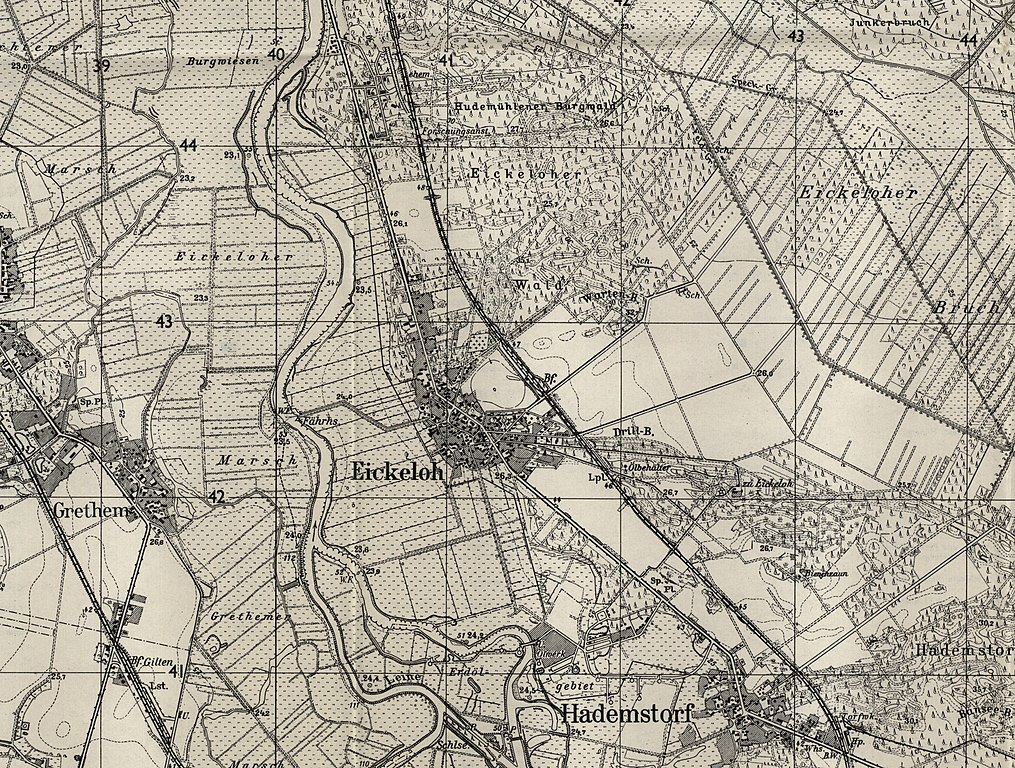
Map of the germany village Eickeloh in 1954
Summary
[edit]
| Description |
English: This image is a map of the german village Eickeloh in 1954. According to the BYU it's part of "a set of topographic maps of pre-World War II Germany, originally printed by the German government, and confiscated by the British and U. S. military after the war. Most of these maps are reprints by the British Geographical Section, General Staff, or the U. S. Army Map Service."
See: https://contentdm.lib.byu.edu/digital/collection/GermanyMaps/id/996 |
| Date | |
| Source | https://contentdm.lib.byu.edu/digital/collection/GermanyMaps/id/996 |
| Author | Reichsamt für Landesaufnahme, Germany |
Licensing
[edit]
This file is in the public domain because it's part of a map that was released as 'public domain' by the Brigham Young University, see https://contentdm.lib.byu.edu/digital/collection/GermanyMaps/id/996
|
File history
Click on a date/time to view the file as it appeared at that time.
| Date/Time | Thumbnail | Dimensions | User | Comment | |
|---|---|---|---|---|---|
| current | 17:13, 17 November 2020 | | 3,652 × 2,764 (3.86 MB) | Politikundwirtschaft (talk | contribs) | Uploaded a work by Reichsamt für Landesaufnahme, Germany from https://contentdm.lib.byu.edu/digital/collection/GermanyMaps/id/996 with UploadWizard |
You cannot overwrite this file.
File usage on Commons
There are no pages that use this file.
File usage on other wikis
The following other wikis use this file:
- Usage on de.wikipedia.org