File:Karte des Deutschen Reiches - 001 - Nimmersatt - 002 - Schattern (1880).jpg
Jump to navigation
Jump to search

Size of this preview: 694 × 599 pixels. Other resolutions: 278 × 240 pixels | 556 × 480 pixels | 889 × 768 pixels | 1,186 × 1,024 pixels | 2,371 × 2,048 pixels | 7,598 × 6,563 pixels.
Original file (7,598 × 6,563 pixels, file size: 14.06 MB, MIME type: image/jpeg)
Captions
Captions
Add a one-line explanation of what this file represents
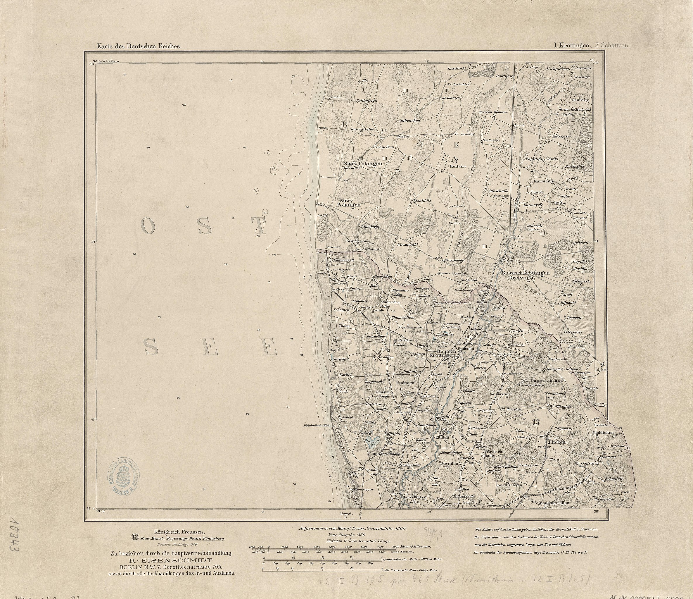
| Karte des Deutschen Reiches (Generalstabskarte), 1 : 100 000 | |||||
|---|---|---|---|---|---|
| 1. Krottingen | 2. Schattern | ||||
| 3. Memel | 4. Paaschken | ||||
| 8. Kinten | 9. Heydekrug | 10. Medischkehmen | |||
| 17. Heinrichswalde | 18. Tilsit | 19. Wischwill | |||
| 33. Pillkallen | 34. Schirwindt-Wladyslawow | ||||
| 54. Stallupönen | |||||
| 78. Mehlkehmen | |||||

.jpg)
.jpg)
.jpg)
.jpg)
.jpg)
.jpg)
.jpg)
.jpg)
.jpg)
.jpg)
.jpg)
.jpg)
.jpg)
Summary
[edit].jpg&action=edit§ion=1)
| Description |
English: Karte des Deutschen Reiches. 1 : 100.000 |
| Date | |
| Source | Karte des Deutschen Reiches |
| Author | Unknown author |
Licensing
[edit].jpg&action=edit§ion=2)
|
This work is in the public domain in its country of origin and other countries and areas where the copyright term is the author's life plus 70 years or fewer. This work is in the public domain in the United States because it was published (or registered with the U.S. Copyright Office) before January 1, 1929. | |
| This file has been identified as being free of known restrictions under copyright law, including all related and neighboring rights. | |
File history
Click on a date/time to view the file as it appeared at that time.
| Date/Time | Thumbnail | Dimensions | User | Comment | |
|---|---|---|---|---|---|
| current | 16:05, 18 September 2018 | | 7,598 × 6,563 (14.06 MB) | Woodie Wood (talk | contribs) | =={{int:filedesc}}== {{Information |description={{en|1=Karte des Deutschen Reiches. 1 : 100.000}} |date=c. 1902 |source=[http://www.deutschefotothek.de/db/apsisa.dll/ete?action=viewPage&page=kartenforum-sachsen-koenigreich.xml Karte des Deutschen Reiches] |author=not known |permission= |other versions= }} =={{int:license-header}}== {{PD-old-70-1923}} Category:Karte des Deutschen Reiches |
You cannot overwrite this file.
File usage on Commons
The following page uses this file:
.jpg)
File usage on other wikis
The following other wikis use this file:
- Usage on de.wikipedia.org
- Usage on lt.wikipedia.org
.jpg&oldid=935638227)
Categories:
- Karte des Deutschen Reiches
- Kretinga in topographic maps
- Kretingalė in topographic maps
- Palanga in topographic maps
- Plikiai in topographic maps
- Bajorai train station in maps
- Baukštininkai train station in maps
- Giruliai train station in maps
- Kalotė train station in maps
- Kopūstai train station in maps
- Kretingalė train station in maps
- Plikiai train station in maps