File:Karte Westtangente Zürich vor Eröffnung der Westumfahrung.png
Jump to navigation
Jump to search

Size of this preview: 669 × 599 pixels. Other resolutions: 268 × 240 pixels | 536 × 480 pixels | 857 × 768 pixels | 1,143 × 1,024 pixels | 1,846 × 1,654 pixels.
Original file (1,846 × 1,654 pixels, file size: 3.64 MB, MIME type: image/png)
Captions
Captions
Add a one-line explanation of what this file represents
Summary
[edit]
| Description |
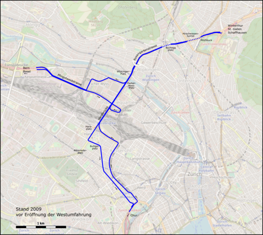
Deutsch: Verlauf der Westtangente in Zürich vor der Eröffnung der Westumfahrung. Kartenhintergrund von Januar 2021, |
| Date | |
| Source |
|
| Author |
|
Licensing
[edit]
This file is licensed under the Creative Commons Attribution-Share Alike 2.0 Generic license.
- You are free:
- to share – to copy, distribute and transmit the work
- to remix – to adapt the work
- Under the following conditions:
- attribution – You must give appropriate credit, provide a link to the license, and indicate if changes were made. You may do so in any reasonable manner, but not in any way that suggests the licensor endorses you or your use.
- share alike – If you remix, transform, or build upon the material, you must distribute your contributions under the same or compatible license as the original.
File history
Click on a date/time to view the file as it appeared at that time.
| Date/Time | Thumbnail | Dimensions | User | Comment | |
|---|---|---|---|---|---|
| current | 03:31, 3 January 2021 | | 1,846 × 1,654 (3.64 MB) | Pechristener (talk | contribs) | Details |
| 08:17, 2 January 2021 |  | 2,113 × 1,654 (4.04 MB) | Pechristener (talk | contribs) | Datenstand in Karte erwähnt | |
| 20:50, 1 January 2021 |  | 1,942 × 1,654 (3.77 MB) | Pechristener (talk | contribs) | Self-Revert to version as of 18:01, 1 January 2021 (UTC) because it was correct | |
| 18:44, 1 January 2021 |  | 2,113 × 1,654 (4.03 MB) | Pechristener (talk | contribs) | im Nordosten ergänzt | |
| 18:01, 1 January 2021 |  | 1,942 × 1,654 (3.77 MB) | Pechristener (talk | contribs) | Uploaded a work by * Verlauf und Hintergrund: OpenStreetMap contributors * Rendering: Pechristener from * Verlauf: [http://www.openstreetmap.org/ Open Street Map] Data * Hintergrund: [http://www.openstreetmap.org/ Open Street Map] with UploadWizard |
You cannot overwrite this file.
File usage on Commons
The following page uses this file:
File usage on other wikis
The following other wikis use this file:
- Usage on de.wikipedia.org