File:Karte Marburg Stadtteile und Nachbargemeinden.png
Jump to navigation
Jump to search

Size of this preview: 681 × 600 pixels. Other resolutions: 273 × 240 pixels | 545 × 480 pixels | 872 × 768 pixels | 1,163 × 1,024 pixels | 1,499 × 1,320 pixels.
Original file (1,499 × 1,320 pixels, file size: 525 KB, MIME type: image/png)
Captions
Captions
Add a one-line explanation of what this file represents
Summary
[edit]
| Description |
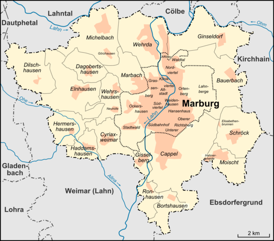
Deutsch: Karte der Stadtteile und Nachbargemeinden der Stadt Marburg |
| Date | |
| Source |
own work, used:
|
| Author | Lencer |
| Other versions |
 |

|
This map has been made or improved in the German Kartenwerkstatt (Map Lab). You can propose maps to improve as well.
|
Licensing
[edit]
This file is licensed under the Creative Commons Attribution-Share Alike 3.0 Unported license.
- You are free:
- to share – to copy, distribute and transmit the work
- to remix – to adapt the work
- Under the following conditions:
- attribution – You must give appropriate credit, provide a link to the license, and indicate if changes were made. You may do so in any reasonable manner, but not in any way that suggests the licensor endorses you or your use.
- share alike – If you remix, transform, or build upon the material, you must distribute your contributions under the same or compatible license as the original.
File history
Click on a date/time to view the file as it appeared at that time.
| Date/Time | Thumbnail | Dimensions | User | Comment | |
|---|---|---|---|---|---|
| current | 18:01, 28 March 2013 | | 1,499 × 1,320 (525 KB) | Lencer (talk | contribs) | auffrischung |
| 11:55, 14 August 2009 |  | 1,500 × 1,321 (537 KB) | Lencer (talk | contribs) | erg. | |
| 07:51, 14 August 2009 |  | 1,500 × 1,321 (494 KB) | Lencer (talk | contribs) | fixes | |
| 13:27, 13 August 2009 |  | 1,500 × 1,321 (495 KB) | Lencer (talk | contribs) | fixes | |
| 12:07, 13 August 2009 |  | 1,500 × 1,321 (492 KB) | Lencer (talk | contribs) | Namen für innere Stadtgebiete ergänzt | |
| 11:22, 13 August 2009 |  | 1,500 × 1,321 (448 KB) | Lencer (talk | contribs) | fix | |
| 11:20, 13 August 2009 |  | 1,500 × 1,321 (448 KB) | Lencer (talk | contribs) | {{Information |Description= Karte der Stadtteile und Nachbargemeinden der Stadt Marburg |Source="own work", used [http://www.marburg.de/sixcms/media.php/19/MR%20Zahlen%202004-2006.pdf Stadtentwicklungsplanung Marburg] |Date=2009-08 |Author |
You cannot overwrite this file.
File usage on Commons
The following page uses this file:
File usage on other wikis
The following other wikis use this file:
- Usage on de.wikipedia.org
- Usage on en.wikipedia.org
- Usage on fa.wikipedia.org
- Usage on hu.wikipedia.org
- Usage on ja.wikipedia.org
- Usage on simple.wikipedia.org