File:Karte Gorxheim Unter-Flockenbach Trösel.jpg
Jump to navigation
Jump to search
Size of this preview: 800 × 462 pixels. Other resolutions: 320 × 185 pixels | 640 × 370 pixels | 1,024 × 592 pixels | 1,280 × 740 pixels | 1,897 × 1,096 pixels.
Original file (1,897 × 1,096 pixels, file size: 2.22 MB, MIME type: image/jpeg)
Captions
Captions
Add a one-line explanation of what this file represents
Summary
[edit]
| Description |
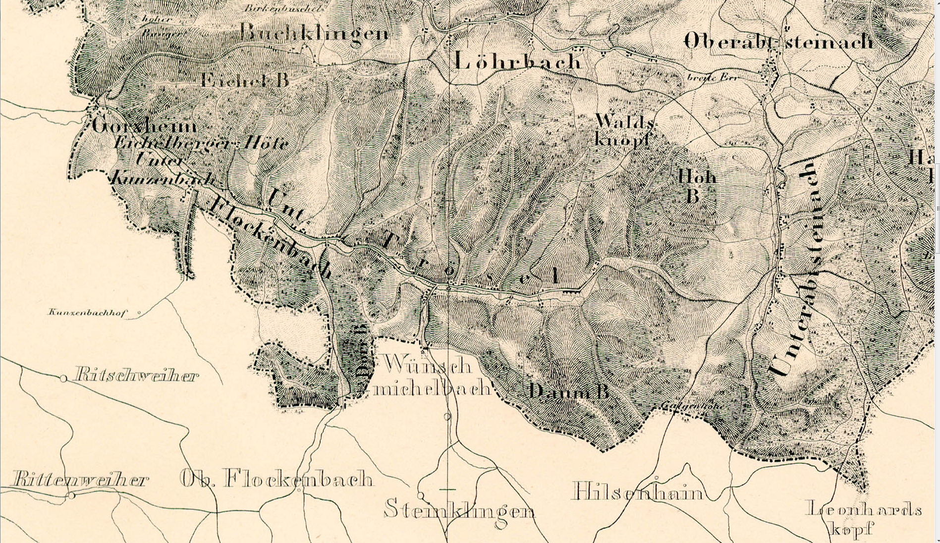
Deutsch: Historische Karte des Großherzogtums Hessen von 1832 bis 1850. Im Maßstab 1:50.000. Blatt 30: Hirschorn. Kartenausschnitt Gorxheim, Unter-Flockenbach und Trösel mit den historischen Weilern Eichenberger Höfe und Kunzenbach English: map Großherzogtums Hessen 1832-1850 |
| Date | between 1832 and 1850 |
| Source | „Großherzogtum Hessen 1832-1850 – 26. Worms“, in: Historische Kartenwerke [1] |
| Author | Capitain Roth |
Licensing
[edit]
|
This work is in the public domain in its country of origin and other countries and areas where the copyright term is the author's life plus 70 years or fewer. This work is in the public domain in the United States because it was published (or registered with the U.S. Copyright Office) before January 1, 1929. | |
| This file has been identified as being free of known restrictions under copyright law, including all related and neighboring rights. | |
File history
Click on a date/time to view the file as it appeared at that time.
| Date/Time | Thumbnail | Dimensions | User | Comment | |
|---|---|---|---|---|---|
| current | 03:29, 26 May 2015 | | 1,897 × 1,096 (2.22 MB) | Kohl Wld (talk | contribs) | User created page with UploadWizard |
You cannot overwrite this file.
File usage on Commons
There are no pages that use this file.
File usage on other wikis
The following other wikis use this file:
- Usage on de.wikipedia.org