File:Karte Alsterhalbring Hamburg (Planungen 1960).png
Jump to navigation
Jump to search
Size of this preview: 759 × 600 pixels. Other resolutions: 304 × 240 pixels | 608 × 480 pixels | 972 × 768 pixels | 1,162 × 918 pixels.
Original file (1,162 × 918 pixels, file size: 399 KB, MIME type: image/png)
Captions
Captions
Add a one-line explanation of what this file represents
| Description |
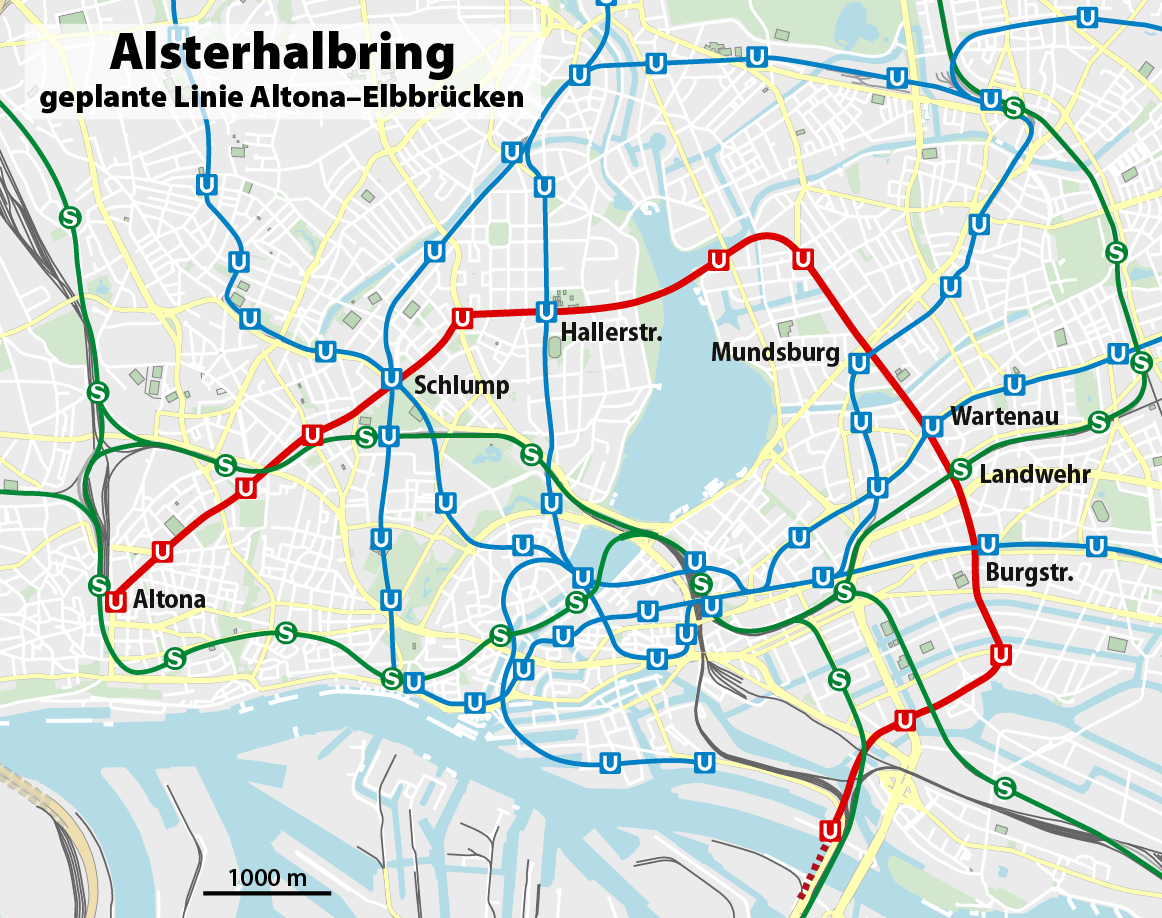
Deutsch: Karte des geplanten Alsterhalbrings in Hamburg
English: Map of planned underground line "Alsterhalbring" in Hamburg |
||||||||||||
| Date | |||||||||||||
| Source |
Own work
|
||||||||||||
| Author | NordNordWest | ||||||||||||
| Permission (Reusing this file) |
|

|
This map has been made or improved in the German Kartenwerkstatt (Map Lab). You can propose maps to improve as well.
|
File history
Click on a date/time to view the file as it appeared at that time.
| Date/Time | Thumbnail | Dimensions | User | Comment | |
|---|---|---|---|---|---|
| current | 15:51, 28 December 2015 | | 1,162 × 918 (399 KB) | NordNordWest (talk | contribs) | c |
| 15:48, 28 December 2015 |  | 1,162 × 918 (399 KB) | NordNordWest (talk | contribs) | upd | |
| 18:47, 13 November 2012 |  | 1,162 × 918 (371 KB) | NordNordWest (talk | contribs) | upd | |
| 17:56, 9 January 2011 |  | 1,167 × 923 (388 KB) | NordNordWest (talk | contribs) | {{Information |Description= {{de|Karte des geplanten Alsterhalbrings in Hamburg}} {{en|Map of planned underground line "Alsterhalbring" in Hamburg}} |Source={{Own}} * Ulrich Alexis Christiansen: ''Hamburgs dunkle Welten'', with a m |
You cannot overwrite this file.
File usage on Commons
The following 4 pages use this file:
File usage on other wikis
The following other wikis use this file:
- Usage on de.wikipedia.org
- Usage on www.wikidata.org
.png&oldid=476555536)