File:Kart over Smaalenenes Amt med Bahus Len samt Dele af Akershus og Hedemarkens Amter 12, 1680.jpg
Jump to navigation
Jump to search

Size of this preview: 800 × 428 pixels. Other resolutions: 320 × 171 pixels | 640 × 343 pixels | 1,024 × 548 pixels | 1,280 × 685 pixels | 2,560 × 1,370 pixels | 14,352 × 7,681 pixels.
Original file (14,352 × 7,681 pixels, file size: 13.24 MB, MIME type: image/jpeg)
Captions
Captions
Add a one-line explanation of what this file represents
Summary
[edit]
| Warning | The original file is very high-resolution. It might not load properly or could cause your browser to freeze when opened at full size. |
|---|
| Title |
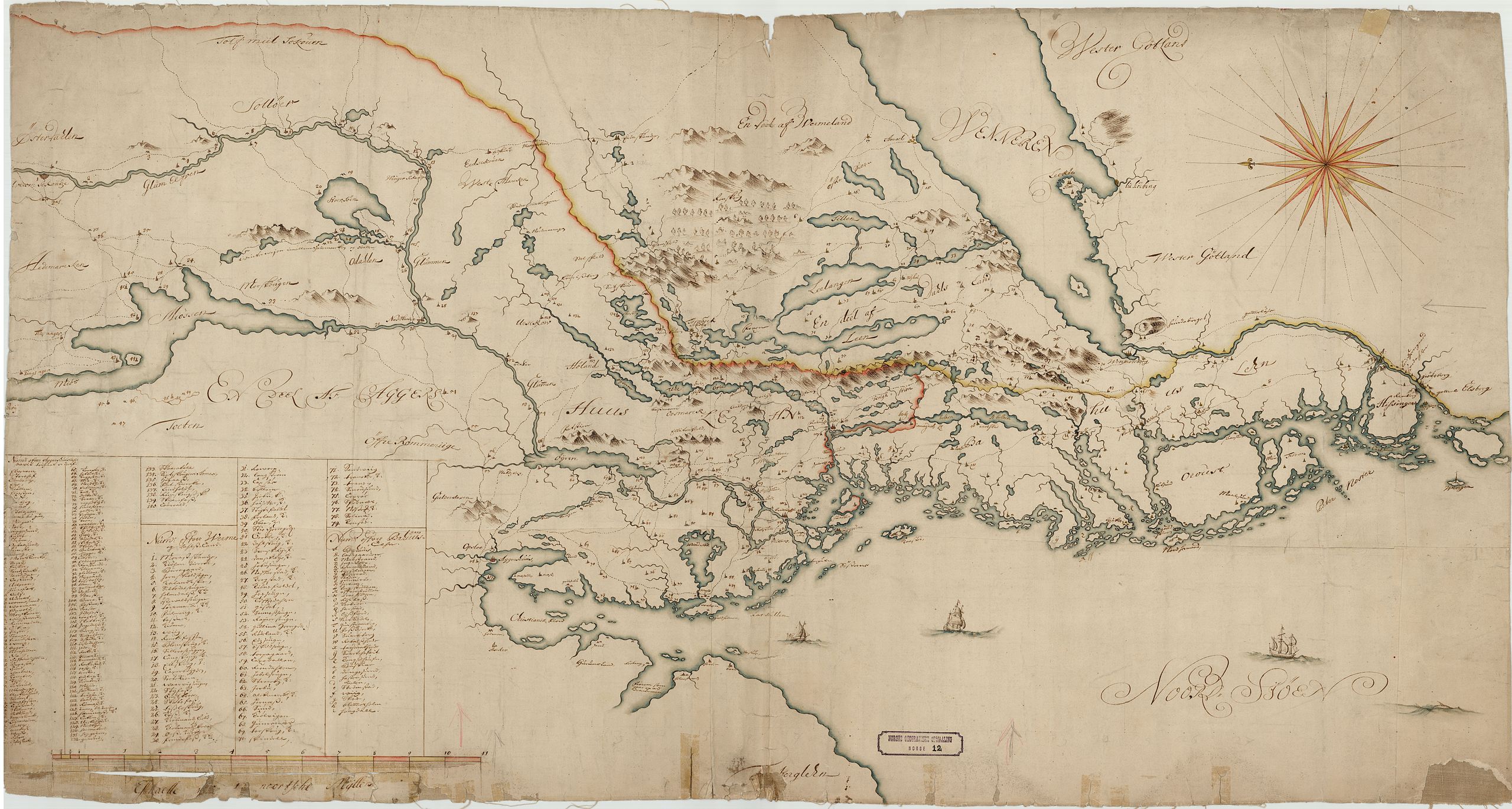
Norsk bokmål: Kart over Smaalenenes Amt med Bahus Len samt Dele af Akershus og Hedemarkens Amter 12, 1680 |
||||||||||||||||||||||||||
| Description |
Norsk bokmål: Årstall usikkert |
||||||||||||||||||||||||||
| Date | |||||||||||||||||||||||||||
| Source |
|
||||||||||||||||||||||||||
| Permission (Reusing this file) |
This file is licensed under the Creative Commons Attribution 4.0 International license.
|
||||||||||||||||||||||||||
| Geotemporal data | |||||||||||||||||||||||||||
| Date depicted | |||||||||||||||||||||||||||
| Map location | Akershus,Hedmark,Østfold (Akershus,Hedmark,Østfold) | ||||||||||||||||||||||||||
| Scale | 1:400,000 | ||||||||||||||||||||||||||
| Georeferencing | If inappropriate please set warp_status = skip to hide. | ||||||||||||||||||||||||||
| Bibliographic data | |||||||||||||||||||||||||||
| Part of the series | Category:Norwegian country division maps | ||||||||||||||||||||||||||
| Map sheet | 12 | ||||||||||||||||||||||||||
| Language | Norwegian | ||||||||||||||||||||||||||
| Archival data | |||||||||||||||||||||||||||
| Collection |
|
||||||||||||||||||||||||||
| Accession number | |||||||||||||||||||||||||||
| Medium | drawing | ||||||||||||||||||||||||||
File history
Click on a date/time to view the file as it appeared at that time.
| Date/Time | Thumbnail | Dimensions | User | Comment | |
|---|---|---|---|---|---|
| current | 18:47, 21 November 2015 | | 14,352 × 7,681 (13.24 MB) | Artturimatias (talk | contribs) | GWToolset: Creating mediafile for Artturimatias. |
You cannot overwrite this file.
File usage on Commons
There are no pages that use this file.
File usage on other wikis
The following other wikis use this file:
- Usage on no.wikipedia.org