File:Kart over Grøndal, Svalbard 1927.png
Jump to navigation
Jump to search

Size of this preview: 698 × 599 pixels. Other resolutions: 280 × 240 pixels | 559 × 480 pixels | 895 × 768 pixels | 1,193 × 1,024 pixels | 2,385 × 2,048 pixels | 3,811 × 3,272 pixels.
Original file (3,811 × 3,272 pixels, file size: 35.68 MB, MIME type: image/png)
Captions
Captions
Add a one-line explanation of what this file represents
Summary
[edit]
| Description |
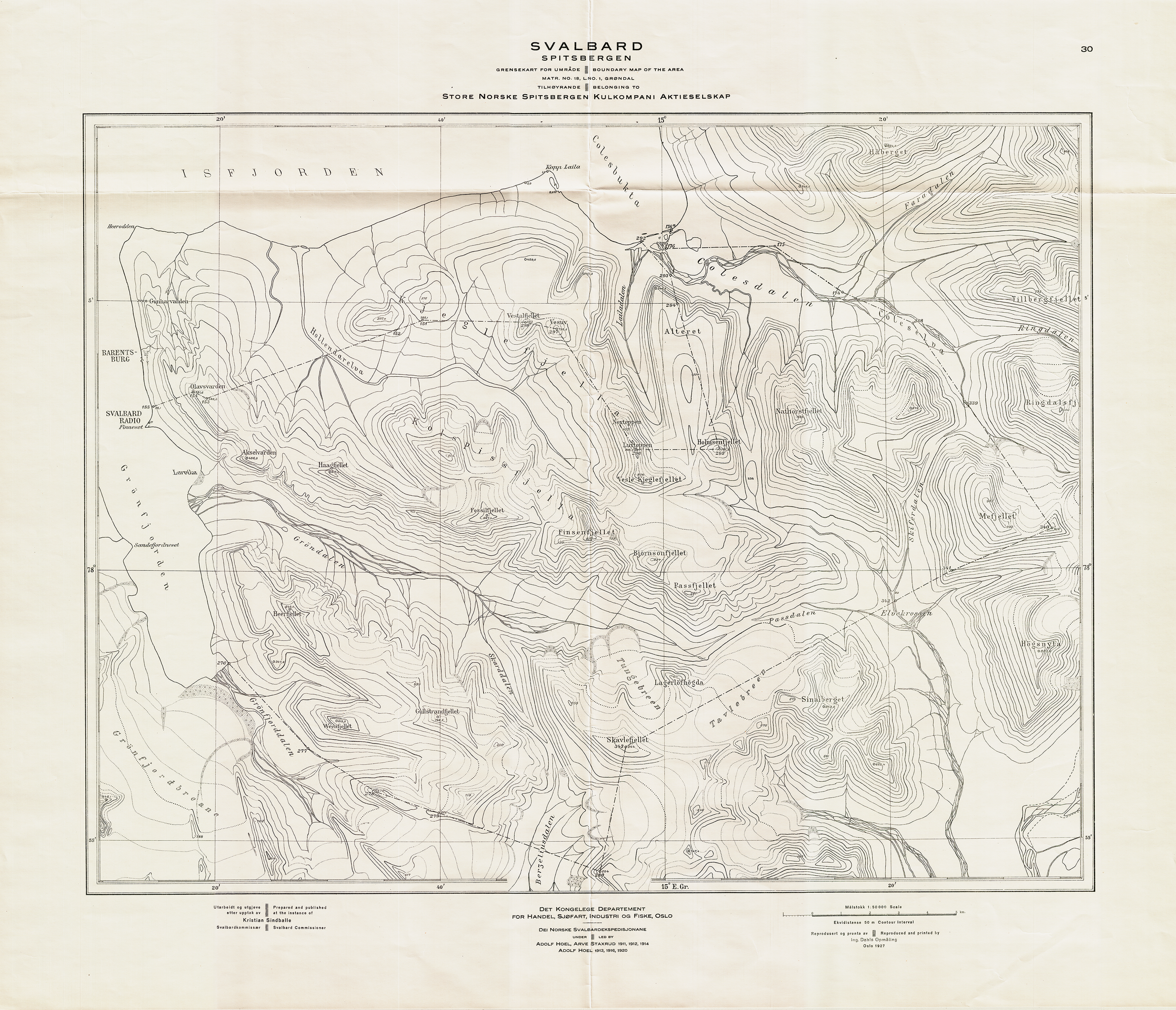
English: Kart over Grøndal på Svalbard fra 1927. Oppmålt under Dei Norske Svalbardekspedisjonane ledet av Adolf Hoel og Arve Staxrud i 1911, 1912 og 1914, og Adolf Hoel i 1913, 1916 og 1920. Trykket og utgitt i målestokk 1:50 000 av Ing. Dahls Opmåling i 1927 på oppdrag fra Statens kartverk Sjø. Original dokumentstørrelse ca 70 cm x 54 cm. Et eksemplar befinner seg hos Statens kartverk Sjø i Stavanger. |
| Date | |
| Source | Own work |
| Author | Statens kartverk Sjø |
Licensing
[edit]
I, the copyright holder of this work, hereby publish it under the following license:
This file is licensed under the Creative Commons Attribution-Share Alike 3.0 Unported license.
- You are free:
- to share – to copy, distribute and transmit the work
- to remix – to adapt the work
- Under the following conditions:
- attribution – You must give appropriate credit, provide a link to the license, and indicate if changes were made. You may do so in any reasonable manner, but not in any way that suggests the licensor endorses you or your use.
- share alike – If you remix, transform, or build upon the material, you must distribute your contributions under the same or compatible license as the original.
File history
Click on a date/time to view the file as it appeared at that time.
| Date/Time | Thumbnail | Dimensions | User | Comment | |
|---|---|---|---|---|---|
| current | 13:32, 6 July 2012 | | 3,811 × 3,272 (35.68 MB) | Kcita (talk | contribs) |
You cannot overwrite this file.
File usage on Commons
There are no pages that use this file.