File:Kagoshima Pref Road 73 Ooaira-Aira Border 2020.jpg
Jump to navigation
Jump to search

Size of this preview: 800 × 600 pixels. Other resolutions: 320 × 240 pixels | 640 × 480 pixels | 1,024 × 768 pixels | 1,280 × 960 pixels | 2,560 × 1,920 pixels | 3,343 × 2,507 pixels.
Original file (3,343 × 2,507 pixels, file size: 2.66 MB, MIME type: image/jpeg)
Captions
Captions
Add a one-line explanation of what this file represents
| Description |
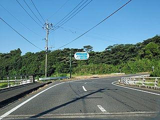
English: Kagoshima Prefectural Road No.73 (Aira, Kanoya City, Kagoshima Prefecture, Japan) 日本語: 主要地方道鹿屋高山串良線(県道73号)、鹿児島県鹿屋市の大姶良地区と吾平地区の境(旧鹿屋市・吾平町境)、東方向。2020年8月撮影。 |
| Date | |
| Source | Own work |
| Author | Sanjo |
| Permission (Reusing this file) |
I, the copyright holder of this work, hereby publish it under the following license: This file is licensed under the Creative Commons Attribution-Share Alike 4.0 International license.
|
File history
Click on a date/time to view the file as it appeared at that time.
| Date/Time | Thumbnail | Dimensions | User | Comment | |
|---|---|---|---|---|---|
| current | 13:46, 26 August 2020 | | 3,343 × 2,507 (2.66 MB) | Sanjo (talk | contribs) | {{Information |description={{ja|1=鹿児島県鹿屋市田淵町(大姶良地区)にある道路記念碑。当時の鹿屋町高須から大姶良村・姶良村を経由して高山村へ至る里道(県道73号鹿屋高山串良線の前身)の整備記念碑である。側面に鹿屋、大姶良、姶良、高山の文字がみえる(姶良は後の吾平町のことで、姶良町→姶良市ではない)。}} |date=2020-08-16 16:43:23 |source={{own}} |author=Sanjo |permission= |other versions= }} =={{int:license-header}}== {{self|cc-by-sa-4.0}} {{Location dec|31.334264|130.836796|}} Category:Kagoshima prefectural roads Category:Memorial stones in Japan {{Information |description={{... |
You cannot overwrite this file.
File usage on Commons
There are no pages that use this file.
File usage on other wikis
The following other wikis use this file:
- Usage on ja.wikipedia.org