File:Kaart Zuid-Hollandse eilanden 1795.jpg
Jump to navigation
Jump to search
Size of this preview: 800 × 574 pixels. Other resolutions: 320 × 229 pixels | 640 × 459 pixels | 1,000 × 717 pixels.
Original file (1,000 × 717 pixels, file size: 297 KB, MIME type: image/jpeg)
Captions
Captions
Add a one-line explanation of what this file represents
Summary
[edit]
| Description |
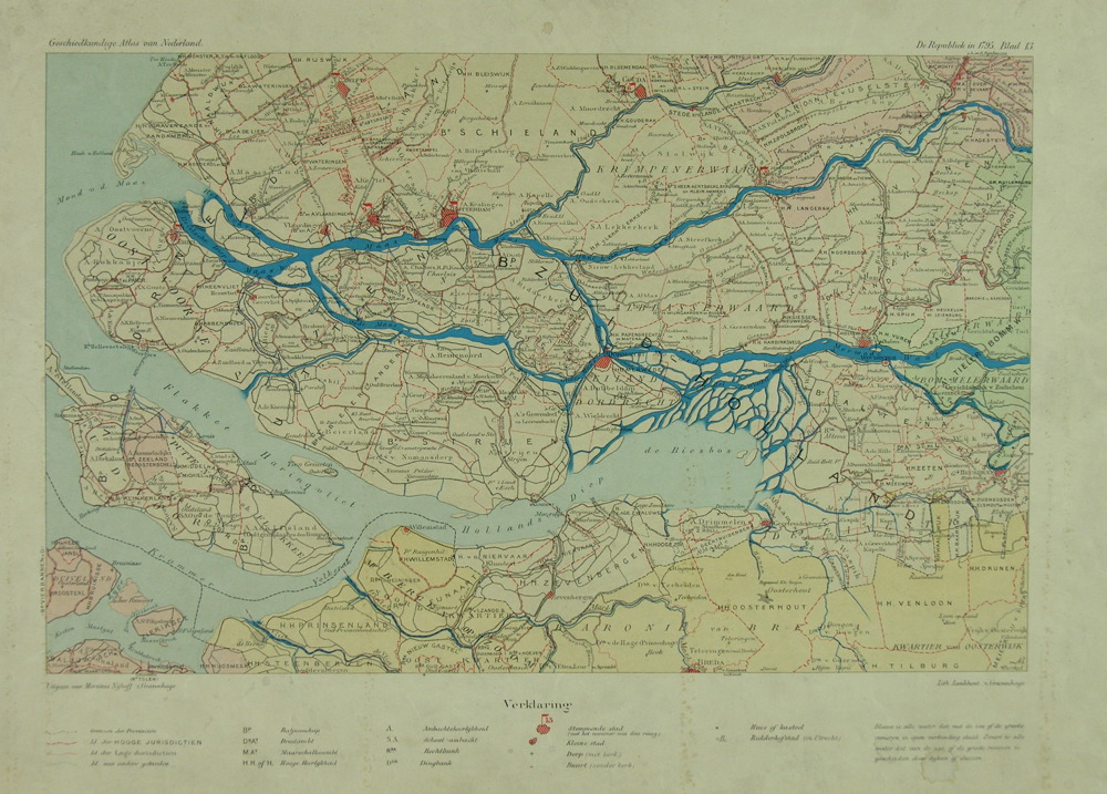
Nederlands: Kaart Zuid-Hollandse eilanden 1795. Kaart van Rotterdam en wijde omgeving. Het afgebeelde gebied wordt begrensd door Monster, Sint-Annaland, Udenhout en Houten. Bevat o.a.: Schieland, Krimpenerwaard, Alblasserwaard, Voorne-Putten, Hoeksche Waard, Goeree-Overflakkee, Albrandswaard, Biesbosch.
Archiefnummer van het Stadsarchief Rotterdams: 1986-1370. Uit: Geschiedkundige atlas van Nederland (De Republiek in 1795. Blad 13) / uitg. door de Commissie voor den Geschiedkundigen Atlas van Nederland en geteekend door A. A. Beekman. 's-Gravenhage : M. Nijhoff, 1913-1938. Met legenda. De kaart is gemaakt tussen 1913-1938 en beeldt de situatie af uit 1795. |
| Date | 1913-1938 |
| Source | https://proxy.archieven.nl/0/EF2C7A40D4DF4FDEB0F1DCD0B62811BC |
| Author | A. A. Beekman (1857-1947) |
Licensing
[edit]
|
This work is in the public domain in its country of origin and other countries and areas where the copyright term is the author's life plus 70 years or fewer. | |
| This file has been identified as being free of known restrictions under copyright law, including all related and neighboring rights. | |
File history
Click on a date/time to view the file as it appeared at that time.
| Date/Time | Thumbnail | Dimensions | User | Comment | |
|---|---|---|---|---|---|
| current | 04:08, 15 July 2022 | | 1,000 × 717 (297 KB) | JopkeB (talk | contribs) | Uploaded a work by A. A. Beekman (1857-1947) from https://proxy.archieven.nl/0/EF2C7A40D4DF4FDEB0F1DCD0B62811BC with UploadWizard |
You cannot overwrite this file.
File usage on Commons
There are no pages that use this file.