File:Kaarst Captrain 404 buizentrein (50390083756).jpg
From Wikimedia Commons, the free media repository
Jump to navigation
Jump to search
![File:Kaarst Captrain 404 buizentrein (50390083756).jpg](https://upload.wikimedia.org/wikipedia/commons/thumb/f/f9/Kaarst_Captrain_404_buizentrein_%2850390083756%29.jpg/800px-Kaarst_Captrain_404_buizentrein_%2850390083756%29.jpg?20210205174757)
Size of this preview: 800 × 450 pixels. Other resolutions: 320 × 180 pixels | 640 × 360 pixels | 1,024 × 576 pixels | 1,280 × 720 pixels | 2,560 × 1,440 pixels | 4,839 × 2,722 pixels.
Original file (4,839 × 2,722 pixels, file size: 16.99 MB, MIME type: image/jpeg)
File information
Structured data
Captions
Captions
Add a one-line explanation of what this file represents
Summary
[edit]DescriptionKaarst Captrain 404 buizentrein (50390083756).jpg |
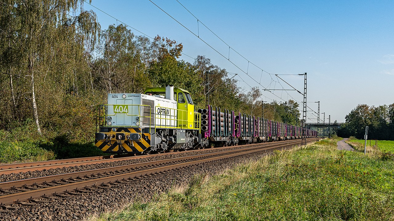
Nederlands: Captrain G1206 met locnummer 404 is met een kleurrijke buizentrein bij Kaarst opweg richting Krefeld. |
Date | |
Source | Kaarst Captrain 404 buizentrein |
Author | Rob Dammers |
Camera location | 51° 14′ 48.36″ N, 6° 38′ 35.48″ E ![]() | View this and other nearby images on: OpenStreetMap | ![]() |
---|
Licensing
[edit]![w:en:Creative Commons](https://upload.wikimedia.org/wikipedia/commons/thumb/7/79/CC_some_rights_reserved.svg/90px-CC_some_rights_reserved.svg.png)
![attribution](https://upload.wikimedia.org/wikipedia/commons/thumb/1/11/Cc-by_new_white.svg/24px-Cc-by_new_white.svg.png)
This file is licensed under the Creative Commons Attribution 2.0 Generic license.
- You are free:
- to share – to copy, distribute and transmit the work
- to remix – to adapt the work
- Under the following conditions:
- attribution – You must give appropriate credit, provide a link to the license, and indicate if changes were made. You may do so in any reasonable manner, but not in any way that suggests the licensor endorses you or your use.
![]() |
This image was originally posted to Flickr by Rob Dammers at https://flickr.com/photos/93388157@N07/50390083756. It was reviewed on 5 February 2021 by FlickreviewR 2 and was confirmed to be licensed under the terms of the cc-by-2.0. |
5 February 2021
File history
Click on a date/time to view the file as it appeared at that time.
Date/Time | Thumbnail | Dimensions | User | Comment | |
---|---|---|---|---|---|
current | 17:47, 5 February 2021 | ![]() | 4,839 × 2,722 (16.99 MB) | Fantaglobe11 (talk | contribs) | {{Information |Description={{nl|1=Captrain G1206 met locnummer 404 is met een kleurrijke buizentrein bij Kaarst opweg richting Krefeld.}} |Source=[https://www.flickr.com/photos/robdammers/50390083756/ Kaarst Captrain 404 buizentrein] |Date=2020-09-21 16:20 |Author=[https://www.flickr.com/people/robdammers/ Rob Dammers] }} {{Location dec|51.246766|6.643188|source:Flickr}} == {{int:license-header}} == {{cc-by-2.0}}{{flickrreview}} Category:MaK G 1206 of Captrain [[Category:Freight trains i... |
You cannot overwrite this file.
File usage on Commons
The following page uses this file:
Metadata
This file contains additional information such as Exif metadata which may have been added by the digital camera, scanner, or software program used to create or digitize it. If the file has been modified from its original state, some details such as the timestamp may not fully reflect those of the original file. The timestamp is only as accurate as the clock in the camera, and it may be completely wrong.
Camera manufacturer | NIKON CORPORATION |
---|---|
Camera model | NIKON D7500 |
Author | ROB DAMMERS |
Copyright holder |
|
Exposure time | 1/640 sec (0.0015625) |
F-number | f/8 |
ISO speed rating | 200 |
Date and time of data generation | 16:20, 21 September 2020 |
Lens focal length | 35 mm |
Latitude | 51° 14′ 48.36″ N |
Longitude | 6° 38′ 35.48″ E |
Altitude | 41 meters above sea level |
City shown | Kaarst |
Horizontal resolution | 300 dpi |
Vertical resolution | 300 dpi |
Software used | Adobe Photoshop Lightroom Classic 9.4 (Windows) |
File change date and time | 17:43, 27 September 2020 |
Exposure Program | Shutter priority |
Exif version | 2.31 |
Date and time of digitizing | 16:20, 21 September 2020 |
APEX shutter speed | 9.321928 |
APEX aperture | 6 |
APEX exposure bias | 0 |
Maximum land aperture | 3 APEX (f/2.83) |
Metering mode | Pattern |
Light source | Unknown |
Flash | Flash did not fire, compulsory flash suppression |
DateTimeOriginal subseconds | 31 |
DateTimeDigitized subseconds | 31 |
Color space | sRGB |
Focal plane X resolution | 2,367.8104248047 |
Focal plane Y resolution | 2,367.8104248047 |
Focal plane resolution unit | 3 |
Sensing method | One-chip color area sensor |
File source | Digital still camera |
Scene type | A directly photographed image |
Custom image processing | Normal process |
Exposure mode | Auto exposure |
White balance | Auto white balance |
Focal length in 35 mm film | 52 mm |
Scene capture type | Standard |
Scene control | None |
Contrast | Normal |
Saturation | Normal |
Sharpness | Normal |
Subject distance range | Unknown |
GPS time (atomic clock) | 12:54:51.99 |
Satellites used for measurement | 00 |
Geodetic survey data used | WGS-84 |
GPS date | 21 September 2020 |
GPS tag version | 0.0.3.2 |
Serial number of camera | 9016702 |
Lens used | 17.0-55.0 mm f/2.8 |
Date metadata was last modified | 19:43, 27 September 2020 |
Unique ID of original document | 29DCCBE0AB35F7EAC1C753FA35477E60 |
Province or state shown | Noordrijn-Westfalen |
Country shown | Duitsland |
Code for country shown | DE |
IIM version | 4 |