File:Kęty (gmina) location map.png

Original file (1,896 × 2,071 pixels, file size: 849 KB, MIME type: image/png)
Captions
Captions
Summary
[edit]_location_map.png&action=edit§ion=1)
| Description |
English: Location map |
| Date | |
| Source | Own work |
| Author | Smat |
| Description |
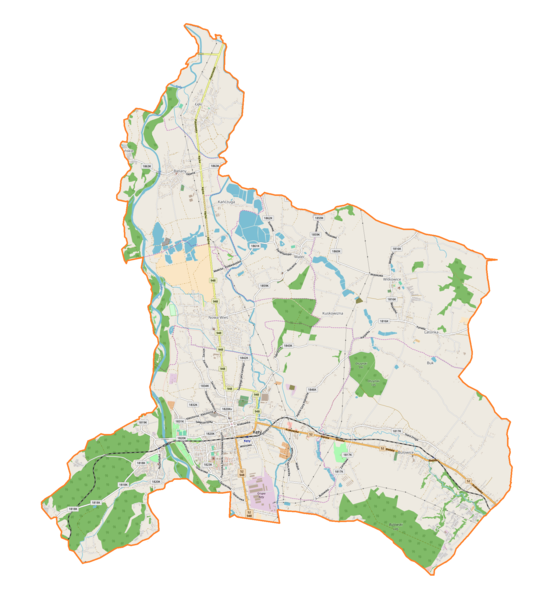
Polski: Mapa gminy Kęty, Polska
English: Map of Kęty (gmina), Poland |
|||||||||
| Date | ||||||||||
| Source | You may find a page on the OpenStreetMap wiki page for Kęty (gmina) | |||||||||
| Creator |
OpenStreetMap contributors OpenStreetMap contributors |
|||||||||
| Permission (Reusing this file) |
OpenStreetMap data is available under the Open Database License (details). Map tiles are licensed under the Creative Commons Attribution-ShareAlike 2.0 license (CC-BY-SA 2.0).
This file is licensed under the Creative Commons Attribution-Share Alike 2.0 Generic license.
|
|||||||||
| Geotemporal data | ||||||||||
| Bounding box |
|
|||||||||
| Georeferencing | If inappropriate please set warp_status = skip to hide. | |||||||||
Licensing
[edit]_location_map.png&action=edit§ion=2)
| This work contains information from OpenStreetMap, which is made available under the Open Database License (ODbL).
The ODbL does not require any particular license for maps produced from ODbL data. Prior to 1 August 2020, map tiles produced by the OpenStreetMap Foundation were licensed under the CC-BY-SA-2.0 license. Maps produced by other people may be subject to other licences. |
File history
Click on a date/time to view the file as it appeared at that time.
| Date/Time | Thumbnail | Dimensions | User | Comment | |
|---|---|---|---|---|---|
| current | 13:05, 29 April 2018 | | 1,896 × 2,071 (849 KB) | Smat (talk | contribs) | User created page with UploadWizard |
You cannot overwrite this file.
File usage on Commons
There are no pages that use this file.
File usage on other wikis
The following other wikis use this file:
- Usage on pl.wikipedia.org
- Kęty
- Klasztor Franciszkanów w Kętach
- Wyższa Szkoła Nauk Ekonomicznych i Społecznych w Kętach
- Bulowice
- Łęki (powiat oświęcimski)
- Nowa Wieś (powiat oświęcimski)
- Malec (województwo małopolskie)
- Witkowice (województwo małopolskie)
- Kościół św. Jana Kantego w Kętach
- Synagoga Anszei Emes w Kętach
- Synagoga w Kętach
- Kęty (stacja kolejowa)
- Kęty Podlesie
- Muzeum im. Aleksandra Kłosińskiego w Kętach
- Bulowice (przystanek kolejowy)
- Zamek Bulowicki
- Bielany (województwo małopolskie)
- Cmentarz żydowski w Kętach
- Pod Kogutem
- Kanada (Witkowice)
- Mały Czaniec
- Nideckie Podlasie
- Chybiny
- Na Zamłyniu
- Kańczuga (województwo małopolskie)
- Olszyny (Bulowice)
- Polana (Bulowice)
- Łęg (Malec)
- Latonka
- Kuskowizna (województwo małopolskie)
- Babuda
- Sybir (województwo małopolskie)
- Granica (powiat oświęcimski)
- Buk (powiat oświęcimski)
- Pałac w Bulowicach
- Parafia Świętych Małgorzaty i Katarzyny w Kętach
- Parafia Najświętszego Serca Pana Jezusa w Kętach
- Parafia Najdroższej Krwi Pana Naszego Jezusa Chrystusa w Kętach
- Kościół Świętych Małgorzaty i Katarzyny w Kętach
- Zbór Kościoła Chrześcijan Baptystów w Kętach
- Cmentarz komunalny w Kętach
- Parafia św. Macieja Apostoła w Bielanach
- Parafia św. Wojciecha BM w Bulowicach
- Parafia św. Jana Kantego w Malcu
- Parafia św. Maksymiliana Kolbego w Nowej Wsi
- Parafia św. Michała Archanioła w Witkowicach
- Owczarnia (województwo małopolskie)
- Widłak (Nowa Wieś)
- Klasztor Klarysek od Wieczystej Adoracji Najświętszego Sakramentu w Kętach
- Moduł:Mapa/dane/Kęty (gmina)
View more global usage of this file.
_location_map.png)
_location_map.png&oldid=706031745)