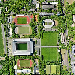
File:Köln Müngersdorf Sportgelände – großes Vertikalpanorama aus 300 m Höhe (April 2020).jpg
Jump to navigation
Jump to search

Size of this preview: 600 × 600 pixels. Other resolutions: 240 × 240 pixels | 480 × 480 pixels | 768 × 768 pixels | 1,024 × 1,024 pixels | 2,048 × 2,048 pixels | 11,793 × 11,792 pixels.
Original file (11,793 × 11,792 pixels, file size: 36 MB, MIME type: image/jpeg)
Captions
Captions
Add a one-line explanation of what this file represents
Summary
[edit].jpg&action=edit§ion=1)
| Warning | The original file is very high-resolution. It might not load properly or could cause your browser to freeze when opened at full size. |
|---|
.jpg&flash=no)
Licensing
[edit].jpg&action=edit§ion=2)
I, the copyright holder of this work, hereby publish it under the following license:
This file is licensed under the Creative Commons Attribution-Share Alike 4.0 International license.
- You are free:
- to share – to copy, distribute and transmit the work
- to remix – to adapt the work
- Under the following conditions:
- attribution – You must give appropriate credit, provide a link to the license, and indicate if changes were made. You may do so in any reasonable manner, but not in any way that suggests the licensor endorses you or your use.
- share alike – If you remix, transform, or build upon the material, you must distribute your contributions under the same or compatible license as the original.
File history
Click on a date/time to view the file as it appeared at that time.
| Date/Time | Thumbnail | Dimensions | User | Comment | |
|---|---|---|---|---|---|
| current | 12:15, 3 May 2020 | | 11,793 × 11,792 (36 MB) | Habitator terrae (talk | contribs) | Reverted to version as of 14:46, 23 April 2020 (UTC) |
| 11:44, 3 May 2020 |  | 2,900 × 2,900 (3.56 MB) | Habitator terrae (talk | contribs) | nur kurzfristig zur Georeferenzierung | |
| 14:46, 23 April 2020 |  | 11,793 × 11,792 (36 MB) | Maximilian Schönherr (talk | contribs) | Uploaded own work with UploadWizard |
You cannot overwrite this file.
File usage on Commons
The following page uses this file:
File usage on other wikis
The following other wikis use this file:
- Usage on www.wikidata.org
.jpg&oldid=847095669)