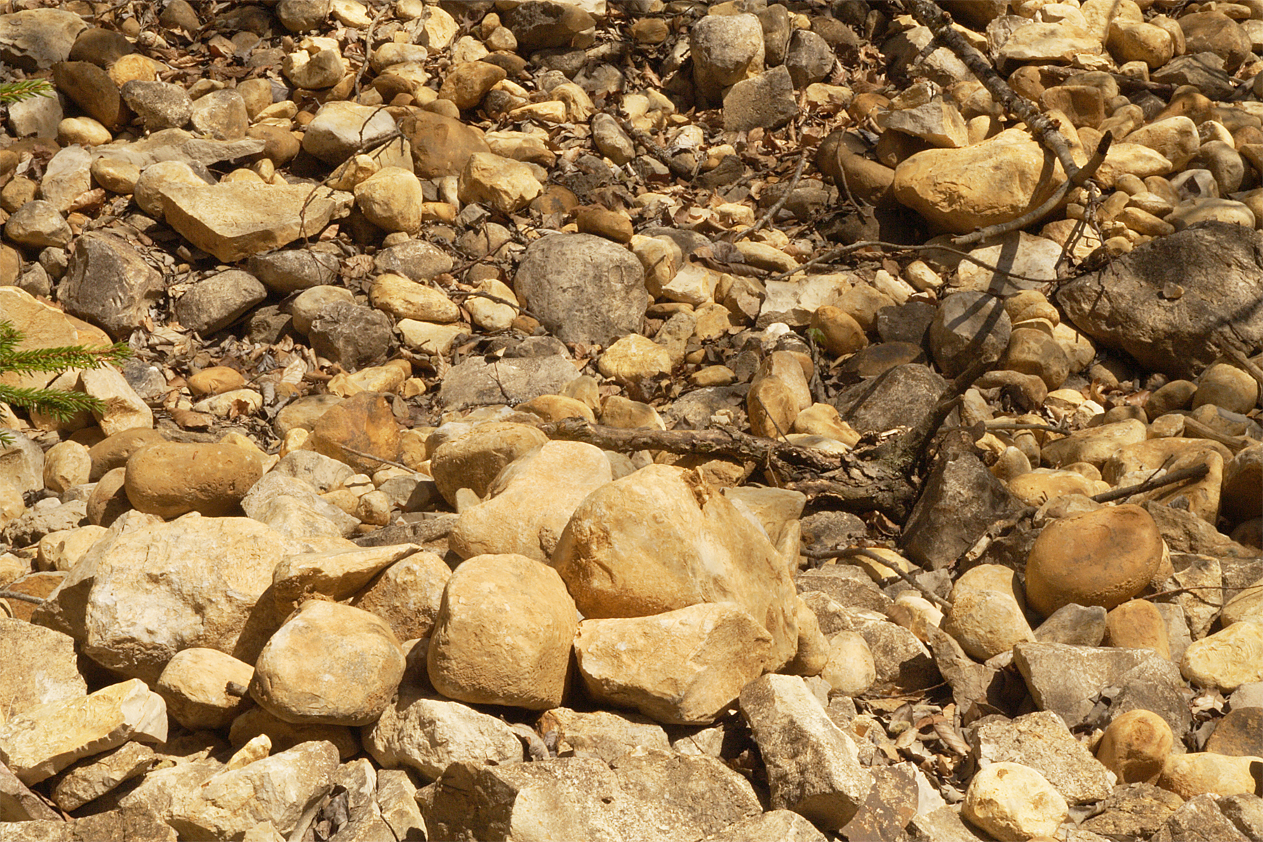
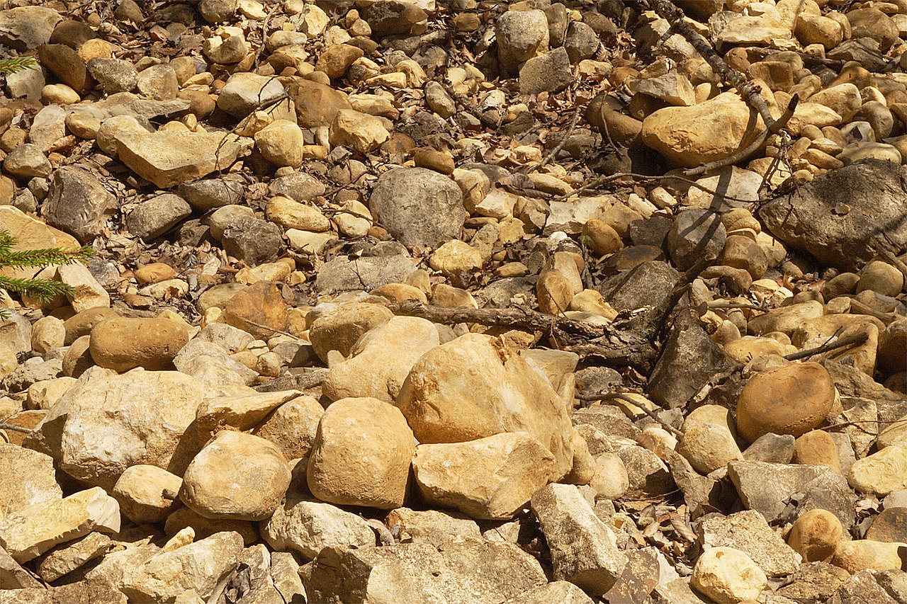
File:Juranagelfluh Obermiozaen Steinbruch-Hondingen Tengener-Rinne Schwaebische-Alb.jpg
Original file (1,800 × 1,200 pixels, file size: 2.69 MB, MIME type: image/jpeg)
Captions
Captions
Summary
[edit]
| Description |
Deutsch: Aufschluss in einem Steinbruchs bei Hondingen (Blumberg), Hegaualb. Hier ist das mittelmiozäne Flussgeröll, „Jüngere Juranagelfluh“, aufgeschlossen. In der so genannten „Tengener Rinne“ wurden Massen von Flussgeröllen transportiert. Diese Rinne ist die größte von drei gewaltigen Urflüssen aus dem Schwarzwald. Das Gestein ist der wichtigste geologische Beleg für Schüttungen zur Zeit der Oberen Süßwassermolasse (OSM) aus dem Norden (Schwarzwald, Albvorland und Plateau der Schwäbischen Alb). Die Schüttung der wohlgerundeten, teilweise 30 cm großen, Gerölle war so gewaltig, dass die Rinnen aufgefüllt wurden und sich auf einer ca. 30 km breite Fläche ablagerten. „Es „kann die Gesamtmächtigkeit der Juranagelfluh am Hohenstoffeln mit 350 bis 380 m angenommen werden“. Schreiner, 1965, S. 328. Vgl. auch das Foto Image:Juranagelfluh_Obermiozaen_Tengener-Rinne_Riedoeschingen_Schwaebische-Alb.jpg, das zeigt, wie auch heute noch Äcker mit diesen Geröllen übersät sind. English: “Jüngere Juranagelfluh” of Miocene age in a quarry in Hondingen, village northeast of Blumberg West-Swabian Alb. The cobbles are a fluvial sediment coming from the northern foreland, the Black Forest and from the plateau of the Swabian Alb. They are associated with the alpine “Obere Süßwassermolasse” (Upper Freshwater Molasse). The cobbles came in such tremendous quantities, they produced three giant “runnels” (the dominant being the “Tengen runnel”) and pored their waters and cobble deposits up to 350 m high. Farming land is covered with it even today, mind the photo Image:Juranagelfluh_Obermiozaen_Tengener-Rinne_Riedoeschingen_Schwaebische-Alb.jpg). These ur-rivers pored their water into the “Graupensanrinne”, there forming huge alluvial fans. |
| Date | |
| Source | Own work |
| Author | Ustill |
Licensing
[edit]
- You are free:
- to share – to copy, distribute and transmit the work
- to remix – to adapt the work
- Under the following conditions:
- attribution – You must give appropriate credit, provide a link to the license, and indicate if changes were made. You may do so in any reasonable manner, but not in any way that suggests the licensor endorses you or your use.
- share alike – If you remix, transform, or build upon the material, you must distribute your contributions under the same or compatible license as the original.

File history
Click on a date/time to view the file as it appeared at that time.
| Date/Time | Thumbnail | Dimensions | User | Comment | |
|---|---|---|---|---|---|
| current | 16:25, 29 July 2018 | | 1,800 × 1,200 (2.69 MB) | Ustill (talk | contribs) | User created page with UploadWizard |
You cannot overwrite this file.
File usage on Commons
There are no pages that use this file.
File usage on other wikis
The following other wikis use this file:
- Usage on de.wikipedia.org