File:Junction of Queen Elizabeth Way (QEW) and Ontario King's Highway 406, St. Catherines, Ontario (29691418350).jpg
Original file (4,000 × 3,000 pixels, file size: 3.38 MB, MIME type: image/jpeg)
Captions
Captions
Summary
[edit]_and_Ontario_King%27s_Highway_406,_St._Catherines,_Ontario_(29691418350).jpg&action=edit§ion=1)
| Description |
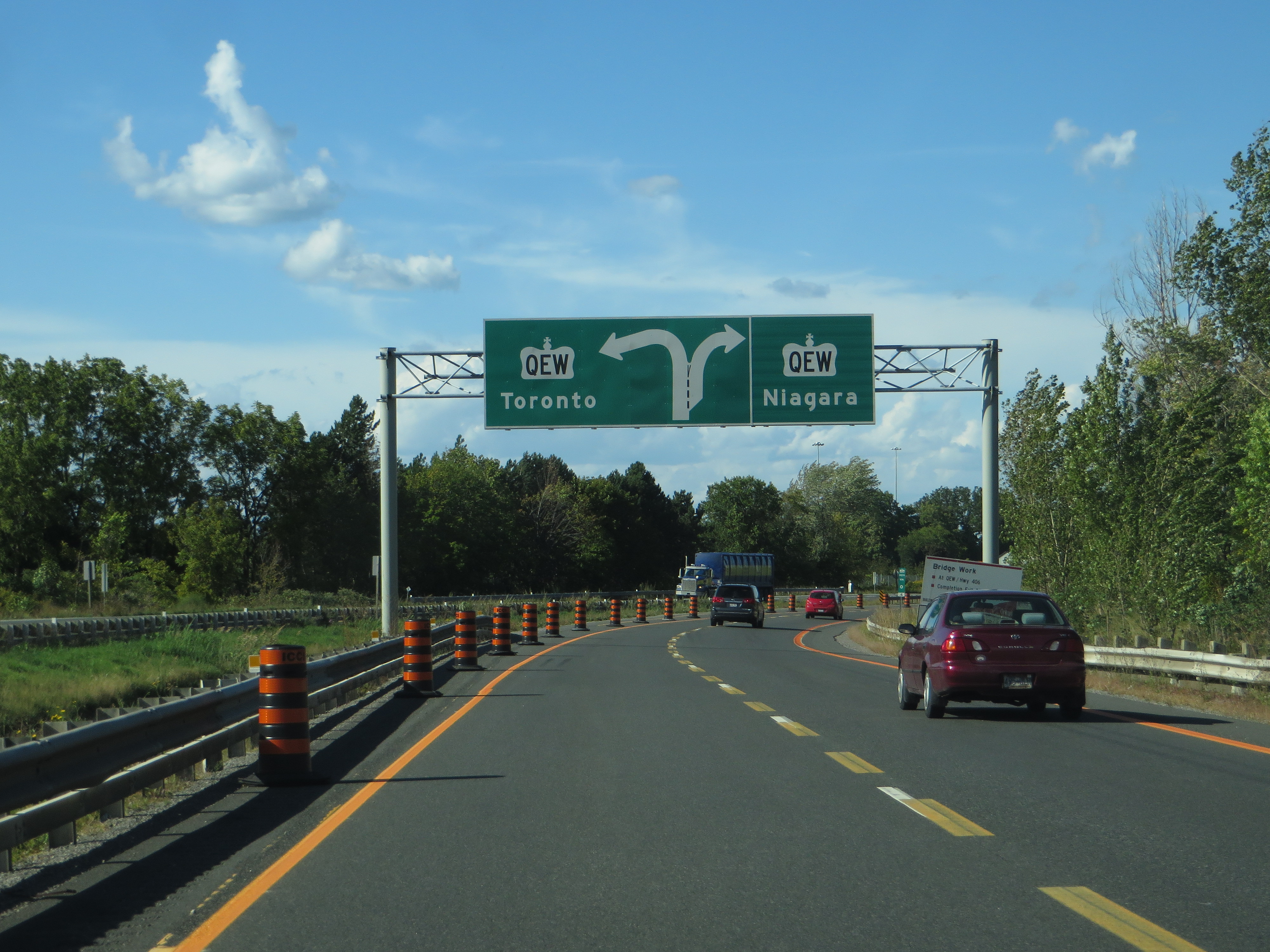
The Queen Elizabeth Way (QEW) is a 400-series highway in the Canadian province of Ontario linking Toronto with the Niagara Peninsula and Buffalo, New York. The freeway begins at the Peace Bridge in Fort Erie and travels 139.1 kilometres (86.4 mi) around the western shore of Lake Ontario, ending at Highway 427. The physical highway, however, continues as the Gardiner Expressway into downtown Toronto. The QEW is one of Ontario's busiest highways, with an average of close to 200,000 vehicles per day on some sections. Major highway junctions are at Highway 420 in Niagara Falls, Highway 405 in Niagara-on-the-Lake, Highway 406 in St. Catharines, the Red Hill Valley Parkway in Hamilton, Highway 403 and Highway 407 in Burlington, Highway 403 at the Oakville–Mississauga boundary, and Highway 427 in Etobicoke. Within the Regional Municipality of Halton, between its two junctions with Highway 403, the QEW is signed concurrently with Highway 403. The history of the QEW dates back to 1931, when work began to widen the Middle Road in a similar fashion to the nearby Dundas Highway and Lakeshore Road as a relief project during the Great Depression. Following the 1934 provincial election, Ontario Minister of Highways Thomas McQuesten and his deputy minister Robert Melville Smith changed the design to be similar to the autobahns of Germany, dividing the opposite directions of travel and using grade-separated interchanges at major crossroads. When opened to traffic in 1937, it was the first intercity divided highway in North America and featured the longest stretch of consistent illumination in the world. While not a true freeway at the time, it was gradually upgraded, widened, and modernized beginning in the 1950s, more or less taking on its current form by 1975. Since then, various projects have continued to widen the route. In 1997, the provincial government turned over the responsibility for the section of the QEW between Highway 427 and the Humber River to the City of Toronto. This section was subsequently redesignated as part of the Gardiner Expressway. <a href="https://en.wikipedia.org/wiki/Queen_Elizabeth_Way" rel="noreferrer nofollow">en.wikipedia.org/wiki/Queen_Elizabeth_Way</a> <a href="https://en.wikipedia.org/wiki/Wikipedia:Text_of_Creative_Commons_Attribution-ShareAlike_3.0_Unported_License" rel="noreferrer nofollow">en.wikipedia.org/wiki/Wikipedia:Text_of_Creative_Commons_...</a> |
| Date | |
| Source | Junction of Queen Elizabeth Way (QEW) and Ontario King's Highway 406, St. Catherines, Ontario |
| Author | Ken Lund from Reno, Nevada, USA |
| Camera location | | View this and other nearby images on: OpenStreetMap |
|---|
_and_Ontario_King%27s_Highway_406,_St._Catherines,_Ontario_(29691418350).jpg¶ms=043.169227_N_-079.282931_E_globe:Earth_type:camera_source:Flickr_&language=en)
Licensing
[edit]_and_Ontario_King%27s_Highway_406,_St._Catherines,_Ontario_(29691418350).jpg&action=edit§ion=2)
- You are free:
- to share – to copy, distribute and transmit the work
- to remix – to adapt the work
- Under the following conditions:
- attribution – You must give appropriate credit, provide a link to the license, and indicate if changes were made. You may do so in any reasonable manner, but not in any way that suggests the licensor endorses you or your use.
- share alike – If you remix, transform, or build upon the material, you must distribute your contributions under the same or compatible license as the original.
| This image was originally posted to Flickr by Ken Lund at https://flickr.com/photos/75683070@N00/29691418350. It was reviewed on 10 March 2022 by FlickreviewR 2 and was confirmed to be licensed under the terms of the cc-by-sa-2.0. |
File history
Click on a date/time to view the file as it appeared at that time.
| Date/Time | Thumbnail | Dimensions | User | Comment | |
|---|---|---|---|---|---|
| current | 19:00, 10 March 2022 | | 4,000 × 3,000 (3.38 MB) | Mindmatrix (talk | contribs) | Transferred from Flickr via #flickr2commons |
You cannot overwrite this file.
File usage on Commons
There are no pages that use this file.
_and_Ontario_King%27s_Highway_406,_St._Catherines,_Ontario_(29691418350).jpg&oldid=781704069)