File:Jugoslawien BV042763126.jpg
Jump to navigation
Jump to search

Size of this preview: 695 × 599 pixels. Other resolutions: 278 × 240 pixels | 557 × 480 pixels | 891 × 768 pixels | 1,187 × 1,024 pixels | 2,375 × 2,048 pixels | 5,329 × 4,596 pixels.
Original file (5,329 × 4,596 pixels, file size: 4.33 MB, MIME type: image/jpeg)
Captions
Captions
Add a one-line explanation of what this file represents
Summary
[edit]| Title |
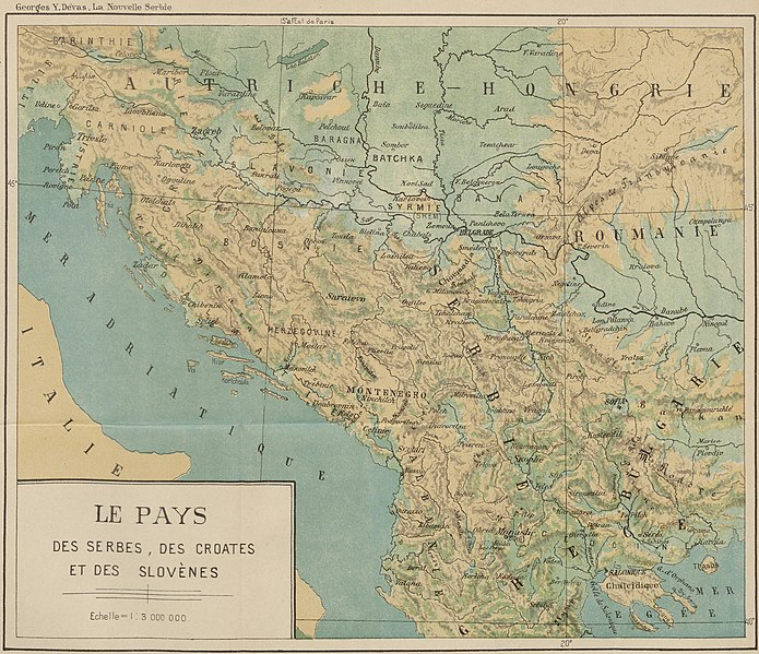
Le pays des Serbes, des Croates et des Slovenes |
|||||||||||||||||||||||
| Description |
Deutsch: JugoslawienPhysischeGeografie |
|||||||||||||||||||||||
| Date | ||||||||||||||||||||||||
| Source | Leibniz-Institut für Ost- und Südosteuropaforschung (IOS) GeoPortOst | |||||||||||||||||||||||
| Permission (Reusing this file) |
|
|||||||||||||||||||||||
| Geotemporal data | ||||||||||||||||||||||||
| Map location | Jugoslawien | |||||||||||||||||||||||
| Map type | Topografische Karte | |||||||||||||||||||||||
| Bounding box |
|
|||||||||||||||||||||||
| Georeferencing | ||||||||||||||||||||||||
| Bibliographic data | ||||||||||||||||||||||||
| Map sheet | Beil. [nach S. 40] | |||||||||||||||||||||||
| Language | French | |||||||||||||||||||||||
| Archival data | ||||||||||||||||||||||||
| Collection |
|
|||||||||||||||||||||||
| Accession number |
BV042763126 |
|||||||||||||||||||||||

Licensing
[edit]
|
This work is in the public domain in its country of origin and other countries and areas where the copyright term is the author's life plus 70 years or fewer. | |
| This file has been identified as being free of known restrictions under copyright law, including all related and neighboring rights. | |
File history
Click on a date/time to view the file as it appeared at that time.
| Date/Time | Thumbnail | Dimensions | User | Comment | |
|---|---|---|---|---|---|
| current | 18:10, 31 August 2021 | | 5,329 × 4,596 (4.33 MB) | Kilom691 (talk | contribs) | Cropped 33 % horizontally, 15 % vertically using CropTool with lossless mode. |
| 21:00, 19 February 2019 |  | 7,926 × 5,422 (5.72 MB) | H.bauer26 (talk | contribs) | pattypan 18.02 |
You cannot overwrite this file.
File usage on Commons
The following page uses this file: